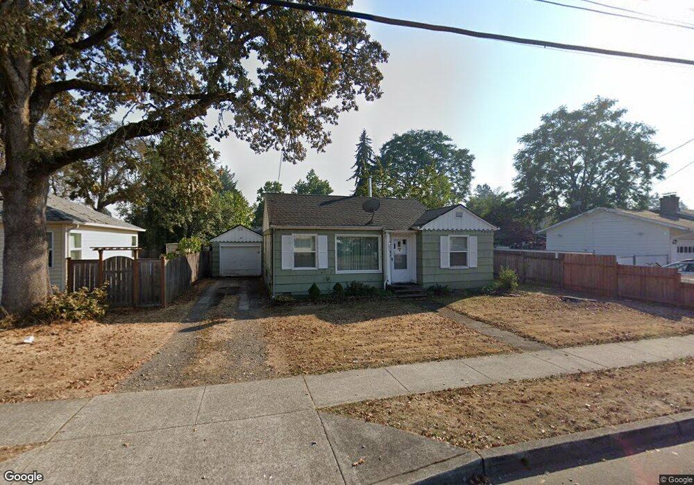
385 W Gloucester St Gladstone, OR 97027
Estimated Value: $379,000 - $429,000
2
Beds
1
Bath
781
Sq Ft
$509/Sq Ft
Est. Value
About This Home
This home is located at 385 W Gloucester St, Gladstone, OR 97027 and is currently estimated at $397,325, approximately $508 per square foot. 385 W Gloucester St is a home located in Clackamas County with nearby schools including John Wetten Elementary School, Walter L Kraxberger Middle School, and Gladstone High School.
Ownership History
Date
Name
Owned For
Owner Type
Purchase Details
Closed on
Oct 27, 2009
Sold by
Nutt Donald J
Bought by
Mocenacagi Amy M
Current Estimated Value
Home Financials for this Owner
Home Financials are based on the most recent Mortgage that was taken out on this home.
Original Mortgage
$161,500
Outstanding Balance
$104,596
Interest Rate
5%
Mortgage Type
New Conventional
Estimated Equity
$292,729
Create a Home Valuation Report for This Property
The Home Valuation Report is an in-depth analysis detailing your home's value as well as a comparison with similar homes in the area
Home Values in the Area
Average Home Value in this Area
Purchase History
| Date | Buyer | Sale Price | Title Company |
|---|---|---|---|
| Mocenacagi Amy M | $170,000 | Fidelity Natl Title Co Of Or |
Source: Public Records
Mortgage History
| Date | Status | Borrower | Loan Amount |
|---|---|---|---|
| Open | Mocenacagi Amy M | $161,500 |
Source: Public Records
Tax History
| Year | Tax Paid | Tax Assessment Tax Assessment Total Assessment is a certain percentage of the fair market value that is determined by local assessors to be the total taxable value of land and additions on the property. | Land | Improvement |
|---|---|---|---|---|
| 2025 | $3,097 | $153,724 | -- | -- |
| 2024 | $3,011 | $149,247 | -- | -- |
| 2023 | $3,011 | $144,900 | $0 | $0 |
| 2022 | $2,801 | $140,680 | $0 | $0 |
| 2021 | $2,698 | $136,583 | $0 | $0 |
| 2020 | $2,633 | $132,605 | $0 | $0 |
| 2019 | $2,603 | $128,743 | $0 | $0 |
| 2018 | $2,508 | $124,993 | $0 | $0 |
| 2017 | $2,433 | $121,352 | $0 | $0 |
| 2016 | $2,353 | $117,817 | $0 | $0 |
Source: Public Records
Map
Nearby Homes
- 700 Barton Ave Unit 1
- 441 W Gloucester St
- 445 W Exeter St
- 330 W Dartmouth St
- 280 Ipswich St
- 390 W Arlington St
- 19605 River Rd Unit 104
- 115 E Jersey St
- 119 E Jersey St
- 325 E Arlington St
- 140 Nelson Ln
- 480 E Gloucester St
- 18605 Sunlite Ct
- 18303 Portland Ave
- 280 Nelson Ln
- 515 E Hereford St
- 1460 Cornell Ave
- 19697 SE Cottonwood St
- 1065 Columbia Ave
- 18345 Petite Ct
- 375 W Gloucester St
- 405 W Gloucester St
- 380 W Fairfield St
- 365 W Gloucester St
- 405 W Fairfield St
- 370 W Fairfield St
- 390 W Gloucester St
- 355 W Gloucester St
- 435 W Gloucester St
- 400 W Gloucester St
- 410 W Gloucester St
- 380 W Gloucester St
- 396 W Gloucester St
- 360 W Fairfield St
- 437 W Gloucester St
- 728 Barton Ave Unit 12
- 345 W Gloucester St
- 726 Barton Ave Unit 11
- 350 W Gloucester St
- 724 Barton Ave Unit 10
Your Personal Tour Guide
Ask me questions while you tour the home.