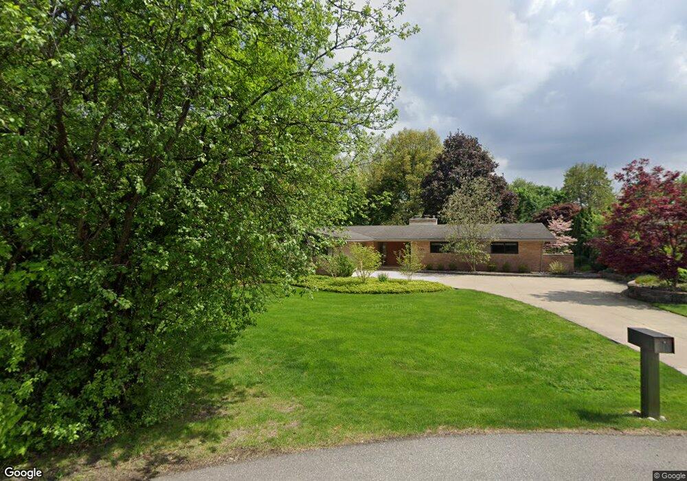
3850 Burning Tree Dr Bloomfield Hills, MI 48302
Estimated Value: $731,000 - $778,000
4
Beds
3
Baths
2,064
Sq Ft
$367/Sq Ft
Est. Value
About This Home
This home is located at 3850 Burning Tree Dr, Bloomfield Hills, MI 48302 and is currently estimated at $756,604, approximately $366 per square foot. 3850 Burning Tree Dr is a home located in Oakland County with nearby schools including Way Elementary School, South Hills Middle School, and Bloomfield Hills High School.
Ownership History
Date
Name
Owned For
Owner Type
Purchase Details
Closed on
Sep 17, 2024
Sold by
Erickson Martin K and Erickson Heather L
Bought by
Heather L Erickson Revocable Trust and Erickson
Current Estimated Value
Purchase Details
Closed on
Aug 9, 2005
Sold by
Cosgriff Elizabeth E and Elizabeth E Cosgriff Revocable
Bought by
Erickson Martin K and Erickson Heather L
Home Financials for this Owner
Home Financials are based on the most recent Mortgage that was taken out on this home.
Original Mortgage
$348,000
Interest Rate
5.69%
Mortgage Type
Fannie Mae Freddie Mac
Purchase Details
Closed on
Oct 14, 1999
Sold by
Cosgriff Elizabeth E
Bought by
Elizabeth E Cosgriff Tr
Create a Home Valuation Report for This Property
The Home Valuation Report is an in-depth analysis detailing your home's value as well as a comparison with similar homes in the area
Home Values in the Area
Average Home Value in this Area
Purchase History
| Date | Buyer | Sale Price | Title Company |
|---|---|---|---|
| Heather L Erickson Revocable Trust | -- | None Listed On Document | |
| Heather L Erickson Revocable Trust | -- | None Listed On Document | |
| Erickson Martin K | $435,000 | Capital Title Ins Agency | |
| Elizabeth E Cosgriff Tr | -- | -- |
Source: Public Records
Mortgage History
| Date | Status | Borrower | Loan Amount |
|---|---|---|---|
| Previous Owner | Erickson Martin K | $348,000 | |
| Closed | Erickson Martin K | $43,500 |
Source: Public Records
Tax History Compared to Growth
Tax History
| Year | Tax Paid | Tax Assessment Tax Assessment Total Assessment is a certain percentage of the fair market value that is determined by local assessors to be the total taxable value of land and additions on the property. | Land | Improvement |
|---|---|---|---|---|
| 2024 | $3,707 | $316,690 | $0 | $0 |
| 2023 | $3,588 | $296,590 | $0 | $0 |
| 2022 | $7,964 | $265,480 | $0 | $0 |
| 2021 | $7,969 | $227,960 | $0 | $0 |
| 2020 | $3,281 | $228,950 | $0 | $0 |
| 2019 | $6,305 | $218,730 | $0 | $0 |
| 2018 | $6,343 | $211,040 | $0 | $0 |
| 2017 | $6,285 | $207,540 | $0 | $0 |
| 2016 | $6,297 | $204,260 | $0 | $0 |
| 2015 | -- | $186,410 | $0 | $0 |
| 2014 | -- | $185,070 | $0 | $0 |
| 2011 | -- | $150,200 | $0 | $0 |
Source: Public Records
Map
Nearby Homes
- 3797 Burning Tree Dr
- 3715 Lahser Rd
- 3531 Brookside Dr
- 830 N Pemberton Rd
- 801 W Long Lake Rd
- 3515 Brookside Dr
- 931 Vaughan Rd
- 3403 Chickering Ln
- 3627 Shallow Brook Dr
- 921 Pine Thistle Ln
- 4650 Lahser Rd
- 362 Keswick Rd
- 3435 Devon Brook Dr
- 4255 Telegraph Rd
- 284 Woodwind Dr
- 341 Keswick Rd
- 965 Bloomfield Woods Unit 4
- 969 Bloomfield Woods
- 229 Barden Rd
- 40 Scenic Oaks Dr N
- 3840 Burning Tree Dr
- 3950 Lahser Rd
- 3870 Burning Tree Dr
- 3839 Burning Tree Dr
- 3830 Burning Tree Dr
- 530 W Long Lake Rd
- 3855 Burning Tree Dr
- 3825 Burning Tree Dr
- 3880 Lahser Rd
- 3765 Thornbrier Way
- 3820 Burning Tree Dr
- 566 Pineway Cir
- 3753 Thornbrier Way
- 572 Pineway Cir
- 520 Tall Tree Ln Unit Bldg-Unit
- 520 Tall Tree Ln
- 560 Pineway Cir
- 530 Tall Tree Ln
- 3925 Lahser Rd
- 3955 Lahser Rd