Estimated Value: $187,591 - $287,000
3
Beds
1
Bath
1,386
Sq Ft
$170/Sq Ft
Est. Value
About This Home
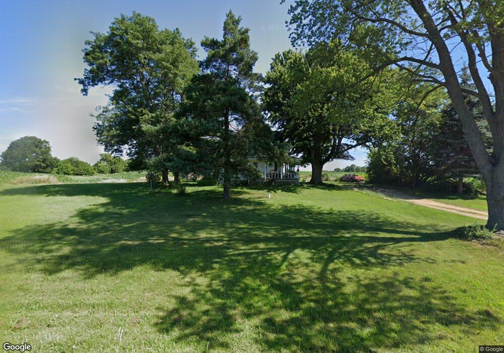
This home is located at 3850 W Kipp Rd, Mason, MI 48854 and is currently estimated at $235,898, approximately $170 per square foot. 3850 W Kipp Rd is a home located in Ingham County with nearby schools including Mason High School.
Ownership History
Date
Name
Owned For
Owner Type
Purchase Details
Closed on
May 2, 2025
Sold by
Caltrider Janice M and Gary D Caltrider Trust
Bought by
Doty Brian and Doty Jennifer
Current Estimated Value
Purchase Details
Closed on
Jun 24, 2023
Sold by
Caltrider James W
Bought by
Williams Janice
Purchase Details
Closed on
Nov 1, 2011
Sold by
Caltrider Gary and Williams Janice
Bought by
Doty Brian and Doty Jennifer
Home Financials for this Owner
Home Financials are based on the most recent Mortgage that was taken out on this home.
Original Mortgage
$69,000
Interest Rate
7%
Mortgage Type
Seller Take Back
Purchase Details
Closed on
Oct 19, 2010
Sold by
Caltrider Gary D and Caltrider Julie A
Bought by
Caltrider Gary D and Gary D Caltrider Trust
Purchase Details
Closed on
Jun 6, 2006
Sold by
Caltrider Robert G and Caltrider Janet E
Bought by
Caltrider Robert G and Caltrider Janet E
Create a Home Valuation Report for This Property
The Home Valuation Report is an in-depth analysis detailing your home's value as well as a comparison with similar homes in the area
Home Values in the Area
Average Home Value in this Area
Purchase History
| Date | Buyer | Sale Price | Title Company |
|---|---|---|---|
| Doty Brian | -- | None Listed On Document | |
| Williams Janice | -- | None Listed On Document | |
| Doty Brian | $69,000 | None Available | |
| Caltrider Gary D | -- | None Available | |
| Caltrider Robert G | -- | None Available |
Source: Public Records
Mortgage History
| Date | Status | Borrower | Loan Amount |
|---|---|---|---|
| Previous Owner | Doty Brian | $69,000 |
Source: Public Records
Tax History Compared to Growth
Tax History
| Year | Tax Paid | Tax Assessment Tax Assessment Total Assessment is a certain percentage of the fair market value that is determined by local assessors to be the total taxable value of land and additions on the property. | Land | Improvement |
|---|---|---|---|---|
| 2025 | $1,987 | $67,600 | $19,300 | $48,300 |
| 2024 | $12 | $64,100 | $18,700 | $45,400 |
| 2023 | $1,843 | $55,300 | $12,400 | $42,900 |
| 2022 | $1,768 | $52,100 | $18,500 | $33,600 |
| 2021 | $1,713 | $48,600 | $0 | $48,600 |
| 2020 | $2,000 | $43,400 | $13,500 | $29,900 |
| 2019 | $2,081 | $48,900 | $19,000 | $29,900 |
| 2018 | $1,726 | $47,200 | $19,000 | $28,200 |
| 2017 | $1,482 | $47,200 | $19,000 | $28,200 |
| 2016 | -- | $45,300 | $19,000 | $26,300 |
| 2015 | -- | $44,200 | $38,000 | $6,200 |
| 2014 | -- | $42,400 | $38,000 | $4,400 |
Source: Public Records
Map
Nearby Homes
- 466 Blue Spruce Ln Unit 55
- 200 Lake Ridge Dr
- 380 Spicetree Ln Unit 48
- 3230 Tomlinson Rd
- 153 Primrose Ln
- 49 Lake Ridge Dr
- 4480 W Columbia Rd
- 814 Carom Cir Unit 142
- 901 Carom Cir Unit 145
- 915 Carom Cir
- 311 Carom Cir
- Lot 6 Sleeping Meadow Dr
- 902 Eagles Nest Ct
- 331 N College Rd
- 709 Judy Ct
- 372 S Eifert Rd
- 1600 Tuttle Rd
- 3888 W Barnes Rd
- 318 N Aurelius Rd
- 0 S Edgar Rd Lot I