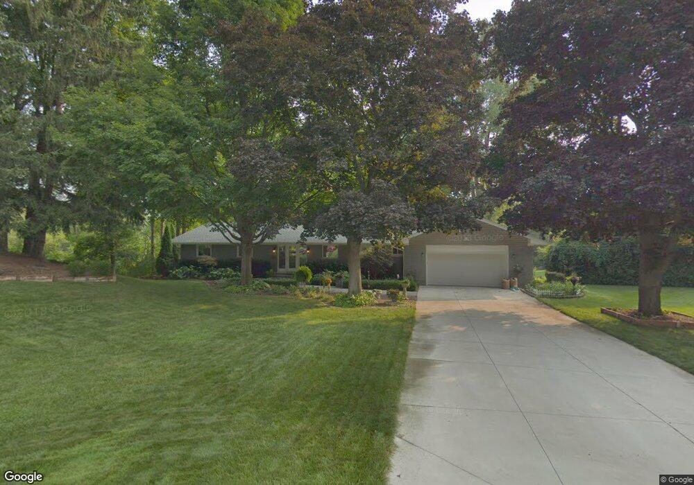
3851 N Adams Rd Bloomfield Hills, MI 48304
Estimated Value: $695,000 - $896,000
5
Beds
3
Baths
1,800
Sq Ft
$419/Sq Ft
Est. Value
About This Home
This home is located at 3851 N Adams Rd, Bloomfield Hills, MI 48304 and is currently estimated at $754,114, approximately $418 per square foot. 3851 N Adams Rd is a home located in Oakland County with nearby schools including Harlan Elementary School, Ernest W. Seaholm High School, and Academy of Sacred Heart.
Ownership History
Date
Name
Owned For
Owner Type
Purchase Details
Closed on
Nov 24, 2015
Sold by
Frey Mark W and Frey Nancy C
Bought by
Frey Mark W and Frey Nancy C
Current Estimated Value
Purchase Details
Closed on
May 27, 2004
Sold by
Nelson James M and Nelson Suzanne
Bought by
Frey Mark W
Home Financials for this Owner
Home Financials are based on the most recent Mortgage that was taken out on this home.
Original Mortgage
$350,000
Outstanding Balance
$171,781
Interest Rate
6.06%
Mortgage Type
Stand Alone First
Estimated Equity
$582,333
Purchase Details
Closed on
Jun 30, 1997
Sold by
Redding Christopher
Bought by
Krueger Christopher W
Create a Home Valuation Report for This Property
The Home Valuation Report is an in-depth analysis detailing your home's value as well as a comparison with similar homes in the area
Home Values in the Area
Average Home Value in this Area
Purchase History
| Date | Buyer | Sale Price | Title Company |
|---|---|---|---|
| Frey Mark W | -- | Attorney | |
| Frey Mark W | $478,000 | Metropolitan Title Company | |
| Krueger Christopher W | $309,900 | -- |
Source: Public Records
Mortgage History
| Date | Status | Borrower | Loan Amount |
|---|---|---|---|
| Open | Frey Mark W | $350,000 |
Source: Public Records
Tax History Compared to Growth
Tax History
| Year | Tax Paid | Tax Assessment Tax Assessment Total Assessment is a certain percentage of the fair market value that is determined by local assessors to be the total taxable value of land and additions on the property. | Land | Improvement |
|---|---|---|---|---|
| 2024 | $3,812 | $310,090 | $0 | $0 |
| 2023 | $3,659 | $283,770 | $0 | $0 |
| 2022 | $6,193 | $273,280 | $0 | $0 |
| 2021 | $6,245 | $252,410 | $0 | $0 |
| 2020 | $3,515 | $231,110 | $0 | $0 |
| 2019 | $6,235 | $228,150 | $0 | $0 |
| 2018 | $6,188 | $240,210 | $0 | $0 |
| 2017 | $6,184 | $231,510 | $0 | $0 |
| 2016 | $6,218 | $218,340 | $0 | $0 |
| 2015 | -- | $204,850 | $0 | $0 |
| 2014 | -- | $182,400 | $0 | $0 |
| 2011 | -- | $135,690 | $0 | $0 |
Source: Public Records
Map
Nearby Homes
- 2991 Lanergan Dr
- 4731 Haddington Dr
- 2840 Bolingbroke Dr
- 2650 Binbrooke Dr
- 4144 Rouge Circle Dr
- 4389 Charing Way
- 2611 Tarragona Way
- 796 Rock Spring Rd
- 433 Whippers In Ct
- 1048 Satterlee Rd
- 0000 Brookdale Rd
- 4890 Charing Cross Rd
- 3826 Lakecrest Dr
- 3665 Estates Dr
- 3729 Boulder Dr
- 2154 Babcock Dr
- 3014 Caswell Dr
- 3036 Newport Ct
- 1333 N Adams Rd
- 1330 Oxford Rd
- 3841 N Adams Rd
- 3861 N Adams Rd
- 3821 N Adams Rd
- 3801 N Adams Rd
- 3871 N Adams Rd
- 3881 N Adams Rd
- 3797 N Adams Rd
- 3945 N Adams Rd
- 791 Robinhood Cir
- 811 Robinhood Rd
- 740 Wattles Rd
- 783 Robinhood Cir
- 3925 N Adams Rd
- 905 Robinhood Rd
- 777 Robinhood Cir
- 4539 Burnley Dr
- 3793 N Adams Rd
- 788 Robinhood Cir
- 4553 Burnley Dr
- 4535 Burnley Dr