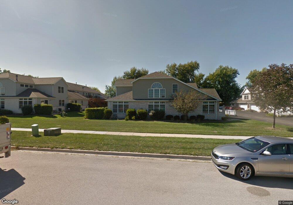
3853 S Pointe Dr Dekalb, IL 60115
Estimated Value: $216,000 - $268,000
--
Bed
--
Bath
--
Sq Ft
10,019
Sq Ft Lot
About This Home
This home is located at 3853 S Pointe Dr, Dekalb, IL 60115 and is currently estimated at $236,143. 3853 S Pointe Dr is a home located in DeKalb County with nearby schools including Lincoln Elementary School, Huntley Middle School, and De Kalb High School.
Ownership History
Date
Name
Owned For
Owner Type
Purchase Details
Closed on
Jul 19, 2005
Sold by
Tuntland John
Bought by
Shered Michael L and Shered Tammie M
Current Estimated Value
Home Financials for this Owner
Home Financials are based on the most recent Mortgage that was taken out on this home.
Original Mortgage
$160,190
Outstanding Balance
$83,729
Interest Rate
5.68%
Mortgage Type
New Conventional
Estimated Equity
$152,414
Purchase Details
Closed on
Apr 8, 2005
Sold by
Waterman Property Dev Inc
Bought by
Tuntland John E
Create a Home Valuation Report for This Property
The Home Valuation Report is an in-depth analysis detailing your home's value as well as a comparison with similar homes in the area
Home Values in the Area
Average Home Value in this Area
Purchase History
| Date | Buyer | Sale Price | Title Company |
|---|---|---|---|
| Shered Michael L | $160,000 | -- | |
| Tuntland John E | $161,500 | -- |
Source: Public Records
Mortgage History
| Date | Status | Borrower | Loan Amount |
|---|---|---|---|
| Open | Shered Michael L | $160,190 |
Source: Public Records
Tax History Compared to Growth
Tax History
| Year | Tax Paid | Tax Assessment Tax Assessment Total Assessment is a certain percentage of the fair market value that is determined by local assessors to be the total taxable value of land and additions on the property. | Land | Improvement |
|---|---|---|---|---|
| 2024 | $3,210 | $62,908 | $10,348 | $52,560 |
| 2023 | $3,210 | $57,529 | $9,463 | $48,066 |
| 2022 | $3,534 | $56,718 | $9,330 | $47,388 |
| 2021 | $3,902 | $49,091 | $8,739 | $40,352 |
| 2020 | $4,849 | $46,514 | $8,280 | $38,234 |
| 2019 | $4,783 | $44,768 | $7,969 | $36,799 |
| 2018 | $4,599 | $42,898 | $7,636 | $35,262 |
| 2017 | $4,492 | $40,318 | $7,177 | $33,141 |
| 2016 | $4,080 | $38,723 | $6,893 | $31,830 |
| 2015 | -- | $36,531 | $6,503 | $30,028 |
| 2014 | -- | $36,212 | $6,446 | $29,766 |
| 2013 | -- | $37,267 | $6,634 | $30,633 |
Source: Public Records
Map
Nearby Homes
- 212 Saint Andrews Dr
- 235 Saint Andrews Dr
- Lot 78 Pebble Beach Ct
- Lot 77 Pebble Beach Ct
- Lot 66 Pebble Beach Ct
- 253 Bent Grass Cir
- 255 Bent Grass Cir
- 283 Par Five Dr Unit D
- 8750 Gurler Rd
- 3011 S 4th St
- 18.6 Acre Lot Fairview Dr
- TBD Peace Rd
- TBD Fairview Dr
- 129 Devonshire Dr
- TBD 8.67 Acres Fairview Dr
- 617 E Fairview Dr
- 216 Pardridge Place
- 111 Salem Dr
- 1208 Stafford St
- 427 & 427.5 6th St
- 3853 S Pointe Dr
- 3853 S Pointe Dr
- 3853 S Pointe Dr
- 3853 S Pointe Dr
- 3853 S Pointe Dr
- 3853 S Pointe Dr Unit E
- 3853 S Pointe Dr Unit A
- 3853 S Pointe Dr Unit F
- 3853 S Pointe Dr Unit B
- 3853 E South Pointe Dr Unit A
- 3805 E South Pointe Dr Unit E
- 3891 South Pointe Dr Unit A
- 3805 S Pointe Dr
- 3805 S Pointe Dr
- 3805 S Pointe Dr
- 3805 S Pointe Dr
- 3805 S Pointe Dr
- 3805 S Pointe Dr
- 3805 S Pointe Dr Unit E
- 3805 S Pointe Dr Unit F