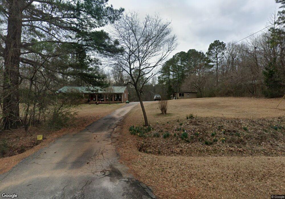
3855 Dial Mill Rd NE Conyers, GA 30013
Estimated Value: $276,595 - $360,000
3
Beds
2
Baths
1,548
Sq Ft
$209/Sq Ft
Est. Value
About This Home
This home is located at 3855 Dial Mill Rd NE, Conyers, GA 30013 and is currently estimated at $323,899, approximately $209 per square foot. 3855 Dial Mill Rd NE is a home located in Rockdale County with nearby schools including Hightower Trail Elementary School, Conyers Middle School, and Rockdale County High School.
Ownership History
Date
Name
Owned For
Owner Type
Purchase Details
Closed on
Apr 6, 2010
Sold by
Chase Hm Fin Llc
Bought by
Federal Home Loan Mortgage Corporation
Current Estimated Value
Purchase Details
Closed on
Jul 30, 2003
Sold by
Groves Gary T
Bought by
Early Michael W and Early Judy
Home Financials for this Owner
Home Financials are based on the most recent Mortgage that was taken out on this home.
Original Mortgage
$174,800
Interest Rate
5.24%
Mortgage Type
New Conventional
Purchase Details
Closed on
Apr 4, 1996
Sold by
Smith David A Emily T
Bought by
Groves Gary T
Purchase Details
Closed on
Dec 21, 1994
Sold by
Sablon Marid G
Bought by
Smith David A Emily T
Home Financials for this Owner
Home Financials are based on the most recent Mortgage that was taken out on this home.
Original Mortgage
$85,500
Interest Rate
9.23%
Create a Home Valuation Report for This Property
The Home Valuation Report is an in-depth analysis detailing your home's value as well as a comparison with similar homes in the area
Home Values in the Area
Average Home Value in this Area
Purchase History
| Date | Buyer | Sale Price | Title Company |
|---|---|---|---|
| Federal Home Loan Mortgage Corporation | $85,900 | -- | |
| Chase Hm Fin Llc | $85,900 | -- | |
| Early Michael W | $184,000 | -- | |
| Groves Gary T | $97,700 | -- | |
| Smith David A Emily T | $90,000 | -- |
Source: Public Records
Mortgage History
| Date | Status | Borrower | Loan Amount |
|---|---|---|---|
| Previous Owner | Early Michael W | $174,800 | |
| Previous Owner | Smith David A Emily T | $85,500 | |
| Closed | Groves Gary T | $0 |
Source: Public Records
Tax History Compared to Growth
Tax History
| Year | Tax Paid | Tax Assessment Tax Assessment Total Assessment is a certain percentage of the fair market value that is determined by local assessors to be the total taxable value of land and additions on the property. | Land | Improvement |
|---|---|---|---|---|
| 2024 | $2,191 | $97,440 | $26,880 | $70,560 |
| 2023 | $1,678 | $80,360 | $25,600 | $54,760 |
| 2022 | $1,644 | $74,040 | $25,600 | $48,440 |
| 2021 | $1,639 | $70,080 | $21,640 | $48,440 |
| 2020 | $1,514 | $65,160 | $16,720 | $48,440 |
| 2019 | $1,355 | $58,760 | $16,720 | $42,040 |
| 2018 | $1,207 | $53,760 | $11,800 | $41,960 |
| 2017 | $800 | $40,280 | $11,800 | $28,480 |
| 2016 | $740 | $40,280 | $11,800 | $28,480 |
| 2015 | $553 | $33,760 | $11,800 | $21,960 |
| 2014 | $552 | $33,760 | $11,800 | $21,960 |
| 2013 | -- | $40,400 | $14,760 | $25,640 |
Source: Public Records
Map
Nearby Homes
- 2528 Stream View Dr
- 0 Stream View Dr Unit LOT 19
- 0 Salem Church Rd NE Unit 10167606
- 3449 Highway 138 NE
- 40 Costleys Bridge Dr
- 0 Kent Rock Rd Unit Tract 3 CM1025514
- 0 Kent Rock Rd Unit 1025511
- 0 Kent Rock Rd Unit TRACT 3 10511414
- 0 Kent Rock Rd Unit 23453234
- 0 Kent Rock Rd Unit 10511296
- 135 Little Haynes Dr
- 3250 Miller Bottom Rd
- 2040 Costley Mill Rd NE
- 3295 Highway 138 NE
- Kent Rock Road Unit: Tract 3
- Kent Rock Road Unit: Tract 5
- 90 Kent Rock Rd
- 3070 N Tower Way NE
- 110 Kent Rock Rd
- 3150 Haverhill Cove NE Unit 2
- 3875 Dial Mill Rd NE
- 3845 Dial Mill Rd NE
- 3901 Dial Mill Rd NE
- 3835 Dial Mill Rd NE
- 3829 Dial Mill Rd NE
- 3820 Dial Mill Rd NE
- 2541 Stream View Dr
- 2537 Stream View Dr
- 2545 Stream View Dr
- 3800 Dial Mill Rd NE
- 2540 Stream View Dr
- 2540 Stream View Dr Unit 18
- 2533 Stream View Dr
- 0 Dial Mill Rd NE Unit 8118372
- 0 Dial Mill Rd NE Unit 7246587
- 3910 Dial Mill Rd NE
- 3910 Dial Mill Rd NE
- 2549 Stream View Dr
- 3790 Dial Mill Rd NE
- 3795 Dial Mill Rd NE