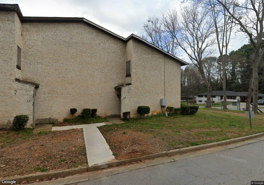
3856 Kensingwood Trace Unit 3856 Decatur, GA 30032
Estimated Value: $157,000 - $191,000
3
Beds
2
Baths
1,496
Sq Ft
$116/Sq Ft
Est. Value
About This Home
This home is located at 3856 Kensingwood Trace Unit 3856, Decatur, GA 30032 and is currently estimated at $173,450, approximately $115 per square foot. 3856 Kensingwood Trace Unit 3856 is a home located in DeKalb County with nearby schools including Rowland Elementary School, Mary McLeod Bethune Middle School, and Towers High School.
Ownership History
Date
Name
Owned For
Owner Type
Purchase Details
Closed on
Sep 9, 1999
Sold by
Duncan C Joseph
Bought by
Harris Michael R
Current Estimated Value
Home Financials for this Owner
Home Financials are based on the most recent Mortgage that was taken out on this home.
Original Mortgage
$64,500
Outstanding Balance
$18,990
Interest Rate
7.73%
Mortgage Type
FHA
Estimated Equity
$154,460
Purchase Details
Closed on
Aug 1, 1995
Sold by
Raffo Norma M Exec
Bought by
Duncan C Joseph
Create a Home Valuation Report for This Property
The Home Valuation Report is an in-depth analysis detailing your home's value as well as a comparison with similar homes in the area
Home Values in the Area
Average Home Value in this Area
Purchase History
| Date | Buyer | Sale Price | Title Company |
|---|---|---|---|
| Harris Michael R | $66,000 | -- | |
| Duncan C Joseph | $49,900 | -- |
Source: Public Records
Mortgage History
| Date | Status | Borrower | Loan Amount |
|---|---|---|---|
| Open | Harris Michael R | $64,500 | |
| Closed | Duncan C Joseph | $0 |
Source: Public Records
Tax History Compared to Growth
Tax History
| Year | Tax Paid | Tax Assessment Tax Assessment Total Assessment is a certain percentage of the fair market value that is determined by local assessors to be the total taxable value of land and additions on the property. | Land | Improvement |
|---|---|---|---|---|
| 2024 | $1,192 | $52,160 | $4,800 | $47,360 |
| 2023 | $1,192 | $33,640 | $4,800 | $28,840 |
| 2022 | $885 | $39,320 | $4,800 | $34,520 |
| 2021 | $305 | $19,680 | $4,800 | $14,880 |
| 2020 | $639 | $29,280 | $4,800 | $24,480 |
| 2019 | $479 | $24,800 | $3,600 | $21,200 |
| 2018 | $137 | $18,000 | $3,600 | $14,400 |
| 2017 | $305 | $19,360 | $3,600 | $15,760 |
| 2016 | $101 | $13,800 | $840 | $12,960 |
| 2014 | $29 | $2,920 | $840 | $2,080 |
Source: Public Records
Map
Nearby Homes
- 3834 Kensingwood Trace
- 3800 Travis Trace
- 1119 Oakwood Manor Ct
- 1068 Longshore Dr
- 1129 Winston Dr
- 3751 Oakwood Manor
- 1127 Renee Dr
- 1178 Winston Dr
- Cabot Plan at Porter Reserve
- Buchanan Plan at Porter Reserve
- Ellison Plan at Porter Reserve
- Salisbury Plan at Porter Reserve
- Hartcliffe Plan at Porter Reserve
- 3744 Redan Rd
- 1089 Canal St
- 3806 London Dr
- 4011 Redan Rd Unit 8
- 4011 Redan Rd Unit 6
- 3873 Jane Marie Ln
- 1019 Privy Ln Unit 74
- 3854 Kensingwood Trace
- 3850 Kensingwood Trace
- 3852 Kensingwood Trace
- 3848 Kensingwood Trace Unit 3848
- 3846 Kensingwood Trace
- 3844 Kensingwood Trace Unit 3844
- 3842 Kensingwood Trace Unit 3842
- 3840 Kensingwood Trace
- 3838 Kensingwood Trace
- 3836 Kensingwood Trace Unit 3834
- 3830 Kensingwood Trace
- 3874 Kensington Rd
- 3832 Kensingwood Trace
- 3826 Kensingwood Trace Unit 3826
- 3828 Kensingwood Trace
- 3824 Kensingwood Trace Unit 3824
- 3822 Kensingwood Trace Unit 3822
- 3818 Kensingwood Trace Unit 3818
- 3820 Kensingwood Trace Unit 3820
- 3816 Kensingwood Trace