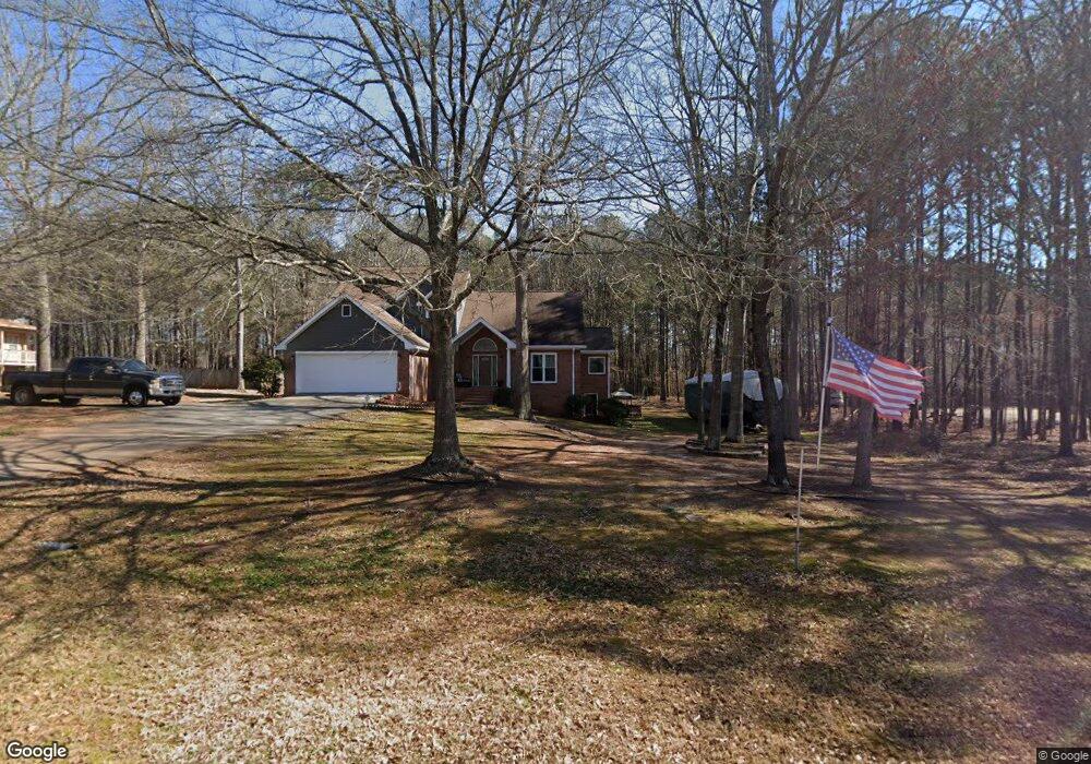
386 Carnation Dr Unit 3 Social Circle, GA 30025
Estimated Value: $433,000 - $601,000
--
Bed
1
Bath
2,649
Sq Ft
$190/Sq Ft
Est. Value
About This Home
This home is located at 386 Carnation Dr Unit 3, Social Circle, GA 30025 and is currently estimated at $502,942, approximately $189 per square foot. 386 Carnation Dr Unit 3 is a home located in Walton County with nearby schools including Social Circle Primary School, Social Circle Elementary School, and Social Circle Middle School.
Ownership History
Date
Name
Owned For
Owner Type
Purchase Details
Closed on
Oct 1, 1996
Sold by
T J Holmes Inc
Bought by
Stapp Mike Nona
Current Estimated Value
Create a Home Valuation Report for This Property
The Home Valuation Report is an in-depth analysis detailing your home's value as well as a comparison with similar homes in the area
Home Values in the Area
Average Home Value in this Area
Purchase History
| Date | Buyer | Sale Price | Title Company |
|---|---|---|---|
| Stapp Mike Nona | $154,400 | -- |
Source: Public Records
Mortgage History
| Date | Status | Borrower | Loan Amount |
|---|---|---|---|
| Closed | Stapp Mike Nona | $0 |
Source: Public Records
Tax History Compared to Growth
Tax History
| Year | Tax Paid | Tax Assessment Tax Assessment Total Assessment is a certain percentage of the fair market value that is determined by local assessors to be the total taxable value of land and additions on the property. | Land | Improvement |
|---|---|---|---|---|
| 2024 | $5,564 | $196,040 | $29,200 | $166,840 |
| 2023 | $445 | $153,920 | $28,000 | $125,920 |
| 2022 | $632 | $137,200 | $21,200 | $116,000 |
| 2021 | $632 | $117,960 | $16,000 | $101,960 |
| 2020 | $648 | $113,480 | $13,600 | $99,880 |
| 2019 | $662 | $88,760 | $12,000 | $76,760 |
| 2018 | $662 | $88,760 | $12,000 | $76,760 |
| 2017 | $3,709 | $88,760 | $12,000 | $76,760 |
| 2016 | $688 | $77,240 | $12,000 | $65,240 |
| 2015 | $683 | $66,720 | $10,000 | $56,720 |
| 2014 | $677 | $61,040 | $0 | $0 |
Source: Public Records
Map
Nearby Homes
- 100 Saint Andrews Ct
- 318 Richmond Dr
- 246 Azalea Farms Rd
- 226 Rogue Rd
- 380 Hickory St SW
- 357 W Hightower Trail
- 433 Clover Dr
- 443 Windsong Ln
- 582 S Cherokee Rd
- 1077 Riverstone Dr
- 241 E Ash St
- 494 Spring St
- (GA)The Ava | Front Entry Plan at Weslyn Park
- (GA)The Everett | Front Entry Plan at Weslyn Park
- (GA) The Brooks | Front Entry Plan at Weslyn Park
- (GA)The Hunter | Front Entry Plan at Weslyn Park
- (GA)The Carson | Front Entry Plan at Weslyn Park
- (GA)The Jackson | Front Entry Plan at Weslyn Park
- (GA)The Ellen | Front Entry Plan at Weslyn Park
- (GA)The Jefferson | Front Entry Plan at Weslyn Park
- 376 Carnation Dr
- 406 Carnation Dr
- 406 Carnation Dr
- 365 Wildflower Dr
- 356 Carnation Dr
- 366 Wildflower Dr
- 232 Saint Andrews Ct
- 196 Saint Andrews Ct
- 196 Saint Andrews Ct
- 232 St Andrews Ct
- 220 Saint Andrews Ct
- 232 St Andrews Ct
- 349 Wildflower Dr Unit 2
- 244 Saint Andrews Ct
- 208 Saint Andrews Ct
- 196 St Andrews Ct
- 184 St Andrews Ct
- 244 St Andrews Ct
- 25 Wynfield Trc
- 25 350 Wildflower Dr