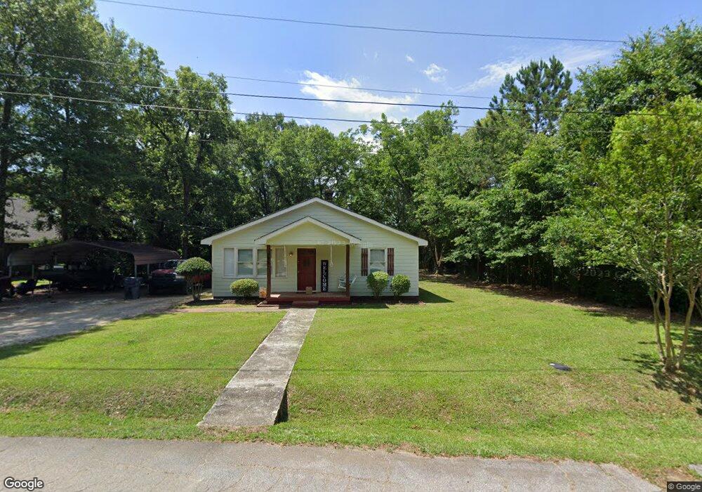
386 Chestnut Dr SE Social Circle, GA 30025
Estimated Value: $210,007 - $252,000
--
Bed
--
Bath
1,023
Sq Ft
$228/Sq Ft
Est. Value
About This Home
This home is located at 386 Chestnut Dr SE, Social Circle, GA 30025 and is currently estimated at $233,502, approximately $228 per square foot. 386 Chestnut Dr SE is a home located in Walton County with nearby schools including Social Circle Primary School, Social Circle Elementary School, and Social Circle Middle School.
Ownership History
Date
Name
Owned For
Owner Type
Purchase Details
Closed on
Jun 20, 2019
Sold by
Mauldin Dennis W
Bought by
Hightower Brandon
Current Estimated Value
Home Financials for this Owner
Home Financials are based on the most recent Mortgage that was taken out on this home.
Original Mortgage
$114,898
Outstanding Balance
$100,819
Interest Rate
4%
Mortgage Type
New Conventional
Estimated Equity
$132,683
Purchase Details
Closed on
Aug 26, 2016
Sold by
Dennis
Bought by
Mauldin Dennis W and Mauldin Angela R
Create a Home Valuation Report for This Property
The Home Valuation Report is an in-depth analysis detailing your home's value as well as a comparison with similar homes in the area
Home Values in the Area
Average Home Value in this Area
Purchase History
| Date | Buyer | Sale Price | Title Company |
|---|---|---|---|
| Hightower Brandon | $122,000 | -- | |
| Mauldin Dennis W | $30,000 | -- |
Source: Public Records
Mortgage History
| Date | Status | Borrower | Loan Amount |
|---|---|---|---|
| Open | Hightower Brandon | $114,898 |
Source: Public Records
Tax History Compared to Growth
Tax History
| Year | Tax Paid | Tax Assessment Tax Assessment Total Assessment is a certain percentage of the fair market value that is determined by local assessors to be the total taxable value of land and additions on the property. | Land | Improvement |
|---|---|---|---|---|
| 2024 | $2,554 | $71,804 | $10,000 | $61,804 |
| 2023 | $2,365 | $65,404 | $8,800 | $56,604 |
| 2022 | $624 | $59,884 | $7,200 | $52,684 |
| 2021 | $546 | $52,404 | $7,200 | $45,204 |
| 2020 | $521 | $48,964 | $5,600 | $43,364 |
| 2019 | $215 | $17,444 | $5,600 | $11,844 |
| 2018 | $190 | $17,444 | $5,600 | $11,844 |
| 2017 | $627 | $15,004 | $4,000 | $11,004 |
| 2016 | $152 | $13,404 | $4,000 | $9,404 |
| 2015 | $138 | $12,244 | $4,000 | $8,244 |
| 2014 | $154 | $13,000 | $4,000 | $9,000 |
Source: Public Records
Map
Nearby Homes
- Adrian Plan at Conner Springs
- Sinclair Plan at Conner Springs
- Shiloh Plan at Conner Springs
- Mira Plan at Conner Springs
- Hemingway Plan at Conner Springs
- Harding Plan at Conner Springs
- Tucker Front Porch Plan at Conner Springs
- 432 Chestnut St
- 177 ORWELL Drive
- 241 E Ash St
- 207 E Hightower Trail
- 135 N Dogwood Ave
- 582 S Cherokee Rd
- 178 Orwell Dr
- 178 Elder Dr SE
- 178 Elder Dr SE Unit 103
- 177 Orwell Dr
- 204 Orwell Dr
- 415 Dove Ln
- 127 Holly St NE
- 399 Chestnut Dr SE
- 252 Spring St SE
- 353 Spring St
- 357 Walnut Dr SE
- 415 Chestnut Dr SE
- 224 Spring St SE
- 0 Spring St Unit 8437831
- 0 Spring St Unit 8527422
- 348 Walnut St
- 352 Walnut Dr SE
- 348 Walnut Dr SE
- 348 Walnut Dr SE
- 360 Walnut St
- 360 Walnut Dr SE Unit 12
- 360 Walnut Dr SE
- 364 Walnut Dr SE
- 0 Walnut St Unit 8590727
- 0 Walnut St Unit 8499804
- 0 Walnut St Unit 8082159
- 0 Walnut St Unit 8524822