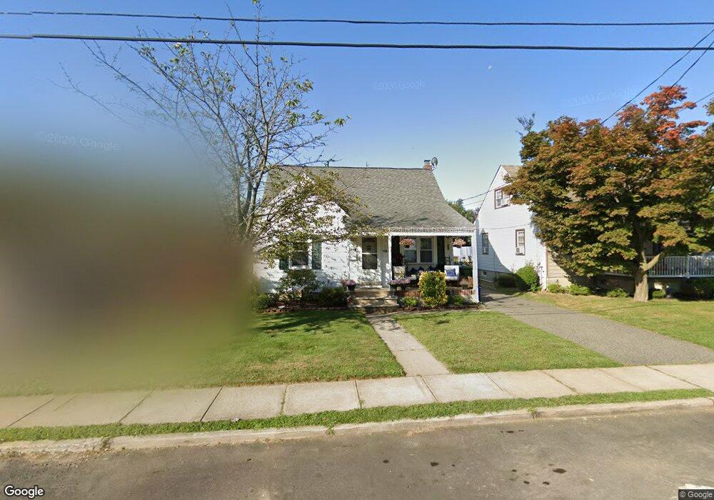
386 Division St South Amboy, NJ 08879
Estimated Value: $365,000 - $485,000
--
Bed
--
Bath
--
Sq Ft
5,750
Sq Ft Lot
About This Home
This home is located at 386 Division St, South Amboy, NJ 08879 and is currently estimated at $416,317. 386 Division St is a home located in Middlesex County with nearby schools including Sayreville War Memorial High School, St. Mary Elementary School, and New Road School of Parlin.
Ownership History
Date
Name
Owned For
Owner Type
Purchase Details
Closed on
Sep 21, 2012
Sold by
Rondeau Jeanette and Hofmeister Georgett
Bought by
Hofmeister Georgette
Current Estimated Value
Home Financials for this Owner
Home Financials are based on the most recent Mortgage that was taken out on this home.
Original Mortgage
$208,867
Outstanding Balance
$142,328
Interest Rate
3.25%
Mortgage Type
FHA
Estimated Equity
$273,989
Purchase Details
Closed on
Jul 10, 2004
Sold by
Mclaughlin Brian
Bought by
Rondeau Jeanette and Hofmeister Georgette
Home Financials for this Owner
Home Financials are based on the most recent Mortgage that was taken out on this home.
Original Mortgage
$223,000
Interest Rate
6.28%
Purchase Details
Closed on
Mar 16, 2001
Sold by
Bowman Lee
Bought by
Mclaughlin Brian and Mc Laughlin Patricia
Home Financials for this Owner
Home Financials are based on the most recent Mortgage that was taken out on this home.
Original Mortgage
$145,845
Interest Rate
6.93%
Mortgage Type
FHA
Create a Home Valuation Report for This Property
The Home Valuation Report is an in-depth analysis detailing your home's value as well as a comparison with similar homes in the area
Home Values in the Area
Average Home Value in this Area
Purchase History
| Date | Buyer | Sale Price | Title Company |
|---|---|---|---|
| Hofmeister Georgette | -- | None Available | |
| Rondeau Jeanette | $234,900 | -- | |
| Mclaughlin Brian | $147,000 | -- |
Source: Public Records
Mortgage History
| Date | Status | Borrower | Loan Amount |
|---|---|---|---|
| Open | Hofmeister Georgette | $208,867 | |
| Closed | Rondeau Jeanette | $223,000 | |
| Previous Owner | Mclaughlin Brian | $145,845 |
Source: Public Records
Tax History Compared to Growth
Tax History
| Year | Tax Paid | Tax Assessment Tax Assessment Total Assessment is a certain percentage of the fair market value that is determined by local assessors to be the total taxable value of land and additions on the property. | Land | Improvement |
|---|---|---|---|---|
| 2025 | $7,015 | $114,900 | $51,500 | $63,400 |
| 2024 | $6,820 | $114,900 | $51,500 | $63,400 |
| 2023 | $6,820 | $114,900 | $51,500 | $63,400 |
| 2022 | $6,371 | $114,900 | $51,500 | $63,400 |
| 2021 | $6,025 | $114,900 | $51,500 | $63,400 |
| 2020 | $6,141 | $114,900 | $51,500 | $63,400 |
| 2019 | $6,013 | $114,900 | $51,500 | $63,400 |
| 2018 | $5,905 | $114,900 | $51,500 | $63,400 |
| 2017 | $5,768 | $114,900 | $51,500 | $63,400 |
| 2016 | $5,614 | $114,900 | $51,500 | $63,400 |
| 2015 | $5,486 | $114,900 | $51,500 | $63,400 |
| 2014 | $5,339 | $114,900 | $51,500 | $63,400 |
Source: Public Records
Map
Nearby Homes
- 380 Prospect St
- 741 Bordentown Ave
- 320 Parker Ave
- 15 Bertram Ave
- 528 Catherine St
- 433 Gordon St
- 442 Bordentown Ave
- 894 Upper Main St
- 504 Colonel D B Kelly Way
- 504 Col Db Kelly Way
- 411 Lefferts St
- 10 Martha Blvd
- 161 Manor St
- 503 Woodland Ave
- 2950 Washington Rd
- 322 George St
- 7 Kenneth Ave
- 20 Gillen Dr
- 3350 Washington Rd
- 518 Center St
- 384 Division St
- 388 Division St
- 382 Division St
- 16 Grover Ave
- 390 Division St
- 14 Grover Ave
- 18 Grover Ave
- 12 Grover Ave
- 20 Grover Ave
- 392 Division St
- 391 Division St
- 407 Division St
- 393 Division St
- 10 Grover Ave
- 22 Grover Ave
- 409 Division St
- 405 Division St
- 376 Division St
- 0-0 Division St
- 394 Division St