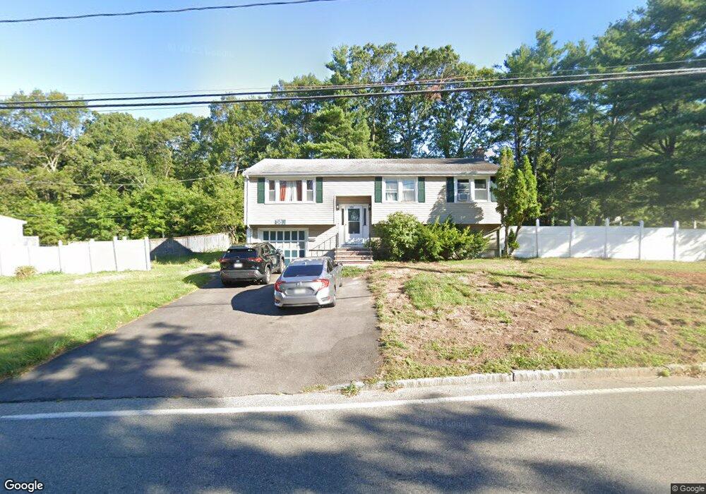
386 E Ashland St Brockton, MA 02302
Montello NeighborhoodEstimated Value: $527,556 - $572,000
3
Beds
2
Baths
1,804
Sq Ft
$305/Sq Ft
Est. Value
About This Home
This home is located at 386 E Ashland St, Brockton, MA 02302 and is currently estimated at $550,139, approximately $304 per square foot. 386 E Ashland St is a home located in Plymouth County with nearby schools including Brookfield Elementary School, Mary E. Baker Elementary School, and Downey Elementary School.
Create a Home Valuation Report for This Property
The Home Valuation Report is an in-depth analysis detailing your home's value as well as a comparison with similar homes in the area
Home Values in the Area
Average Home Value in this Area
Tax History
| Year | Tax Paid | Tax Assessment Tax Assessment Total Assessment is a certain percentage of the fair market value that is determined by local assessors to be the total taxable value of land and additions on the property. | Land | Improvement |
|---|---|---|---|---|
| 2025 | $5,445 | $449,600 | $152,600 | $297,000 |
| 2024 | $5,319 | $442,500 | $152,600 | $289,900 |
| 2023 | $5,231 | $403,000 | $118,100 | $284,900 |
| 2022 | $5,120 | $366,500 | $107,600 | $258,900 |
| 2021 | $5,039 | $347,500 | $99,800 | $247,700 |
| 2020 | $4,795 | $316,500 | $95,600 | $220,900 |
| 2019 | $4,572 | $294,200 | $89,400 | $204,800 |
| 2018 | $4,354 | $271,100 | $89,400 | $181,700 |
| 2017 | $4,019 | $249,600 | $89,400 | $160,200 |
| 2016 | $4,034 | $232,400 | $85,700 | $146,700 |
| 2015 | $3,862 | $212,800 | $85,700 | $127,100 |
| 2014 | $3,731 | $205,800 | $85,700 | $120,100 |
Source: Public Records
Map
Nearby Homes
- 14 Eastfield Dr
- 378 E Ashland St
- 406 E Ashland St
- 20 Eastfield Dr
- 381 E Ashland St
- 397 E Ashland St
- 15 Eastfield Dr
- 412 E Ashland St
- 11 Dickinson Rd
- 5 Dickinson Rd
- 407 E Ashland St
- 29 Dickinson Rd
- 19 Stella Rd
- 375 E Ashland St
- 371 E Ashland St
- 416 E Ashland St
- 12 Upton St
- 360 E Ashland St
- 14 Stella Rd
- 413 E Ashland St
Your Personal Tour Guide
Ask me questions while you tour the home.