Estimated Value: $737,656 - $799,000
3
Beds
3
Baths
1,632
Sq Ft
$468/Sq Ft
Est. Value
About This Home
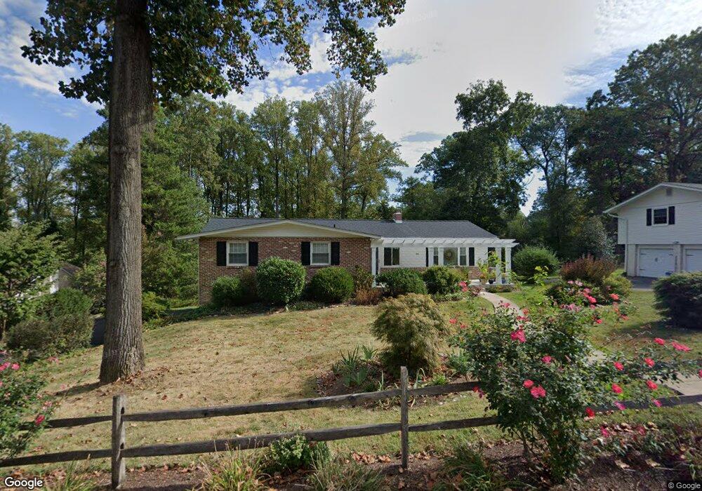
This home is located at 386 Friendship Dr, Paoli, PA 19301 and is currently estimated at $763,914, approximately $468 per square foot. 386 Friendship Dr is a home located in Chester County with nearby schools including Hillside Elementary School, Valley Forge Middle School, and Conestoga Senior High School.
Ownership History
Date
Name
Owned For
Owner Type
Purchase Details
Closed on
Apr 19, 1996
Sold by
Mcentee Mary Jane and Aeugle Margaretta E
Bought by
Thomas Michael J and Thomas Wendy
Current Estimated Value
Home Financials for this Owner
Home Financials are based on the most recent Mortgage that was taken out on this home.
Original Mortgage
$154,200
Interest Rate
7.62%
Create a Home Valuation Report for This Property
The Home Valuation Report is an in-depth analysis detailing your home's value as well as a comparison with similar homes in the area
Home Values in the Area
Average Home Value in this Area
Purchase History
| Date | Buyer | Sale Price | Title Company |
|---|---|---|---|
| Thomas Michael J | $205,600 | -- |
Source: Public Records
Mortgage History
| Date | Status | Borrower | Loan Amount |
|---|---|---|---|
| Previous Owner | Thomas Michael J | $154,200 |
Source: Public Records
Tax History Compared to Growth
Tax History
| Year | Tax Paid | Tax Assessment Tax Assessment Total Assessment is a certain percentage of the fair market value that is determined by local assessors to be the total taxable value of land and additions on the property. | Land | Improvement |
|---|---|---|---|---|
| 2025 | $6,672 | $189,420 | $67,750 | $121,670 |
| 2024 | $6,672 | $189,420 | $67,750 | $121,670 |
| 2023 | $6,267 | $189,420 | $67,750 | $121,670 |
| 2022 | $6,106 | $189,420 | $67,750 | $121,670 |
| 2021 | $5,990 | $189,420 | $67,750 | $121,670 |
| 2020 | $5,824 | $189,420 | $67,750 | $121,670 |
| 2019 | $5,640 | $189,420 | $67,750 | $121,670 |
| 2018 | $5,529 | $189,420 | $67,750 | $121,670 |
| 2017 | $5,397 | $189,420 | $67,750 | $121,670 |
| 2016 | -- | $189,420 | $67,750 | $121,670 |
| 2015 | -- | $189,420 | $67,750 | $121,670 |
| 2014 | -- | $189,420 | $67,750 | $121,670 |
Source: Public Records
Map
Nearby Homes
- 109 Vincent Rd
- 5 Kent Ln
- 202 Shoreline Dr
- 1242 Old Lancaster Rd
- 106 N Valley Rd
- 1250 Swedesford Rd
- 1 Whitworth Ave
- 1441 Berwyn Paoli Rd
- 521 Foxwood Ln
- 211 Wooded Way
- 2102 Quail Ridge Dr
- 896 Conestoga Rd
- 1304 Weatherstone Dr Unit 1304
- 32 Manchester Ct
- 1705 Weatherstone Dr
- 21 Manor Rd
- 29 Manor Rd
- 104 Lynbrook Rd
- 793 Tory Hollow Rd
- 114 Manor Rd
- 382 Friendship Dr
- 378 Friendship Dr
- 420 Hilltop Rd
- 404 Hilltop Rd
- 428 Hilltop Rd
- 383 Friendship Dr
- 412 Hilltop Rd
- 375 Friendship Dr
- 387 Friendship Dr
- 393 Friendship Dr
- 434 Hilltop Rd
- 392 Hilltop Rd
- 374 Friendship Dr
- 367 Friendship Dr
- 382 Hilltop Rd
- 405 Hilltop Rd
- 442 Hilltop Rd
- 370 Friendship Dr
- 401 Hilltop Rd
- 407 Hilltop Rd