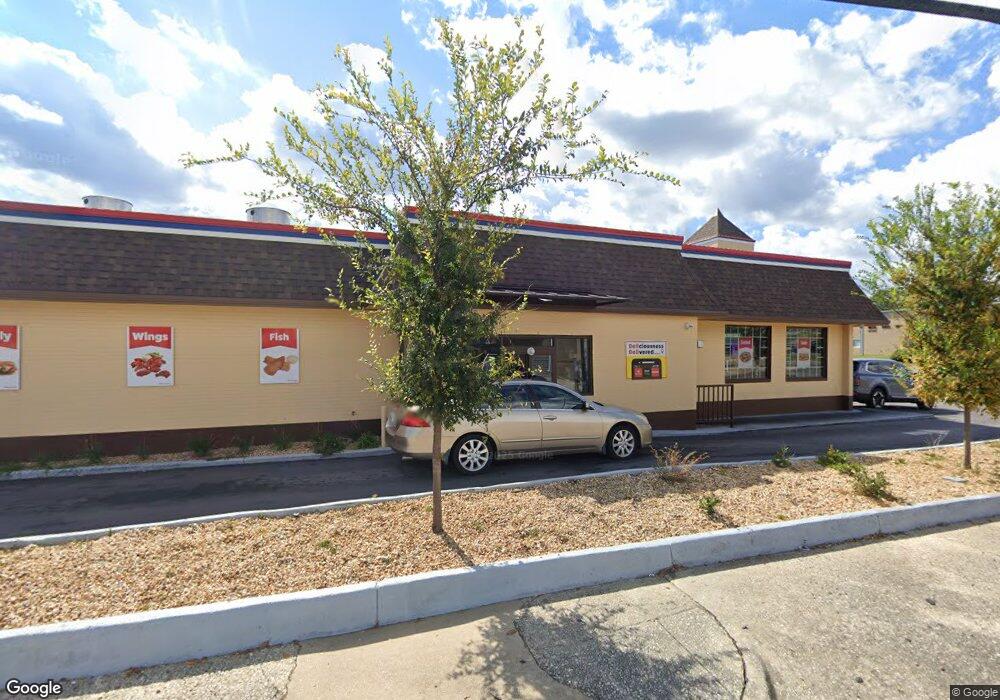
386 N Oates St Dothan, AL 36303
Estimated Value: $709,865
Studio
--
Bath
2,460
Sq Ft
$289/Sq Ft
Est. Value
About This Home
This home is located at 386 N Oates St, Dothan, AL 36303 and is currently estimated at $709,865, approximately $288 per square foot. 386 N Oates St is a home located in Houston County with nearby schools including Dothan City Early Education Center, Jerry Lee Faine Elementary School, and Dothan Preparatory Academy.
Ownership History
Date
Name
Owned For
Owner Type
Purchase Details
Closed on
Nov 5, 2020
Sold by
Patel Maheshkumar Mulchandbhai
Bought by
Jay Veer Krupa Llc
Current Estimated Value
Home Financials for this Owner
Home Financials are based on the most recent Mortgage that was taken out on this home.
Original Mortgage
$300,000
Interest Rate
2.8%
Mortgage Type
Seller Take Back
Purchase Details
Closed on
Jan 8, 2019
Sold by
Patel Nirav and Patel Jatin
Bought by
Patel Maheshkumar Mulchandbhai
Purchase Details
Closed on
Apr 6, 2017
Sold by
Nailen Properties Ggg Llp
Bought by
Patel Nirav and Patel Jatin
Create a Home Valuation Report for This Property
The Home Valuation Report is an in-depth analysis detailing your home's value as well as a comparison with similar homes in the area
Purchase History
| Date | Buyer | Sale Price | Title Company |
|---|---|---|---|
| Jay Veer Krupa Llc | $510,000 | None Available | |
| Patel Maheshkumar Mulchandbhai | $260,000 | None Available | |
| Patel Nirav | $250,000 | -- |
Source: Public Records
Mortgage History
| Date | Status | Borrower | Loan Amount |
|---|---|---|---|
| Closed | Jay Veer Krupa Llc | $300,000 |
Source: Public Records
Tax History Compared to Growth
Tax History
| Year | Tax Paid | Tax Assessment Tax Assessment Total Assessment is a certain percentage of the fair market value that is determined by local assessors to be the total taxable value of land and additions on the property. | Land | Improvement |
|---|---|---|---|---|
| 2025 | $3,168 | $88,000 | $0 | $0 |
| 2024 | $3,168 | $87,920 | $0 | $0 |
| 2023 | $3,165 | $87,920 | $0 | $0 |
| 2022 | $1,537 | $44,540 | $0 | $0 |
| 2021 | $1,350 | $44,540 | $0 | $0 |
| 2020 | $1,455 | $39,140 | $0 | $0 |
| 2018 | $1,792 | $51,940 | $0 | $0 |
| 2017 | $2,075 | $60,140 | $0 | $0 |
| 2016 | $2,075 | $0 | $0 | $0 |
| 2015 | $2,075 | $0 | $0 | $0 |
| 2014 | $2,018 | $0 | $0 | $0 |
Source: Public Records
Map
Nearby Homes
- 241 Headland Ave
- 184 S Oates St W Crawford St (1 38+-Ac)
- 180 Omussee Rd
- Lot 12 W Crawford St
- 758 N Oates St
- 605 E Newton St
- 105 Boone Ln
- 610 Toad St
- 302 E Stough St
- 516 Headland Ave
- 412 N Range St
- 706 Westmead St
- 303 Beulah St
- 950 Chickasaw St
- 709 Westmead St
- 711 Westmead St
- 504 S Saint Andrews St
- 601 Headland Ave
- 104 N Herring St
- 505 Somerset St
- Lot 36 Brushfire
- 344 N Oates St
- 401 Grand Harbor
- 401 N Foster St
- 355 N Oates St
- 319 Grand Harbor
- 325 N Oates St
- 320 N Foster St
- 0 N Oates St
- 306 N Foster St
- 485 N Oates St
- 101 W Adams St
- 300 N Foster St
- 412 N Foster St
- 206 W Adams St
- 504 N Saint Andrews St
- 101 E Adams St
- 520 N Oates St
- 261 N Oates St
- 208 W Adams St
