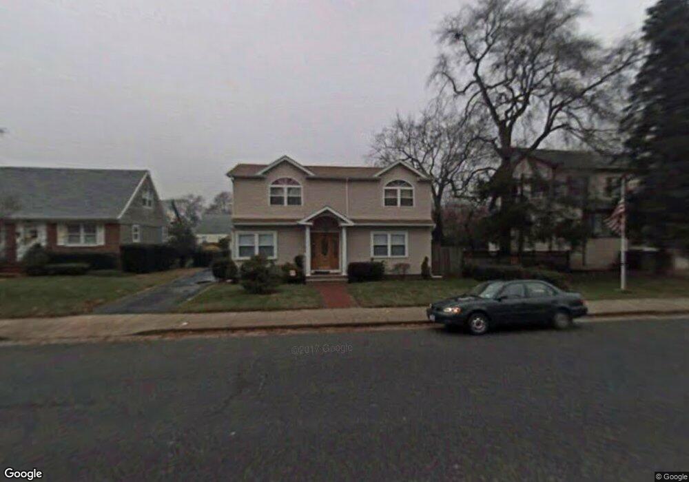
386 S Long Beach Ave Freeport, NY 11520
Estimated Value: $664,000 - $715,667
6
Beds
2
Baths
1,920
Sq Ft
$359/Sq Ft
Est. Value
About This Home
This home is located at 386 S Long Beach Ave, Freeport, NY 11520 and is currently estimated at $689,834, approximately $359 per square foot. 386 S Long Beach Ave is a home located in Nassau County with nearby schools including Columbus Avenue School, Caroline G. Atkinson Intermediate School, and John W Dodd Middle School.
Ownership History
Date
Name
Owned For
Owner Type
Purchase Details
Closed on
Jun 9, 2016
Sold by
Zhu Lin Yun and Chen Xue Qin
Bought by
Boyd Earl
Current Estimated Value
Home Financials for this Owner
Home Financials are based on the most recent Mortgage that was taken out on this home.
Original Mortgage
$309,294
Outstanding Balance
$251,472
Interest Rate
4.25%
Mortgage Type
FHA
Estimated Equity
$438,362
Purchase Details
Closed on
Oct 26, 2001
Sold by
Dunne James A and Dunne Maryjoan
Bought by
Lin Yun Zhu
Create a Home Valuation Report for This Property
The Home Valuation Report is an in-depth analysis detailing your home's value as well as a comparison with similar homes in the area
Home Values in the Area
Average Home Value in this Area
Purchase History
| Date | Buyer | Sale Price | Title Company |
|---|---|---|---|
| Boyd Earl | $315,000 | First American Title Insuran | |
| Lin Yun Zhu | $230,000 | Nolan Cheng |
Source: Public Records
Mortgage History
| Date | Status | Borrower | Loan Amount |
|---|---|---|---|
| Open | Boyd Earl | $309,294 |
Source: Public Records
Tax History Compared to Growth
Tax History
| Year | Tax Paid | Tax Assessment Tax Assessment Total Assessment is a certain percentage of the fair market value that is determined by local assessors to be the total taxable value of land and additions on the property. | Land | Improvement |
|---|---|---|---|---|
| 2025 | $9,530 | $442 | $173 | $269 |
| 2024 | $949 | $442 | $173 | $269 |
| 2023 | $8,885 | $442 | $173 | $269 |
| 2022 | $8,885 | $442 | $173 | $269 |
| 2021 | $12,503 | $424 | $166 | $258 |
| 2020 | $8,025 | $466 | $407 | $59 |
| 2019 | $6,858 | $499 | $435 | $64 |
| 2018 | $7,225 | $533 | $0 | $0 |
| 2017 | $5,412 | $566 | $439 | $127 |
| 2016 | $6,261 | $600 | $358 | $242 |
| 2015 | $914 | $633 | $378 | $255 |
| 2014 | $914 | $633 | $378 | $255 |
| 2013 | $1,063 | $779 | $465 | $314 |
Source: Public Records
Map
Nearby Homes
- 119 S Bay Ave
- 173 Cedar St
- 78 Saint Marks Ave
- 31 Casino St Unit PH
- 310 Miller Ave
- 437 Ray St
- 494 S Ocean Ave Unit 3A
- 494 S Ocean Ave Unit 1H
- 280 Guy Lombardo Ave Unit 5G
- 120 Sportsmans Ave
- 171 Westside Ave
- 159 Southside Ave
- 175 Archer St Unit 3A
- 175 Archer St Unit 1C
- 177 Sportsmans Ave
- 209 Nassau Ave
- 374 Miller Ave
- 103 Rose St
- 16 Johnson Place
- 536 S Ocean Ave
- 388 S Long Beach Ave
- 211 Roosevelt Ave
- 215 Roosevelt Ave
- 392 S Long Beach Ave
- 309 Ray St
- 219 Roosevelt Ave
- 400 S Long Beach Ave
- 225 Roosevelt Ave
- 375 S Long Beach Ave
- 389 S Long Beach Ave
- 379 S Long Beach Ave
- 360 S Long Beach Ave
- 312 Ray St
- 395 S Long Beach Ave
- 229 Roosevelt Ave
- 404 S Long Beach Ave
- 399 S Long Beach Ave
- 218 Roosevelt Ave
- 233 Roosevelt Ave
- 216 Roosevelt Ave