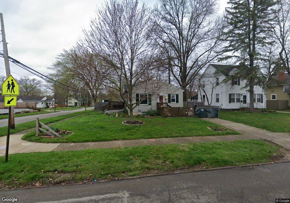
386 the Brooklands Akron, OH 44305
Goodyear Heights NeighborhoodEstimated Value: $113,966 - $133,000
3
Beds
1
Bath
960
Sq Ft
$128/Sq Ft
Est. Value
About This Home
This home is located at 386 the Brooklands, Akron, OH 44305 and is currently estimated at $122,992, approximately $128 per square foot. 386 the Brooklands is a home located in Summit County with nearby schools including Seiberling Community Learning Center, Akron Preparatory school, and Middlebury Academy.
Ownership History
Date
Name
Owned For
Owner Type
Purchase Details
Closed on
Jul 22, 2002
Sold by
Hud
Bought by
Nigro Anthony F
Current Estimated Value
Home Financials for this Owner
Home Financials are based on the most recent Mortgage that was taken out on this home.
Original Mortgage
$35,600
Outstanding Balance
$15,188
Interest Rate
6.8%
Estimated Equity
$107,804
Purchase Details
Closed on
Nov 28, 2001
Sold by
Bennett Rickey J
Bought by
Hud
Create a Home Valuation Report for This Property
The Home Valuation Report is an in-depth analysis detailing your home's value as well as a comparison with similar homes in the area
Home Values in the Area
Average Home Value in this Area
Purchase History
| Date | Buyer | Sale Price | Title Company |
|---|---|---|---|
| Nigro Anthony F | -- | Gateway Title Agency Inc | |
| Hud | $55,000 | -- |
Source: Public Records
Mortgage History
| Date | Status | Borrower | Loan Amount |
|---|---|---|---|
| Open | Nigro Anthony F | $35,600 | |
| Closed | Nigro Anthony F | $37,500 |
Source: Public Records
Tax History
| Year | Tax Paid | Tax Assessment Tax Assessment Total Assessment is a certain percentage of the fair market value that is determined by local assessors to be the total taxable value of land and additions on the property. | Land | Improvement |
|---|---|---|---|---|
| 2025 | $5,360 | $28,116 | $8,015 | $20,101 |
| 2024 | $1,726 | $28,116 | $8,015 | $20,101 |
| 2023 | $5,360 | $28,116 | $8,015 | $20,101 |
| 2022 | $1,611 | $20,384 | $5,684 | $14,700 |
| 2021 | $1,612 | $20,384 | $5,684 | $14,700 |
| 2020 | $1,639 | $20,380 | $5,680 | $14,700 |
| 2019 | $1,820 | $21,070 | $6,050 | $15,020 |
| 2018 | $1,799 | $21,070 | $6,050 | $15,020 |
| 2017 | $1,740 | $21,070 | $6,050 | $15,020 |
| 2016 | $1,824 | $21,070 | $6,050 | $15,020 |
| 2015 | $1,740 | $21,070 | $6,050 | $15,020 |
| 2014 | $1,728 | $21,070 | $6,050 | $15,020 |
| 2013 | $1,889 | $23,880 | $6,050 | $17,830 |
Source: Public Records
Map
Nearby Homes
- 425 Frazier Ave
- 291 Malacca St
- 465 Saint Leger Ave
- 295 Goodview Ave
- 248 Malacca St
- 349/351, 353/355 Cluster Ave
- 1991-1993 Congo St
- 439 Larkin Ave
- 1591 Pilgrim St
- 365 Larkin Ave
- 1581 Hillside Terrace
- 1578 Pilgrim St
- 561 Melrose St
- 1837 Marks Ave
- 1874 Adelaide Blvd
- 1492 Onondago Ave
- 1551 Preston Ave
- 1430 Ottawa Ave
- 1442 Hillside Terrace
- 570 Mohawk Ave
- 396 the Brooklands
- 400 the Brooklands
- 1819 Newton St
- 1855 Tonawanda Ave
- 406 the Brooklands
- 1851 Tonawanda Ave
- 1873 Tonawanda Ave
- 389 the Brooklands
- 395 the Brooklands
- 1845 Tonawanda Ave
- 410 the Brooklands
- 1879 Tonawanda Ave
- 399 the Brooklands
- 370 the Brooklands
- 1841 Tonawanda Ave
- 405 the Brooklands
- 416 the Brooklands
- 1883 Tonawanda Ave
- 369 the Brooklands
- 364 the Brooklands
Your Personal Tour Guide
Ask me questions while you tour the home.