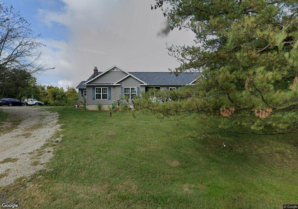
3861 S State Route 377 Stockport, OH 43787
Estimated Value: $231,000 - $342,000
3
Beds
2
Baths
3,006
Sq Ft
$98/Sq Ft
Est. Value
About This Home
This home is located at 3861 S State Route 377, Stockport, OH 43787 and is currently estimated at $294,876, approximately $98 per square foot. 3861 S State Route 377 is a home with nearby schools including Morgan High School.
Ownership History
Date
Name
Owned For
Owner Type
Purchase Details
Closed on
Feb 14, 2005
Sold by
Matson David L and Matson Bonnie L
Bought by
Matson Carlos W and Matson Carol J
Current Estimated Value
Purchase Details
Closed on
Feb 10, 2005
Sold by
Matson David L and Matson Bonnie L
Bought by
Matson Carlos W and Matson Carol J
Purchase Details
Closed on
Oct 12, 1999
Sold by
Rainer Myrta L
Bought by
Matson David L and Matson Bonnie L
Purchase Details
Closed on
Feb 23, 1998
Sold by
Wells Jerry R and Wells Linda
Bought by
Rainer Myrta L
Create a Home Valuation Report for This Property
The Home Valuation Report is an in-depth analysis detailing your home's value as well as a comparison with similar homes in the area
Home Values in the Area
Average Home Value in this Area
Purchase History
| Date | Buyer | Sale Price | Title Company |
|---|---|---|---|
| Matson Carlos W | -- | -- | |
| Matson Carlos W | -- | John A Wells, Attorney | |
| Matson David L | $14,000 | -- | |
| Rainer Myrta L | $7,000 | -- |
Source: Public Records
Tax History Compared to Growth
Tax History
| Year | Tax Paid | Tax Assessment Tax Assessment Total Assessment is a certain percentage of the fair market value that is determined by local assessors to be the total taxable value of land and additions on the property. | Land | Improvement |
|---|---|---|---|---|
| 2024 | $2,496 | $75,380 | $7,220 | $68,160 |
| 2023 | $1,659 | $50,300 | $5,880 | $44,420 |
| 2022 | $1,663 | $50,300 | $5,880 | $44,420 |
| 2021 | $1,679 | $50,300 | $5,880 | $44,420 |
| 2020 | $1,638 | $45,730 | $5,350 | $40,380 |
| 2019 | $1,596 | $45,730 | $5,350 | $40,380 |
| 2018 | $1,116 | $33,110 | $5,350 | $27,760 |
| 2017 | $165 | $4,631 | $4,631 | $0 |
| 2016 | $166 | $4,631 | $4,631 | $0 |
| 2015 | $165 | $4,631 | $4,631 | $0 |
| 2014 | $171 | $4,631 | $4,631 | $0 |
| 2013 | $174 | $4,631 | $4,631 | $0 |
Source: Public Records
Map
Nearby Homes
- 681 Downing Rd
- 781 Downing Rd
- 0 Downing Rd
- 1673 S State Route 377
- 3205 Goshen Run Rd
- 5174 Lightner Ridge Rd
- 3265 Tieber Rd
- 1715 South St
- 0 Meadow St Unit Lot 9 5158299
- 0 Meadow St Unit Lot 9 225008020
- 1770 Broadway St
- 7.38 acres County Road 13
- 1920 North St
- 1960 Broadway St
- 0 Benjamin Rd
- 75 S River Rd SE
- 643 Townsend Rd
- 0 Ohio 555 Unit 5146049
- 7600 Marion St
- 3020 State Route 376
- 1650 Beach Hilaman Rd
- 3926 Beech Hilaman Rd
- 3795 State Route 377
- 1839 Embree Rd
- 841 Young Ln
- 4356 State Route 377
- 4377 State Route 377
- 805 Downing Rd
- 00 Downing Rd
- 1695 Beach Hilaman Rd
- 800 Downing Rd
- 1383 Embree Rd
- 545 Downing Rd
- 485 Downing Rd
- 3925 Coulson Rd
- 0 Hilaman Rd
- 2950 S State Route 377
- 00 Woodyard Union Rd
- 3575 T-99
- 3585 Coulson Rd