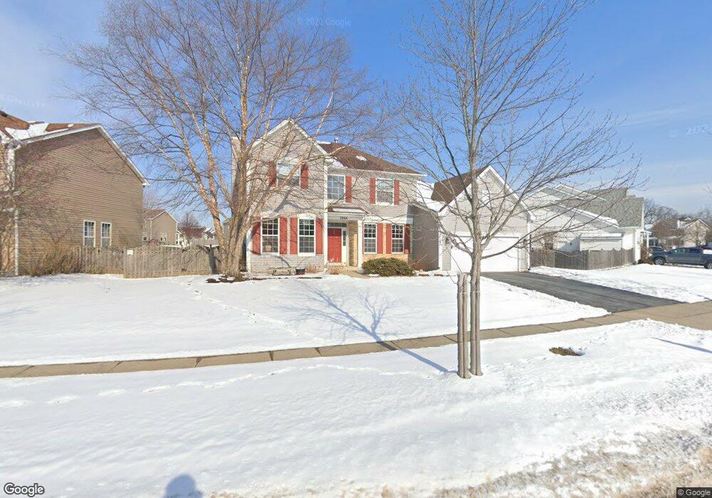
3866 Parsons Rd Carpentersville, IL 60110
Estimated Value: $463,495 - $517,000
4
Beds
--
Bath
2,484
Sq Ft
$200/Sq Ft
Est. Value
About This Home
This home is located at 3866 Parsons Rd, Carpentersville, IL 60110 and is currently estimated at $497,624, approximately $200 per square foot. 3866 Parsons Rd is a home located in Kane County with nearby schools including Liberty Elementary School, Dundee Middle School, and Harry D Jacobs High School.
Ownership History
Date
Name
Owned For
Owner Type
Purchase Details
Closed on
Feb 8, 2024
Sold by
Holkenbrink Frank J
Bought by
Frank J Holkenbrink And Julia L Holkenbrink L and Holkenbrink
Current Estimated Value
Purchase Details
Closed on
Jun 12, 2001
Sold by
Chestnut Woods Development Corp
Bought by
Holenbrink Frank J and Holkenbrink Julia L
Home Financials for this Owner
Home Financials are based on the most recent Mortgage that was taken out on this home.
Original Mortgage
$232,056
Interest Rate
7.18%
Create a Home Valuation Report for This Property
The Home Valuation Report is an in-depth analysis detailing your home's value as well as a comparison with similar homes in the area
Home Values in the Area
Average Home Value in this Area
Purchase History
| Date | Buyer | Sale Price | Title Company |
|---|---|---|---|
| Frank J Holkenbrink And Julia L Holkenbrink L | -- | None Listed On Document | |
| Holenbrink Frank J | $290,500 | -- |
Source: Public Records
Mortgage History
| Date | Status | Borrower | Loan Amount |
|---|---|---|---|
| Previous Owner | Holenbrink Frank J | $232,056 |
Source: Public Records
Tax History Compared to Growth
Tax History
| Year | Tax Paid | Tax Assessment Tax Assessment Total Assessment is a certain percentage of the fair market value that is determined by local assessors to be the total taxable value of land and additions on the property. | Land | Improvement |
|---|---|---|---|---|
| 2024 | $8,745 | $131,467 | $26,492 | $104,975 |
| 2023 | $8,595 | $118,290 | $23,837 | $94,453 |
| 2022 | $9,223 | $116,918 | $23,837 | $93,081 |
| 2021 | $9,004 | $110,394 | $22,507 | $87,887 |
| 2020 | $8,853 | $107,912 | $22,001 | $85,911 |
| 2019 | $8,652 | $102,442 | $20,886 | $81,556 |
| 2018 | $8,521 | $96,865 | $30,927 | $65,938 |
| 2017 | $8,166 | $90,613 | $28,931 | $61,682 |
| 2016 | $8,992 | $87,735 | $28,012 | $59,723 |
| 2015 | -- | $82,210 | $26,248 | $55,962 |
| 2014 | -- | $79,940 | $25,523 | $54,417 |
| 2013 | -- | $82,387 | $26,304 | $56,083 |
Source: Public Records
Map
Nearby Homes
- 3835 Parsons Rd
- 3404 Green Pastures Rd
- Lot 84 Spruce Dr
- Lot 83 Spruce Dr
- 35W543 Miller Rd
- Lot 133 Walnut Dr
- Lot 132 Walnut Dr
- Lot 131 Walnut Dr
- Lot 129 Walnut Dr
- Lot 128 Walnut Dr
- Lot 108 Walnut Dr
- Lot 26 Walnut Dr
- Lot 24 Walnut Dr
- Lot 80 Ash Dr
- Lot 79 Ash Dr
- 6109 Dunroven Lakes Ct
- 36W461 Binnie Rd
- 7046 Nathan Ln
- Lot 120 Oak Dr
- lot 009 Huntley Rd
- 3860 Parsons Rd
- 3872 Parsons Rd
- 3854 Parsons Rd
- 3874 Parsons Rd
- 3918 Farmstead Ln
- 3871 Parsons Rd Unit 4
- 3916 Farmstead Ln
- 3852 Parsons Rd
- 3873 Parsons Rd
- 3876 Parsons Rd Unit 4
- 3861 Parsons Rd Unit 4
- 3875 Parsons Rd
- 3850 Parsons Rd
- 3877 Parsons Rd Unit 4
- 3859 Parsons Rd Unit 4
- 3857 Parsons Rd
- 3913 Farmstead Ln
- 3914 Farmstead Ln
- 3878 Parsons Rd Unit 4
- 3879 Parsons Rd