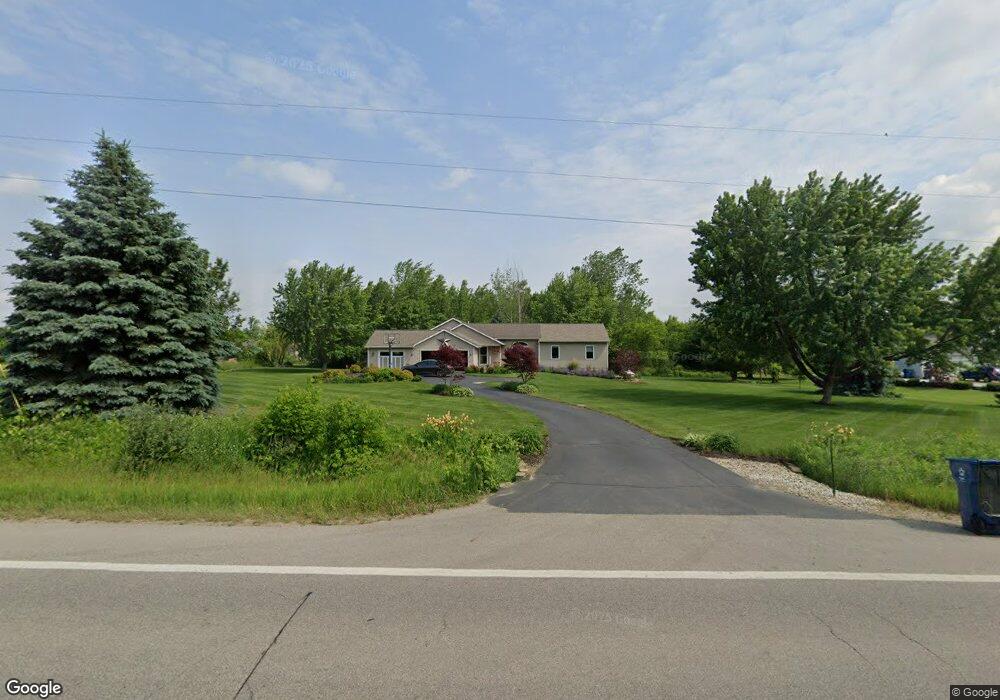
387 129th Ave Wayland, MI 49348
Estimated Value: $438,640 - $550,000
4
Beds
3
Baths
2,460
Sq Ft
$196/Sq Ft
Est. Value
About This Home
This home is located at 387 129th Ave, Wayland, MI 49348 and is currently estimated at $482,910, approximately $196 per square foot. 387 129th Ave is a home located in Allegan County with nearby schools including Wayland High School.
Create a Home Valuation Report for This Property
The Home Valuation Report is an in-depth analysis detailing your home's value as well as a comparison with similar homes in the area
Home Values in the Area
Average Home Value in this Area
Tax History Compared to Growth
Tax History
| Year | Tax Paid | Tax Assessment Tax Assessment Total Assessment is a certain percentage of the fair market value that is determined by local assessors to be the total taxable value of land and additions on the property. | Land | Improvement |
|---|---|---|---|---|
| 2025 | $2,906 | $198,100 | $28,100 | $170,000 |
| 2024 | $2,543 | $196,800 | $26,800 | $170,000 |
| 2023 | $2,609 | $182,400 | $25,300 | $157,100 |
| 2022 | $2,543 | $168,000 | $13,800 | $154,200 |
| 2021 | $2,421 | $158,300 | $13,800 | $144,500 |
| 2020 | $2,361 | $164,000 | $12,500 | $151,500 |
| 2019 | $2,298 | $126,800 | $12,500 | $114,300 |
| 2018 | $2,255 | $109,200 | $14,900 | $94,300 |
| 2017 | $0 | $109,200 | $14,900 | $94,300 |
| 2016 | $0 | $78,200 | $14,400 | $63,800 |
| 2015 | -- | $78,200 | $14,400 | $63,800 |
| 2014 | -- | $61,800 | $15,200 | $46,600 |
| 2013 | -- | $51,200 | $15,200 | $36,000 |
Source: Public Records
Map
Nearby Homes
- 590 129th Ave
- 516 131st Ave
- 2841 Odawa Trail
- 2724 Pasture Ln
- 35 Cannonball Ln
- 3214 7th St
- 12712 Sunrise Ct
- 1736 Parker Dr
- 12940 Cleland Ave
- 3140 Sandy Beach St
- 1980 Parker Dr
- 12169 Pine Meadows Dr
- 2681 Geneva Lake Dr S
- 12031 Sandstone Dr
- 3296 Stonehill Ct
- 3282 Stonehill Ct
- 12720 S Grey Ct
- 1164 E Bernie Ct
- 12857 Michael Dr Unit 49
- 843 Wild Flower Ct