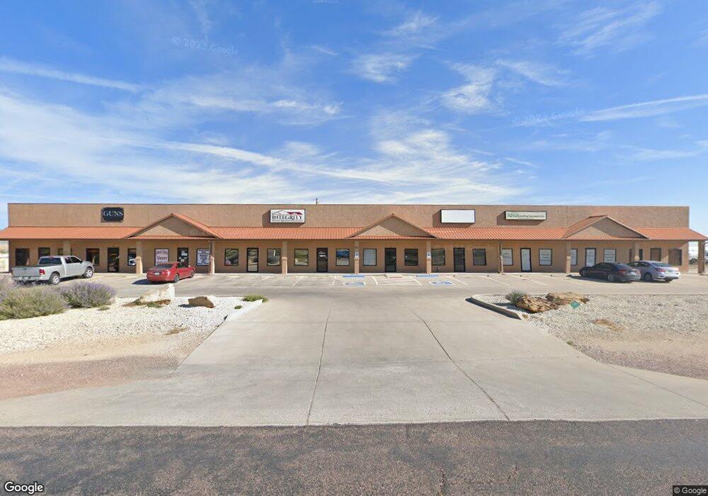
387 E Enterprise Dr Pueblo West, CO 81007
Estimated Value: $616,000
--
Bed
--
Bath
8,000
Sq Ft
$77/Sq Ft
Est. Value
About This Home
This home is located at 387 E Enterprise Dr, Pueblo West, CO 81007 and is currently estimated at $616,000, approximately $77 per square foot. 387 E Enterprise Dr is a home located in Pueblo County with nearby schools including Prairie Winds Elementary School, Liberty Point International School, and Pueblo West High School.
Ownership History
Date
Name
Owned For
Owner Type
Purchase Details
Closed on
Jul 15, 2010
Sold by
Mccarthy Jerry L and Mccarthy Dawn C
Bought by
Mccarthy Enterprises Llc
Current Estimated Value
Purchase Details
Closed on
May 24, 2005
Sold by
Roadgear Inc
Bought by
Mccarthy Jerry L and Mccarthy Dawn C
Home Financials for this Owner
Home Financials are based on the most recent Mortgage that was taken out on this home.
Original Mortgage
$161,062
Interest Rate
5.87%
Mortgage Type
Commercial
Purchase Details
Closed on
Dec 4, 2002
Sold by
Roadgear Inc
Bought by
Same
Purchase Details
Closed on
Oct 28, 2002
Sold by
Roadgear Inc
Bought by
Roadgear Inc
Purchase Details
Closed on
Mar 20, 1996
Sold by
Boles French T and Boles Gj
Bought by
Rg + Lg
Purchase Details
Closed on
Mar 15, 1996
Sold by
French and Boles
Bought by
Roadgear Inc
Purchase Details
Closed on
Mar 7, 1995
Sold by
Boles Gerald J + L Gene
Bought by
Boles French T and Boles Gj
Purchase Details
Closed on
Jan 17, 1984
Sold by
Lawyers Title Of Pueblo
Bought by
Boles Gerald J + L Gene
Create a Home Valuation Report for This Property
The Home Valuation Report is an in-depth analysis detailing your home's value as well as a comparison with similar homes in the area
Home Values in the Area
Average Home Value in this Area
Purchase History
| Date | Buyer | Sale Price | Title Company |
|---|---|---|---|
| Mccarthy Enterprises Llc | -- | None Available | |
| Mccarthy Jerry L | $201,000 | Land Title Guarantee Company | |
| Same | -- | -- | |
| Roadgear Inc | -- | -- | |
| Rg + Lg | -- | -- | |
| Roadgear Inc | $12,500 | -- | |
| Boles French T | -- | -- | |
| Boles Gerald J + L Gene | $54,900 | -- |
Source: Public Records
Mortgage History
| Date | Status | Borrower | Loan Amount |
|---|---|---|---|
| Previous Owner | Mccarthy Jerry L | $161,062 |
Source: Public Records
Tax History Compared to Growth
Tax History
| Year | Tax Paid | Tax Assessment Tax Assessment Total Assessment is a certain percentage of the fair market value that is determined by local assessors to be the total taxable value of land and additions on the property. | Land | Improvement |
|---|---|---|---|---|
| 2024 | $20,120 | $203,030 | -- | -- |
| 2023 | $20,354 | $211,400 | $46,580 | $164,820 |
| 2022 | $20,153 | $202,880 | $55,420 | $147,460 |
| 2021 | $20,088 | $202,880 | $55,420 | $147,460 |
| 2020 | $20,030 | $201,830 | $55,930 | $145,900 |
| 2019 | $19,974 | $201,826 | $55,930 | $145,896 |
| 2018 | $19,895 | $200,917 | $55,930 | $144,987 |
| 2017 | $19,919 | $200,917 | $55,930 | $144,987 |
| 2016 | $17,416 | $175,371 | $22,372 | $152,999 |
| 2015 | $17,270 | $175,371 | $22,372 | $152,999 |
| 2014 | $16,781 | $170,268 | $22,372 | $147,896 |
Source: Public Records
Map
Nearby Homes
- 89 Precision Dr
- 25 N Fabrication Dr
- 37 Fabrication Dr
- 385 E Larchmont Dr
- 453 E Enterprise Dr
- 861 E Enterprise Dr
- 213 S Dacona Dr
- 228 S Caddoa Dr
- 288 S Wiggins Dr
- 226 E Falcon Dr
- 293 S Maher Dr
- 142 E Croyden Dr
- 463 E Fraser Dr
- LOT 39 Swallows Rd
- 557 E Clarion Dr
- 91 E Industrial Blvd
- 161 E Croyden Dr
- 83 E Industrial Blvd
- 77 E Industrial Blvd
- 189 S Crescent Cir
- 387 E Enterprise Dr Unit 27
- 35 N Precision Dr
- 355 E Spaulding Ave Unit 1
- 355 E Spaulding Ave
- 41 N Precision Dr
- 34 N Precision Dr
- 322 E Spaulding Ave
- 390 E Spaulding Ave Unit 7
- 49 N Precision Dr
- 393 E Spaulding Ave
- 57 Precision Dr
- 346 E Spaulding Ave
- 79 Precision Dr Unit 19
- 56 N Precision Dr
- 12 Fabrication Dr
- 12 N Fabrication Dr
- 21 & 33 N Magneto Dr
- 24 N Fabrication Dr
- 24 N Fabrication Dr Unit 11
- 65 N Precision Dr