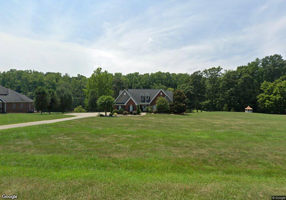
387 Fly Fisher Dr Salisbury, NC 28147
Estimated Value: $655,432 - $744,000
4
Beds
4
Baths
3,278
Sq Ft
$218/Sq Ft
Est. Value
About This Home
This home is located at 387 Fly Fisher Dr, Salisbury, NC 28147 and is currently estimated at $714,108, approximately $217 per square foot. 387 Fly Fisher Dr is a home located in Rowan County with nearby schools including Millbridge Elementary School, Southeast Middle School, and West Rowan High School.
Ownership History
Date
Name
Owned For
Owner Type
Purchase Details
Closed on
May 21, 2015
Sold by
Noonan John P and Noonan Noralee H
Bought by
Helvey Keenan M and Helvey Diane J
Current Estimated Value
Home Financials for this Owner
Home Financials are based on the most recent Mortgage that was taken out on this home.
Original Mortgage
$160,000
Outstanding Balance
$123,571
Interest Rate
3.75%
Mortgage Type
New Conventional
Estimated Equity
$590,537
Create a Home Valuation Report for This Property
The Home Valuation Report is an in-depth analysis detailing your home's value as well as a comparison with similar homes in the area
Home Values in the Area
Average Home Value in this Area
Purchase History
| Date | Buyer | Sale Price | Title Company |
|---|---|---|---|
| Helvey Keenan M | $315,000 | None Available |
Source: Public Records
Mortgage History
| Date | Status | Borrower | Loan Amount |
|---|---|---|---|
| Open | Helvey Keenan M | $160,000 |
Source: Public Records
Tax History Compared to Growth
Tax History
| Year | Tax Paid | Tax Assessment Tax Assessment Total Assessment is a certain percentage of the fair market value that is determined by local assessors to be the total taxable value of land and additions on the property. | Land | Improvement |
|---|---|---|---|---|
| 2025 | $3,780 | $557,872 | $95,625 | $462,247 |
| 2024 | $3,780 | $557,872 | $95,625 | $462,247 |
| 2023 | $3,780 | $557,872 | $95,625 | $462,247 |
| 2022 | $2,609 | $345,601 | $78,625 | $266,976 |
| 2021 | $2,583 | $345,601 | $78,625 | $266,976 |
| 2020 | $2,583 | $345,601 | $78,625 | $266,976 |
| 2019 | $2,583 | $345,601 | $78,625 | $266,976 |
| 2018 | $2,316 | $312,449 | $78,625 | $233,824 |
| 2017 | $2,316 | $312,449 | $78,625 | $233,824 |
| 2016 | $2,316 | $312,449 | $78,625 | $233,824 |
| 2015 | $2,343 | $312,449 | $78,625 | $233,824 |
| 2014 | $2,249 | $314,575 | $78,625 | $235,950 |
Source: Public Records
Map
Nearby Homes
- 611 Davis Farm Dr
- 4860 Patterson Rd
- 1045 Castle Mill Ln Unit 38
- 210 Goldenrod Cir
- 1213 Stonegate Dr
- 203 Trinity Ct
- 1120 Coppergate Dr
- 1340 Coppergate Dr
- 1110 Coppergate Dr
- 1160 Coppergate Dr
- 1370 Coppergate Dr
- 1030 Stonegate Dr
- Azalea II Plan at Yorkshire Farms
- Daffodil Plan at Yorkshire Farms
- 1355 Coppergate Dr
- 1033 Stonegate Dr
- 1280 Coppergate Dr
- 1150 Coppergate Dr
- 7245 Mooresville Rd
- 1240 Coppergate Dr
- 355 Fly Fisher Dr
- 457 Fly Fisher Dr
- 435 Fly Fisher Dr
- 360 Fly Fisher Dr
- 360 Fly Fisher Dr Unit 92
- 321 Fly Fisher Dr
- 330 Fly Fisher Dr
- 307 Fly Fisher Dr
- 490 Fly Fisher Dr
- 258 Fly Fisher Dr
- 475 Fly Fisher Dr
- 499 Fly Fisher Dr
- 1172 Blueberry Rd
- 1202 Blueberry Rd
- 1114 Blueberry Rd
- 2284 Blueberry Rd Unit 10
- 2276 Blueberry Rd Unit 8
- 2272 Blueberry Rd Unit 7
- 2264 Blueberry Rd Unit 5