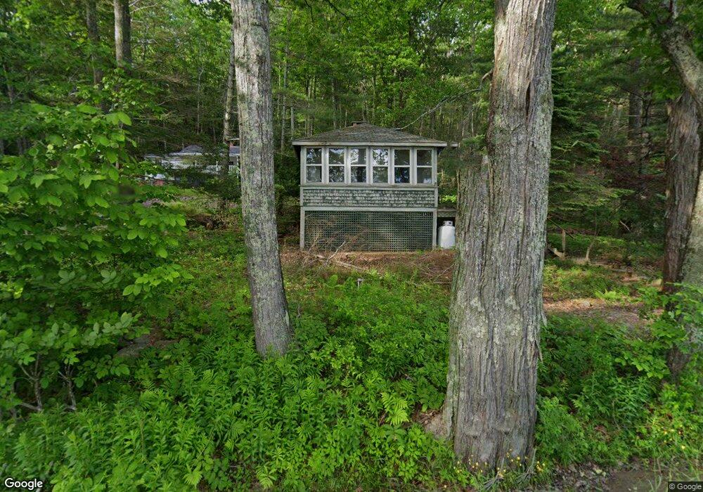
387 Hosmer Pond Rd Camden, ME 04843
Estimated Value: $286,301 - $400,000
1
Bed
1
Bath
714
Sq Ft
$464/Sq Ft
Est. Value
About This Home
This home is located at 387 Hosmer Pond Rd, Camden, ME 04843 and is currently estimated at $331,575, approximately $464 per square foot. 387 Hosmer Pond Rd is a home located in Knox County with nearby schools including Camden-Rockport Elementary School, Camden-Rockport Middle School, and Camden Hills Regional High School.
Ownership History
Date
Name
Owned For
Owner Type
Purchase Details
Closed on
Aug 23, 2024
Sold by
Stone Road Corp
Bought by
Kipp Michael D and Blanchard Guy V
Current Estimated Value
Purchase Details
Closed on
Aug 30, 2022
Sold by
Fhlm
Bought by
Stone Road Corp
Create a Home Valuation Report for This Property
The Home Valuation Report is an in-depth analysis detailing your home's value as well as a comparison with similar homes in the area
Home Values in the Area
Average Home Value in this Area
Purchase History
| Date | Buyer | Sale Price | Title Company |
|---|---|---|---|
| Kipp Michael D | $265,000 | None Available | |
| Kipp Michael D | $265,000 | None Available | |
| Stone Road Corp | $225,000 | None Available | |
| Stone Road Corp | $225,000 | None Available |
Source: Public Records
Tax History Compared to Growth
Tax History
| Year | Tax Paid | Tax Assessment Tax Assessment Total Assessment is a certain percentage of the fair market value that is determined by local assessors to be the total taxable value of land and additions on the property. | Land | Improvement |
|---|---|---|---|---|
| 2024 | $3,389 | $322,800 | $223,000 | $99,800 |
| 2023 | $3,780 | $273,900 | $173,000 | $100,900 |
| 2022 | $3,615 | $273,900 | $173,000 | $100,900 |
| 2021 | $2,137 | $139,200 | $59,700 | $79,500 |
| 2020 | $2,092 | $139,200 | $59,700 | $79,500 |
| 2019 | $2,075 | $139,200 | $59,700 | $79,500 |
| 2018 | $2,025 | $136,100 | $60,900 | $75,200 |
| 2017 | $1,957 | $136,100 | $60,900 | $75,200 |
| 2016 | $1,846 | $118,400 | $47,200 | $71,200 |
| 2015 | $1,791 | $118,400 | $47,200 | $71,200 |
| 2014 | $1,709 | $118,400 | $47,200 | $71,200 |
| 2013 | $1,662 | $118,400 | $47,200 | $71,200 |
Source: Public Records
Map
Nearby Homes
- 6 Rd
- 2 Bald Mountain Rd
- 424 Molyneaux Rd
- 43 Melvin Heights Rd
- 24 White Tail Dr
- 4 Ministerial Rd
- 91 Simonton Rd
- 76 Park St
- 315 Beaucaire Ave
- 159 Mechanic St
- 80 Cobb Rd
- 10 Glenfield Cir
- Lot 25 West St
- 111 Start Rd
- TBD Map 15 Lot 150 Mt Pleasant St
- 180 Mistic Ave
- 319 West St
- 161 Beaucaire Ave
- 646 West St
- 109 Mistic Ave
- 391 Hosmer Pond Rd
- 385 Hosmer Pond Rd
- 395 Hosmer Pond Rd
- 383 Hosmer Pond Rd
- 397 Hosmer Pond Rd
- 379 Hosmer Pond Rd
- 399 Hosmer Pond Rd
- 382 Hosmer Pond Rd
- 31 Gosses Hill Rd
- 576 Molyneaux Rd
- 375 Hosmer Pond Rd
- 374 Hosmer Pond Rd
- 4524 Molyneaux & Barnstown
- 365 Hosmer Pond Rd
- 33 Gosses Hill Rd
- 25 Gosses Hill Rd
- 0 Hosmer Pond Rd
- 360 Hosmer Pond Rd
- 361 Hosmer Pond Rd
- 8 Brandy Brook Rd