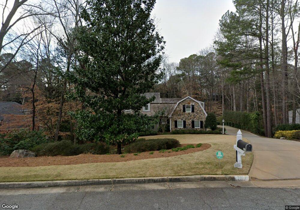
3870 Brandy Station Ct SE Atlanta, GA 30339
Estimated Value: $1,207,517 - $1,320,000
3
Beds
5
Baths
3,896
Sq Ft
$322/Sq Ft
Est. Value
About This Home
This home is located at 3870 Brandy Station Ct SE, Atlanta, GA 30339 and is currently estimated at $1,256,379, approximately $322 per square foot. 3870 Brandy Station Ct SE is a home located in Cobb County with nearby schools including Teasley Elementary School, Campbell Middle School, and Campbell High School.
Ownership History
Date
Name
Owned For
Owner Type
Purchase Details
Closed on
Jun 22, 1993
Sold by
Pass Lynn Jerry R
Bought by
Jones Roy M Carter L
Current Estimated Value
Home Financials for this Owner
Home Financials are based on the most recent Mortgage that was taken out on this home.
Original Mortgage
$330,500
Interest Rate
7.52%
Create a Home Valuation Report for This Property
The Home Valuation Report is an in-depth analysis detailing your home's value as well as a comparison with similar homes in the area
Home Values in the Area
Average Home Value in this Area
Purchase History
| Date | Buyer | Sale Price | Title Company |
|---|---|---|---|
| Jones Roy M Carter L | $413,200 | -- |
Source: Public Records
Mortgage History
| Date | Status | Borrower | Loan Amount |
|---|---|---|---|
| Closed | Jones Roy M Carter L | $330,500 |
Source: Public Records
Tax History Compared to Growth
Tax History
| Year | Tax Paid | Tax Assessment Tax Assessment Total Assessment is a certain percentage of the fair market value that is determined by local assessors to be the total taxable value of land and additions on the property. | Land | Improvement |
|---|---|---|---|---|
| 2025 | $2,983 | $446,600 | $170,000 | $276,600 |
| 2024 | $2,992 | $446,600 | $170,000 | $276,600 |
| 2023 | $2,710 | $421,452 | $170,000 | $251,452 |
| 2022 | $2,898 | $415,452 | $164,000 | $251,452 |
| 2021 | $2,783 | $376,880 | $160,000 | $216,880 |
| 2020 | $2,681 | $342,806 | $144,000 | $198,806 |
| 2019 | $2,795 | $380,896 | $160,000 | $220,896 |
| 2018 | $2,724 | $357,200 | $160,000 | $197,200 |
| 2017 | $2,414 | $352,816 | $160,000 | $192,816 |
| 2016 | $8,909 | $352,816 | $160,000 | $192,816 |
| 2015 | $8,582 | $330,212 | $148,000 | $182,212 |
| 2014 | $8,362 | $317,916 | $0 | $0 |
Source: Public Records
Map
Nearby Homes
- 3773 Randall Rd SE
- 2872 Bainbridge Way SE
- 3191 Lemons Ridge
- 2966 Waverly Ct SE
- 3201 Teton Dr SE
- 3680 Tanglewood Dr SE
- 3088 Vinings Ferry Dr SE
- 4220 Paces Ferry Rd SE
- 3600 Tanglewood Dr SE
- 3338 Paces Ferry Ave SE
- 3772 Paces Ferry West SE
- 3621 Vinings Slope SE Unit 3406
- 3621 Vinings Slope SE Unit 2115
- 3621 Vinings Slope SE Unit 1530
- 3621 Vinings Slope SE Unit 1432
- 3621 Vinings Slope SE Unit 2317
- 3621 Vinings Slope SE Unit 2516
- 3621 Vinings Slope SE Unit 3311
- 3621 Vinings Slope SE Unit 1537
- 2792 Broughton Ln SE Unit 3
- 3860 Brandy Station Ct SE
- 3880 Brandy Station Ct SE
- 0 Brandy Station Ct SE Unit 8536190
- 0 Brandy Station Ct SE Unit 8373276
- 3869 Brandy Station Ct SE
- 3890 Brandy Station Ct SE
- 3850 Brandy Station Ct SE
- 3849 Brandy Station Ct SE
- 3028 Vinings Forest Way SE
- 3890 Randall Farm Rd SE
- 3115 Brandy Station SE
- 3129 Brandy Station SE
- 3842 Randall Farm Rd SE
- 3908 Randall Farm Rd SE
- 3839 Brandy Station Ct SE
- 3109 Brandy Station SE
- 3130 Brandy Station SE
- 3120 Brandy Station SE
- 3830 Randall Farm Rd SE