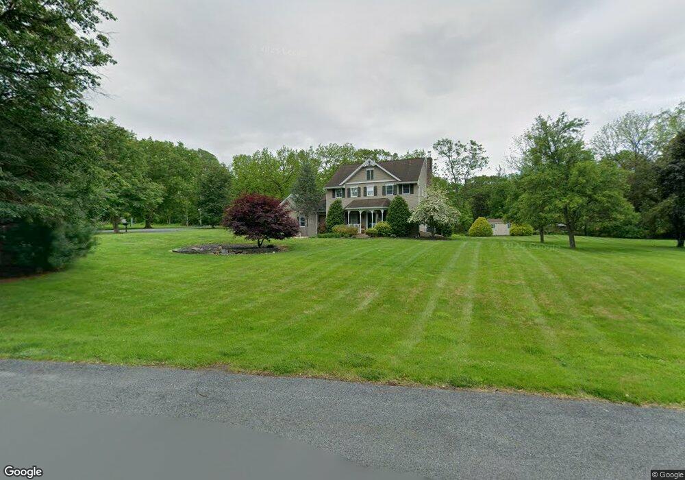
3870 Colt Cir Alburtis, PA 18011
Lower Macungie Township West NeighborhoodEstimated Value: $494,000 - $595,000
4
Beds
3
Baths
2,360
Sq Ft
$237/Sq Ft
Est. Value
About This Home
This home is located at 3870 Colt Cir, Alburtis, PA 18011 and is currently estimated at $559,616, approximately $237 per square foot. 3870 Colt Cir is a home located in Lehigh County with nearby schools including Alburtis Elementary School, Lower Macungie Middle School, and Emmaus High School.
Ownership History
Date
Name
Owned For
Owner Type
Purchase Details
Closed on
Feb 14, 2007
Sold by
Southwell Dolores K and Evans Dolores K
Bought by
Evans Mark D and Evans Dolores K
Current Estimated Value
Purchase Details
Closed on
Nov 25, 1986
Sold by
Koehler Elizabeth C
Bought by
Southwell Michael L and Southwell Dolores K
Purchase Details
Closed on
May 9, 1984
Bought by
Koehler Elizabeth C
Create a Home Valuation Report for This Property
The Home Valuation Report is an in-depth analysis detailing your home's value as well as a comparison with similar homes in the area
Home Values in the Area
Average Home Value in this Area
Purchase History
| Date | Buyer | Sale Price | Title Company |
|---|---|---|---|
| Evans Mark D | -- | None Available | |
| Southwell Michael L | $25,900 | -- | |
| Koehler Elizabeth C | -- | -- |
Source: Public Records
Tax History Compared to Growth
Tax History
| Year | Tax Paid | Tax Assessment Tax Assessment Total Assessment is a certain percentage of the fair market value that is determined by local assessors to be the total taxable value of land and additions on the property. | Land | Improvement |
|---|---|---|---|---|
| 2025 | $7,238 | $283,500 | $71,200 | $212,300 |
| 2024 | $7,002 | $283,500 | $71,200 | $212,300 |
| 2023 | $6,863 | $283,500 | $71,200 | $212,300 |
| 2022 | $6,700 | $283,500 | $212,300 | $71,200 |
| 2021 | $6,558 | $283,500 | $71,200 | $212,300 |
| 2020 | $6,495 | $283,500 | $71,200 | $212,300 |
| 2019 | $6,385 | $283,500 | $71,200 | $212,300 |
| 2018 | $6,301 | $283,500 | $71,200 | $212,300 |
| 2017 | $6,191 | $283,500 | $71,200 | $212,300 |
| 2016 | -- | $283,500 | $71,200 | $212,300 |
| 2015 | -- | $283,500 | $71,200 | $212,300 |
| 2014 | -- | $283,500 | $71,200 | $212,300 |
Source: Public Records
Map
Nearby Homes
- 428 Thomas St
- 31 Barbara Dr
- 3371 Mathews Ln
- 241 Flint Hill Rd
- 1108 S Barbara Dr
- 317 Lockridge Ln
- 121 S Main St Unit 123
- 354 W 2nd St
- 0 Clauss Hunt Knight Dr Unit 10 Units 763578
- 6903 Lincoln Dr
- 6709 Mountain Rd
- 4759 Sheep Rock Rd
- 0 Mountain Lot 1
- 83 Mansfield Dr
- 8312 Mertztown Rd
- 146 Mountain Village Dr
- 107 Haddon Dr
- 7318 Sauerkraut Ln Unit E
- 194 Haddon Dr
- 7230 Pioneer Dr
- 3862 Colt Cir
- 8357 Winchester Ln
- 3885 Gun Club Rd
- 3897 Gun Club Rd
- 3871 Colt Cir
- 8341 Winchester Ln
- 3863 Colt Cir
- 3877 Gun Club Rd
- 8337 Winchester Ln
- 8336 Winchester Ln
- 3933 Gun Club Rd
- 8313 Winchester Ln
- 3865 Gun Club Rd
- 8320 Winchester Ln
- 8338 Hensingersville Rd
- 8299 Winchester Ln
- 3941 Gun Club Rd
- 3831 Gun Club Rd
- 8388 Hensingersville Rd
- 8412 Hensingersville Rd