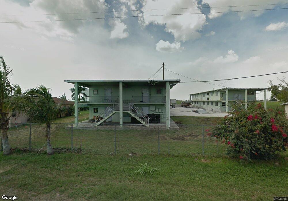
38715 Morgan West Rd Pahokee, FL 33476
Estimated Value: $217,000 - $466,895
--
Bed
--
Bath
21,518
Sq Ft
$16/Sq Ft
Est. Value
About This Home
This home is located at 38715 Morgan West Rd, Pahokee, FL 33476 and is currently estimated at $341,948, approximately $15 per square foot. 38715 Morgan West Rd is a home with nearby schools including Pahokee Elementary School, Pahokee Middle/Senior High School, and Glades Academy Elementary School.
Ownership History
Date
Name
Owned For
Owner Type
Purchase Details
Closed on
Aug 23, 2001
Sold by
Sugar Industry Equipment Sales & Consult
Bought by
Okeechobee Land Company
Current Estimated Value
Home Financials for this Owner
Home Financials are based on the most recent Mortgage that was taken out on this home.
Original Mortgage
$84,000
Outstanding Balance
$31,600
Interest Rate
6.97%
Mortgage Type
Seller Take Back
Estimated Equity
$310,348
Purchase Details
Closed on
Aug 18, 2000
Sold by
Sugar Cane Growers
Bought by
Sugar Industry Equip
Create a Home Valuation Report for This Property
The Home Valuation Report is an in-depth analysis detailing your home's value as well as a comparison with similar homes in the area
Home Values in the Area
Average Home Value in this Area
Purchase History
| Date | Buyer | Sale Price | Title Company |
|---|---|---|---|
| Okeechobee Land Company | $130,000 | -- | |
| Sugar Industry Equip | $55,000 | -- |
Source: Public Records
Mortgage History
| Date | Status | Borrower | Loan Amount |
|---|---|---|---|
| Open | Okeechobee Land Company | $84,000 |
Source: Public Records
Tax History Compared to Growth
Tax History
| Year | Tax Paid | Tax Assessment Tax Assessment Total Assessment is a certain percentage of the fair market value that is determined by local assessors to be the total taxable value of land and additions on the property. | Land | Improvement |
|---|---|---|---|---|
| 2025 | $7,680 | $180,855 | -- | -- |
| 2024 | $7,680 | $174,479 | -- | -- |
| 2023 | $7,514 | $171,980 | -- | -- |
| 2022 | $7,230 | $163,361 | -- | -- |
| 2021 | $6,839 | $148,510 | $34,186 | $114,324 |
| 2020 | $6,737 | $147,410 | $34,186 | $113,224 |
| 2019 | $6,870 | $143,400 | $34,186 | $109,214 |
| 2018 | $6,796 | $144,900 | $34,186 | $110,714 |
| 2017 | $6,905 | $144,430 | $34,186 | $110,244 |
| 2016 | $6,592 | $128,551 | $0 | $0 |
| 2015 | $6,608 | $122,234 | $0 | $0 |
| 2014 | $6,732 | $111,122 | $0 | $0 |
Source: Public Records
Map
Nearby Homes
- 1450 Muck City Rd
- * S Lake Ave
- 300-398 S Lake Ave
- 817 E 7th St
- 875 Joe Louis Ave
- 33 Muck City Rd
- 170 Apple Ave
- 0 W Martin Luther King jr Blvd Unit R10990459
- 398 Cypress Ave
- 297 E 4th St
- 0 Rardin Ave
- 364 S Lake Ave
- 353 S Lake Place
- 334 S Barfield Hwy
- 363 S Lake Ave Unit 1
- 0 S Lake Ave Unit R11061220
- 3250 Bacom Point Rd
- 312 Carissa Dr
- 2727 Bacom Point Rd
- 176 Bacom Point Rd