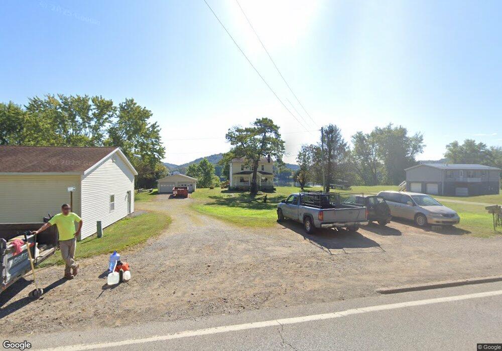
38730 State Route 7 Sardis, OH 43946
Estimated Value: $79,000 - $153,000
--
Bed
1
Bath
672
Sq Ft
$173/Sq Ft
Est. Value
About This Home
This home is located at 38730 State Route 7, Sardis, OH 43946 and is currently estimated at $116,161, approximately $172 per square foot. 38730 State Route 7 is a home located in Monroe County with nearby schools including River Elementary School and River High School.
Ownership History
Date
Name
Owned For
Owner Type
Purchase Details
Closed on
Jan 8, 2023
Sold by
Craig Marsha A and Craig Terry R
Bought by
Carver Jonell
Current Estimated Value
Home Financials for this Owner
Home Financials are based on the most recent Mortgage that was taken out on this home.
Original Mortgage
$149,600
Outstanding Balance
$145,494
Interest Rate
7.25%
Mortgage Type
New Conventional
Estimated Equity
-$29,333
Purchase Details
Closed on
Nov 2, 2003
Bought by
Craig Marsha A and Craig Terry R
Create a Home Valuation Report for This Property
The Home Valuation Report is an in-depth analysis detailing your home's value as well as a comparison with similar homes in the area
Home Values in the Area
Average Home Value in this Area
Purchase History
| Date | Buyer | Sale Price | Title Company |
|---|---|---|---|
| Carver Jonell | $187,000 | -- | |
| Craig Marsha A | -- | -- |
Source: Public Records
Mortgage History
| Date | Status | Borrower | Loan Amount |
|---|---|---|---|
| Open | Carver Jonell | $149,600 |
Source: Public Records
Tax History Compared to Growth
Tax History
| Year | Tax Paid | Tax Assessment Tax Assessment Total Assessment is a certain percentage of the fair market value that is determined by local assessors to be the total taxable value of land and additions on the property. | Land | Improvement |
|---|---|---|---|---|
| 2024 | $612 | $21,510 | $5,460 | $16,050 |
| 2023 | $612 | $21,510 | $5,460 | $16,050 |
| 2022 | $513 | $18,040 | $5,460 | $12,580 |
| 2021 | $437 | $15,250 | $4,540 | $10,710 |
| 2020 | $437 | $15,250 | $4,540 | $10,710 |
| 2019 | $437 | $15,250 | $4,540 | $10,710 |
| 2018 | $414 | $13,980 | $3,780 | $10,200 |
| 2017 | $418 | $13,980 | $3,780 | $10,200 |
| 2016 | $424 | $13,980 | $3,780 | $10,200 |
| 2015 | $351 | $10,960 | $3,030 | $7,930 |
| 2014 | $351 | $10,960 | $3,030 | $7,930 |
| 2013 | $366 | $10,630 | $2,940 | $7,690 |
Source: Public Records
Map
Nearby Homes
- 210 Ack Ferry Adn
- 601 4th St
- 270 Duerr St
- 337 Mceldowney Ave
- 735 5th St
- 653 6th St
- 180 Pike St
- 803 5th St
- 807 5th St
- 405 Edgewood Terrace
- 46 W Rolling Acres Rd
- 37311 Willow St
- 37370 5th Ave
- 52100 State Route 536
- 0 Lot 2 Country Blvd
- 37283 Border St
- 0 Country Blvd Unit 5119547
- 296 N State Route 2
- 37020 Monroe St
- 711 James St
- 38698 State Route 7
- 38668 State Route 7
- 38744 State Route 7
- 38712 State Route 7
- 38764 State Route 7
- 38764 State Route 7
- 38721 State Route 7
- 38739 State Route 7
- 38707 State Route 7
- 38786 State Route 7
- 38669 State Route 7
- 38679 State Route 7
- 38763 State Route 7
- 52758 Fry Hill Rd
- 38657 State Route 7
- 38777 State Route 7
- 38647 State Route 7
- 38801 State Route 7
- 52765 Fry Hill Rd
- 38811 State Route 7