Estimated Value: $122,395 - $222,000
--
Bed
2
Baths
1,265
Sq Ft
$133/Sq Ft
Est. Value
About This Home
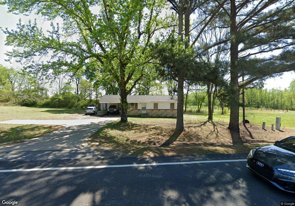
This home is located at 3875 Highway 89 S, Cabot, AR 72023 and is currently estimated at $168,599, approximately $133 per square foot. 3875 Highway 89 S is a home located in Lonoke County with nearby schools including Southside Elementary School, Cabot Junior High South, and Cabot Middle School South.
Ownership History
Date
Name
Owned For
Owner Type
Purchase Details
Closed on
Aug 28, 2025
Sold by
Blakey Donald Bruce
Bought by
Donald Blakey Trust and Blakey
Current Estimated Value
Purchase Details
Closed on
Oct 7, 2022
Sold by
Garner Robert and Garner Sharon
Bought by
Blakey Don
Purchase Details
Closed on
Nov 23, 2010
Sold by
Garner Robert
Bought by
Garner Louise
Purchase Details
Closed on
Nov 22, 2010
Sold by
Garner Robert
Bought by
Garner Louise
Purchase Details
Closed on
Jun 3, 2009
Sold by
Garner Louise
Bought by
Garner Robert
Purchase Details
Closed on
Jun 7, 2004
Bought by
Mark and Billie Lyons
Purchase Details
Closed on
Apr 30, 2004
Bought by
Lyons and Lyons Lyons
Create a Home Valuation Report for This Property
The Home Valuation Report is an in-depth analysis detailing your home's value as well as a comparison with similar homes in the area
Home Values in the Area
Average Home Value in this Area
Purchase History
| Date | Buyer | Sale Price | Title Company |
|---|---|---|---|
| Donald Blakey Trust | -- | None Listed On Document | |
| Blakey Don | -- | -- | |
| Garner Louise | -- | -- | |
| Garner Louise | -- | -- | |
| Garner Robert | -- | -- | |
| Mark | -- | -- | |
| Lyons | -- | -- | |
| Lyons | -- | -- |
Source: Public Records
Tax History Compared to Growth
Tax History
| Year | Tax Paid | Tax Assessment Tax Assessment Total Assessment is a certain percentage of the fair market value that is determined by local assessors to be the total taxable value of land and additions on the property. | Land | Improvement |
|---|---|---|---|---|
| 2025 | $561 | $12,220 | $1,700 | $10,520 |
| 2024 | $561 | $12,220 | $1,700 | $10,520 |
| 2023 | $561 | $12,220 | $1,700 | $10,520 |
| 2022 | $561 | $12,220 | $1,700 | $10,520 |
| 2021 | $561 | $12,220 | $1,700 | $10,520 |
| 2020 | $545 | $11,870 | $1,020 | $10,850 |
| 2019 | $545 | $11,870 | $1,020 | $10,850 |
| 2018 | $545 | $11,870 | $1,020 | $10,850 |
| 2017 | $503 | $11,870 | $1,020 | $10,850 |
| 2016 | $545 | $11,870 | $1,020 | $10,850 |
| 2015 | $493 | $11,620 | $1,020 | $10,600 |
| 2014 | $533 | $11,620 | $1,020 | $10,600 |
Source: Public Records
Map
Nearby Homes
- 33 Ravell Rd
- 29 Calvados Ct
- 28 Calvados Ct
- 11 Calvados Ct
- 13 Calvados Ct
- 11 Brixton
- 30 Ravell
- 29 Mcclellan Dr
- 3400 Arkansas 89
- 75 Chickadee Cove
- 21 Wolfsbridge Loop
- 19 Wolfsbridge Loop
- 17 Wolfsbridge Loop
- 15 Wolfsbridge Loop
- 13 Wolfsbridge Loop
- 19 Aberdeen Dr
- 36 Brentwood Cove
- 15 Castle Heights Dr
- 885 Mount Carmel Rd
- 400 Mount Carmel Rd
- 3865 Highway 89 S
- 3805 Highway 89 S
- 3885 Highway 89 S
- 3805 Highway 89 S
- 105 Guess Ln
- 3990 Highway 89 S
- 000 Pickthorne Rd
- 20 Mount Tabor W
- 36 Guess Ln
- 4010 Highway 89 S
- 4010 Arkansas 89
- 4010 Arkansas 89
- LOT 188 Mt Tabor Rd
- 12 Pickthorne Rd
- 30 Ravelle
- 61 Pickthorne Rd
- lot 149 Mt Tabor Estates
- 24 Guess Ln
- 71 Pickthorne Rd
- 3645 Arkansas 89