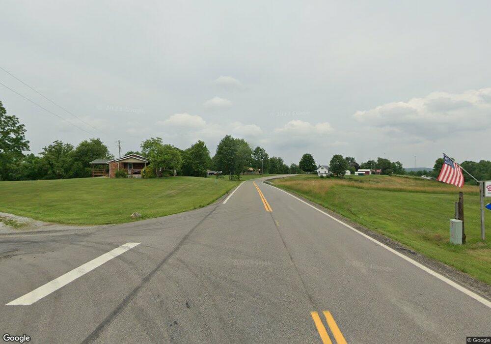
38759 State Route 800 Sardis, OH 43946
Estimated Value: $65,025 - $240,000
--
Bed
1
Bath
1,112
Sq Ft
$125/Sq Ft
Est. Value
About This Home
This home is located at 38759 State Route 800, Sardis, OH 43946 and is currently estimated at $139,006, approximately $125 per square foot. 38759 State Route 800 is a home located in Monroe County with nearby schools including River Elementary School and River High School.
Ownership History
Date
Name
Owned For
Owner Type
Purchase Details
Closed on
Apr 25, 2014
Sold by
Stanley Stanley and Miller Nancy
Bought by
Sefert Valerie
Current Estimated Value
Home Financials for this Owner
Home Financials are based on the most recent Mortgage that was taken out on this home.
Original Mortgage
$28,800
Outstanding Balance
$22,014
Interest Rate
4.41%
Mortgage Type
Stand Alone First
Estimated Equity
$116,992
Purchase Details
Closed on
Jul 31, 2003
Bought by
Sefert Valerie
Purchase Details
Closed on
Jun 5, 2002
Bought by
Sefert Valerie
Purchase Details
Closed on
Oct 26, 1999
Bought by
Sefert Valerie
Create a Home Valuation Report for This Property
The Home Valuation Report is an in-depth analysis detailing your home's value as well as a comparison with similar homes in the area
Home Values in the Area
Average Home Value in this Area
Purchase History
| Date | Buyer | Sale Price | Title Company |
|---|---|---|---|
| Sefert Valerie | -- | -- | |
| Sefert Valerie | $15,000 | -- | |
| Sefert Valerie | -- | -- | |
| Sefert Valerie | $14,400 | -- |
Source: Public Records
Mortgage History
| Date | Status | Borrower | Loan Amount |
|---|---|---|---|
| Open | Sefert Valerie | $28,800 |
Source: Public Records
Tax History Compared to Growth
Tax History
| Year | Tax Paid | Tax Assessment Tax Assessment Total Assessment is a certain percentage of the fair market value that is determined by local assessors to be the total taxable value of land and additions on the property. | Land | Improvement |
|---|---|---|---|---|
| 2024 | $445 | $13,130 | $6,930 | $6,200 |
| 2023 | $435 | $13,130 | $6,930 | $6,200 |
| 2022 | $434 | $13,130 | $6,930 | $6,200 |
| 2021 | $484 | $14,450 | $5,670 | $8,780 |
| 2020 | $484 | $14,450 | $5,670 | $8,780 |
| 2019 | $484 | $14,450 | $5,670 | $8,780 |
| 2018 | $477 | $13,100 | $4,730 | $8,370 |
| 2017 | $496 | $14,110 | $4,730 | $9,380 |
| 2016 | $448 | $12,530 | $3,150 | $9,380 |
| 2015 | $355 | $9,260 | $3,240 | $6,020 |
| 2014 | $355 | $9,260 | $3,240 | $6,020 |
| 2013 | -- | $3,500 | $3,150 | $350 |
Source: Public Records
Map
Nearby Homes
- 39567 State Route 800
- Township Road 460
- 0 Township Rd 460 Unit 23727141
- 35515 State Route 800
- 0 Lickskillet Rd
- 44603 Roy Bower Rd
- 34104 Brwnsvl Co Line Rd
- 44883 Bondi Ridge Rd
- 39110 State Route 26
- 33855 State Route 800
- 33855 Ohio 800
- 48375 Benwood Rd
- 34625 State Route 7
- 0 Z Hill Rd Unit 5158339
- 0 State Route 7 - Talbot Ln
- 503 Riverside Dr
- 107 Elizabeth St
- 306 Monroe St
- 44952 Moose Ridge Rd
- 821 Main St
- 38815 State Route 800
- 38803 State Route 800
- 38824 State Route 800
- 38816 State Route 800
- 38837 State Route 800
- 38843 State Route 800
- 38648 State Route 800
- 38851 State Route 800
- 38865 State Route 800
- 38862 State Route 800
- 38868 State Route 800
- 38608 State Route 800
- 38999 Vernon St
- 38886 State Route 800
- 38895 State Route 800
- 38896 State Route 800
- 38907 State Route 800
- 38904 State Route 800
- 38919 State Route 800
- 38564 State Route 800
