Estimated Value: $410,000 - $427,316
6
Beds
3
Baths
2,250
Sq Ft
$186/Sq Ft
Est. Value
About This Home
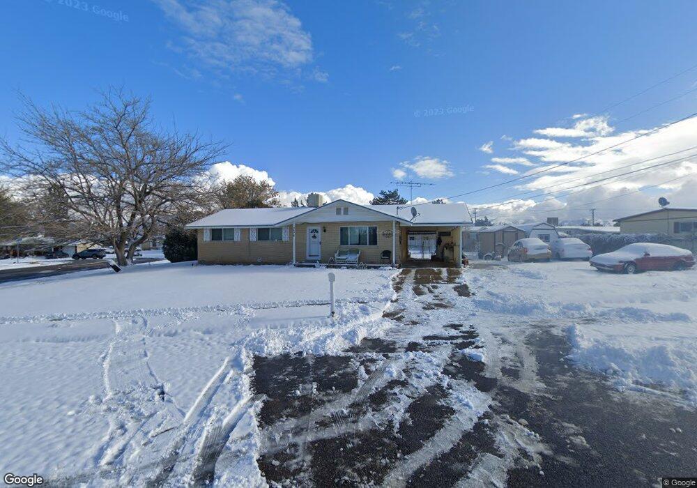
This home is located at 3876 S 1950 W, Roy, UT 84067 and is currently estimated at $418,829, approximately $186 per square foot. 3876 S 1950 W is a home located in Weber County with nearby schools including North Park School, Sand Ridge Junior High School, and Roy High School.
Ownership History
Date
Name
Owned For
Owner Type
Purchase Details
Closed on
Nov 30, 2020
Sold by
Jones Tyson M
Bought by
Solorio Araceli and Solorio Maria Violeta
Current Estimated Value
Home Financials for this Owner
Home Financials are based on the most recent Mortgage that was taken out on this home.
Original Mortgage
$12,100
Outstanding Balance
$10,792
Interest Rate
2.8%
Mortgage Type
Stand Alone Second
Estimated Equity
$408,037
Purchase Details
Closed on
Oct 17, 2017
Sold by
Davis Brett Robert
Bought by
Jones Tyson M
Home Financials for this Owner
Home Financials are based on the most recent Mortgage that was taken out on this home.
Original Mortgage
$199,323
Interest Rate
4.25%
Mortgage Type
FHA
Purchase Details
Closed on
Aug 3, 2011
Sold by
Laub Sharon
Bought by
Davis Brett Robert
Home Financials for this Owner
Home Financials are based on the most recent Mortgage that was taken out on this home.
Original Mortgage
$100,778
Interest Rate
4.62%
Mortgage Type
FHA
Purchase Details
Closed on
Apr 10, 2007
Sold by
Melaney David D
Bought by
Laub Sharon
Home Financials for this Owner
Home Financials are based on the most recent Mortgage that was taken out on this home.
Original Mortgage
$159,900
Interest Rate
6.11%
Mortgage Type
Purchase Money Mortgage
Purchase Details
Closed on
Jun 29, 2005
Sold by
Lancor Properties Lp
Bought by
Melaney David D
Home Financials for this Owner
Home Financials are based on the most recent Mortgage that was taken out on this home.
Original Mortgage
$3,080
Interest Rate
5.65%
Mortgage Type
Stand Alone Second
Purchase Details
Closed on
Jan 9, 2004
Sold by
Draper Rockland N
Bought by
Lancor Properties Lp
Purchase Details
Closed on
Nov 26, 2003
Sold by
Wallick
Bought by
Draper Rockland N
Purchase Details
Closed on
Oct 10, 2003
Sold by
Hoffman John
Bought by
Wallick
Purchase Details
Closed on
Oct 17, 2001
Sold by
Irish Timothy M and Irish Carolyn
Bought by
Hoffman John
Home Financials for this Owner
Home Financials are based on the most recent Mortgage that was taken out on this home.
Original Mortgage
$128,976
Interest Rate
6.88%
Mortgage Type
FHA
Create a Home Valuation Report for This Property
The Home Valuation Report is an in-depth analysis detailing your home's value as well as a comparison with similar homes in the area
Home Values in the Area
Average Home Value in this Area
Purchase History
| Date | Buyer | Sale Price | Title Company |
|---|---|---|---|
| Solorio Araceli | -- | Vanguard Title Ins Agcy | |
| Jones Tyson M | -- | Us Title Insurance Agency | |
| Davis Brett Robert | -- | Hickman Land Title Company | |
| Laub Sharon | -- | Heritage West | |
| Melaney David D | -- | Us Title Of Utah Ogden | |
| Lancor Properties Lp | -- | Mountain View Title | |
| Draper Rockland N | -- | Mountain View Title | |
| Wallick | $153,467 | Backman Stewart Title | |
| Hoffman John | -- | Associated Title |
Source: Public Records
Mortgage History
| Date | Status | Borrower | Loan Amount |
|---|---|---|---|
| Open | Solorio Araceli | $12,100 | |
| Previous Owner | Jones Tyson M | $199,323 | |
| Previous Owner | Davis Brett Robert | $100,778 | |
| Previous Owner | Laub Sharon | $159,900 | |
| Previous Owner | Melaney David D | $3,080 | |
| Previous Owner | Hoffman John | $128,976 |
Source: Public Records
Tax History
| Year | Tax Paid | Tax Assessment Tax Assessment Total Assessment is a certain percentage of the fair market value that is determined by local assessors to be the total taxable value of land and additions on the property. | Land | Improvement |
|---|---|---|---|---|
| 2025 | $2,636 | $417,071 | $122,844 | $294,227 |
| 2024 | $2,573 | $225,499 | $67,621 | $157,878 |
| 2023 | $2,353 | $205,150 | $62,235 | $142,915 |
| 2022 | $2,387 | $214,500 | $54,011 | $160,489 |
| 2021 | $1,968 | $290,000 | $67,977 | $222,023 |
| 2020 | $1,861 | $252,000 | $67,977 | $184,023 |
| 2019 | $1,741 | $221,000 | $42,417 | $178,583 |
| 2018 | $1,578 | $187,000 | $37,298 | $149,702 |
| 2017 | $1,482 | $164,000 | $35,288 | $128,712 |
| 2016 | $1,421 | $84,443 | $14,006 | $70,437 |
| 2015 | $1,205 | $71,967 | $17,334 | $54,633 |
| 2014 | $1,168 | $68,719 | $17,334 | $51,385 |
Source: Public Records
Map
Nearby Homes
- 1940 W 3920 S
- 3923 S 1975 W Unit 15
- 1910 W 3920 S
- 1959 3985 St S Unit 2
- 3800 S 1900 W Unit 196
- 3800 S 1900 W Unit 257
- 3800 S 1900 W Unit 248
- 3800 S 1900 W Unit 111
- 3800 S 1900 W Unit 144
- 3800 S 1900 W Unit 28
- 3800 S 1900 W Unit 66
- 3800 S 1900 W Unit 163
- 3800 S 1900 W Unit 295
- 3800 S 1900 W Unit 241
- 3800 S 1900 W Unit 133
- 3800 S 1900 W Unit 72
- 2240 W 3875 S
- 3705 S 2025 W
- 4047 S 2175 W
- 4061 S 2175 W
- 1935 W 3875 S
- 1932 W 3920 S Unit 55
- 3879 S 1950 W
- 1918 W 3920 S Unit 57
- 1952 W 3920 S Unit 19
- 3871 S 1925 W
- 1921 W 3875 S
- 1946 W 3875 S
- 3874 S 1925 W
- 1983 W 3875 S
- 1966 W 3875 S
- 1953 W 3920 S Unit 20
- 3868 S 1925 W
- 3924 S 1915 W
- 3924 S 1915 W Unit 60
- 1959 W 3920 S Unit 21
- 3855 S 1925 W
- 1982 W 3875 S
- 3937 S 1915 W Unit 51
- 1965 W 3920 S Unit 22
Your Personal Tour Guide
Ask me questions while you tour the home.