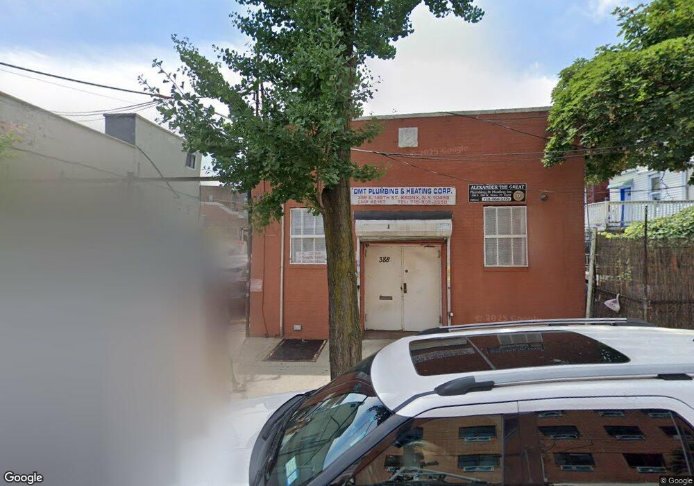
388-390 E 198th St Bronx, NY 10458
Fordham Manor NeighborhoodEstimated Value: $1,420,354
Studio
--
Bath
2,350
Sq Ft
$604/Sq Ft
Est. Value
About This Home
This home is located at 388-390 E 198th St, Bronx, NY 10458 and is currently estimated at $1,420,354, approximately $604 per square foot. 388-390 E 198th St is a home located in Bronx County with nearby schools including Ps 20 George J Werdan Iii, Thomas C Giordano Middleschool 45, and Children's Aid College Preparatory Charter School.
Ownership History
Date
Name
Owned For
Owner Type
Purchase Details
Closed on
Jan 16, 2024
Sold by
De East 198 Llc
Bought by
388 E 198 St Llc
Current Estimated Value
Home Financials for this Owner
Home Financials are based on the most recent Mortgage that was taken out on this home.
Original Mortgage
$1,300,000
Outstanding Balance
$1,270,571
Interest Rate
6.61%
Mortgage Type
Purchase Money Mortgage
Estimated Equity
$149,783
Purchase Details
Closed on
Dec 19, 2012
Sold by
Estate Of Sheldon Sternbach and Nancy Sternbach As
Bought by
De East 198 Llc
Purchase Details
Closed on
May 6, 1996
Sold by
Market Equipment Corp
Bought by
Sternbach Sheldon
Create a Home Valuation Report for This Property
The Home Valuation Report is an in-depth analysis detailing your home's value as well as a comparison with similar homes in the area
Home Values in the Area
Average Home Value in this Area
Purchase History
| Date | Buyer | Sale Price | Title Company |
|---|---|---|---|
| 388 E 198 St Llc | $1,300,000 | -- | |
| 388 E 198 St Llc | $1,300,000 | -- | |
| 388 E 198 St Llc | $1,300,000 | -- | |
| De East 198 Llc | $335,000 | -- | |
| De East 198 Llc | $335,000 | -- | |
| Sternbach Sheldon | -- | Lawyers Title Insurance Corp | |
| Sternbach Sheldon | -- | Lawyers Title Insurance Corp |
Source: Public Records
Mortgage History
| Date | Status | Borrower | Loan Amount |
|---|---|---|---|
| Open | 388 E 198 St Llc | $1,300,000 |
Source: Public Records
Tax History
| Year | Tax Paid | Tax Assessment Tax Assessment Total Assessment is a certain percentage of the fair market value that is determined by local assessors to be the total taxable value of land and additions on the property. | Land | Improvement |
|---|---|---|---|---|
| 2025 | $13,851 | $129,060 | $50,400 | $78,660 |
| 2024 | $13,851 | $130,770 | $50,400 | $80,370 |
| 2023 | $13,692 | $128,610 | $50,400 | $78,210 |
| 2022 | $13,658 | $128,250 | $50,400 | $77,850 |
| 2021 | $12,223 | $114,300 | $50,400 | $63,900 |
| 2020 | $11,674 | $137,700 | $50,400 | $87,300 |
| 2019 | $9,756 | $130,950 | $50,400 | $80,550 |
| 2018 | $8,005 | $123,750 | $50,400 | $73,350 |
| 2017 | $6,365 | $110,700 | $50,400 | $60,300 |
| 2016 | $4,974 | $50,850 | $31,500 | $19,350 |
| 2015 | $3,287 | $47,700 | $31,500 | $16,200 |
| 2014 | $3,287 | $47,700 | $31,500 | $16,200 |
Source: Public Records
Map
Nearby Homes
- 398 Oliver Place Unit 1A
- 2866 Marion Ave Unit 6J
- 2866 Marion Ave Unit 3J
- 2866 Marion Ave Unit 4C
- 330 E 198th St
- 2962 Decatur Ave Unit 1D
- 2962 Decatur Ave Unit 1C
- 2962 Decatur Ave Unit 4B
- 2962 Decatur Ave Unit 5G
- 2962 Decatur Ave Unit 5th Floor
- 2696 Marion Ave
- 2830 Briggs Ave Unit WIA
- 2830 Briggs Ave Unit 4-H
- 2830 Briggs Ave Unit 4-E
- 2830 Briggs Ave Unit 5-G
- 2862 Briggs Ave
- 2670 Marion Ave
- 2969 Perry Ave
- 2875 Briggs Ave
- 2877 Briggs Ave
- 2774 Decatur Ave
- 2772 Decatur Ave
- 2776 Decatur Ave
- 2770 Decatur Ave
- 2778 Decatur Ave
- 2771 Webster Ave
- 2769 Webster Ave
- 2768 Decatur Ave
- 2765 Webster Ave
- 2767 Webster Ave
- 2766 Decatur Ave
- 2763 Webster Ave
- 2761 Webster Ave
- 2775 Webster Ave
- 2764 Decatur Ave
- 391 E 198th St
- 389 E 198th St
- 385 E 198th St
- 366 E 198th St
- 2773 Webster Ave
Your Personal Tour Guide
Ask me questions while you tour the home.