Estimated Value: $1,935,000 - $3,531,000
3
Beds
3
Baths
4,198
Sq Ft
$582/Sq Ft
Est. Value
About This Home
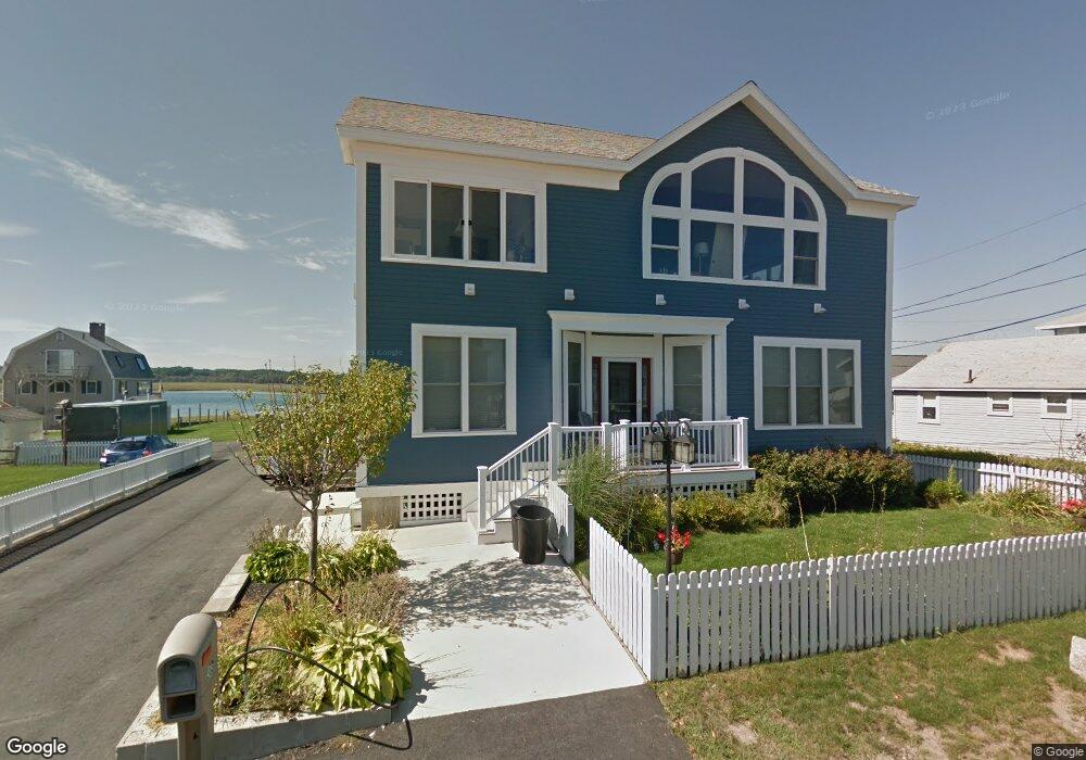
This home is located at 388 Atlantic Ave, Wells, ME 04090 and is currently estimated at $2,441,861, approximately $581 per square foot. 388 Atlantic Ave is a home located in York County with nearby schools including Wells Junior High School, Wells Elementary School, and Wells High School.
Ownership History
Date
Name
Owned For
Owner Type
Purchase Details
Closed on
Jul 31, 2013
Sold by
Chick Kathleen and Chick Richard W
Bought by
Tardif Christopher and Tardif Monica
Current Estimated Value
Purchase Details
Closed on
Apr 21, 2009
Sold by
Chick Anne F and Chick Kathleen A
Bought by
Chick Kathleen A
Home Financials for this Owner
Home Financials are based on the most recent Mortgage that was taken out on this home.
Original Mortgage
$295,000
Interest Rate
5.02%
Mortgage Type
Unknown
Create a Home Valuation Report for This Property
The Home Valuation Report is an in-depth analysis detailing your home's value as well as a comparison with similar homes in the area
Home Values in the Area
Average Home Value in this Area
Purchase History
| Date | Buyer | Sale Price | Title Company |
|---|---|---|---|
| Tardif Christopher | -- | -- | |
| Tardif Christopher | -- | -- | |
| Chick Kathleen A | -- | -- | |
| Chick Kathleen A | -- | -- |
Source: Public Records
Mortgage History
| Date | Status | Borrower | Loan Amount |
|---|---|---|---|
| Previous Owner | Chick Kathleen A | $295,000 |
Source: Public Records
Tax History Compared to Growth
Tax History
| Year | Tax Paid | Tax Assessment Tax Assessment Total Assessment is a certain percentage of the fair market value that is determined by local assessors to be the total taxable value of land and additions on the property. | Land | Improvement |
|---|---|---|---|---|
| 2024 | $12,542 | $2,062,820 | $1,124,640 | $938,180 |
| 2023 | $12,294 | $2,062,820 | $1,124,640 | $938,180 |
| 2022 | $11,645 | $1,113,300 | $659,200 | $454,100 |
| 2021 | $11,263 | $1,070,640 | $659,200 | $411,440 |
| 2020 | $3,366 | $1,070,640 | $659,200 | $411,440 |
| 2019 | $3,366 | $1,070,640 | $659,200 | $411,440 |
| 2018 | $3,366 | $1,070,640 | $659,200 | $411,440 |
| 2017 | $10,809 | $1,063,840 | $659,200 | $404,640 |
| 2016 | $3,142 | $1,063,840 | $659,200 | $404,640 |
| 2015 | $10,585 | $1,063,840 | $659,200 | $404,640 |
| 2013 | $9,702 | $1,063,840 | $659,200 | $404,640 |
Source: Public Records
Map
Nearby Homes
- 9 Robert Ln
- 446 Atlantic Ave
- 500 Atlantic Ave Unit 2
- 229 Atlantic Ave
- 225 Atlantic Ave
- 75 Ox Cart Ln Unit 2
- 61 Atlantic Ave Unit 3
- 46 Ox Cart Ln
- 163 Island Beach Rd
- 42 Rachel Carson Ln
- 4 Tidal Ct
- 1373 Post Rd Unit 1F
- 1373 Post Rd Unit 7C
- 1373 Post Rd Unit 6B
- 1373 Post Rd Unit 10A
- 1516 Post Rd
- 1801 Post Rd Unit 190
- 1801 Post Rd Unit 180
- 1801 Post Rd Unit 143
- 1413 Post Rd Unit 58
- 0 Riverside Dr Unit 549095
- 0 Riverside Dr Unit 546953
- 0 Riverside Dr Unit 593693
- 0 Riverside Dr Unit 586257
- 0 Riverside Dr Unit 575333
- 0 Riverside Dr Unit 547353
- 0 Riverside Dr Unit 930466
- 0 Riverside Dr Unit 1022596
- 396 Atlantic Ave
- 382 Atlantic Ave
- 380 Atlantic Ave
- 393 Atlantic Ave
- 389 Atlantic Ave
- 400 Atlantic Ave Unit C
- 400 Atlantic Ave Unit B
- 400 Atlantic Ave Unit A
- 400 Atlantic Ave Unit D
- 15 Pickett Ln
- 17 Pickett Ln
- 376 Atlantic Ave