Estimated Value: $345,216 - $536,000
3
Beds
2
Baths
1,296
Sq Ft
$312/Sq Ft
Est. Value
About This Home
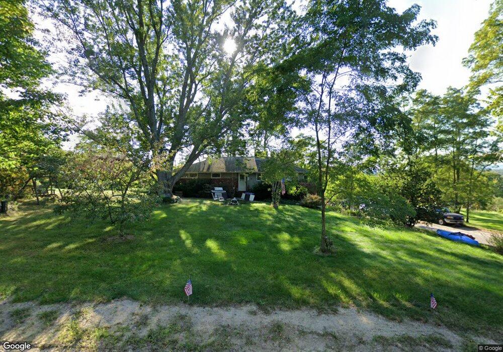
This home is located at 388 Foxes Ridge Rd, Acton, ME 04001 and is currently estimated at $403,804, approximately $311 per square foot. 388 Foxes Ridge Rd is a home located in York County with nearby schools including Acton Elementary School.
Ownership History
Date
Name
Owned For
Owner Type
Purchase Details
Closed on
Jul 31, 2024
Sold by
Landry Donald M
Bought by
Landry Jessica R
Current Estimated Value
Purchase Details
Closed on
Oct 6, 2005
Sold by
Joslyn Diane E and Joslyn David A
Bought by
Landry Donald M
Home Financials for this Owner
Home Financials are based on the most recent Mortgage that was taken out on this home.
Original Mortgage
$200,000
Interest Rate
5.81%
Mortgage Type
Commercial
Create a Home Valuation Report for This Property
The Home Valuation Report is an in-depth analysis detailing your home's value as well as a comparison with similar homes in the area
Home Values in the Area
Average Home Value in this Area
Purchase History
| Date | Buyer | Sale Price | Title Company |
|---|---|---|---|
| Landry Jessica R | -- | None Available | |
| Landry Jessica R | -- | None Available | |
| Landry Donald M | -- | -- | |
| Landry Donald M | -- | -- | |
| Landry Donald M | -- | -- |
Source: Public Records
Mortgage History
| Date | Status | Borrower | Loan Amount |
|---|---|---|---|
| Previous Owner | Landry Donald M | $200,000 |
Source: Public Records
Tax History Compared to Growth
Tax History
| Year | Tax Paid | Tax Assessment Tax Assessment Total Assessment is a certain percentage of the fair market value that is determined by local assessors to be the total taxable value of land and additions on the property. | Land | Improvement |
|---|---|---|---|---|
| 2024 | $1,434 | $202,760 | $68,304 | $134,456 |
| 2023 | $1,308 | $202,760 | $68,304 | $134,456 |
| 2022 | $1,619 | $135,486 | $43,855 | $91,631 |
| 2021 | $1,619 | $135,486 | $43,855 | $91,631 |
| 2020 | $1,633 | $135,486 | $43,855 | $91,631 |
| 2019 | $1,633 | $135,486 | $43,855 | $91,631 |
| 2018 | $1,633 | $135,486 | $43,855 | $91,631 |
| 2017 | $1,612 | $135,486 | $43,855 | $91,631 |
| 2016 | $1,524 | $135,486 | $43,855 | $91,631 |
| 2015 | $1,565 | $135,486 | $43,855 | $91,631 |
| 2014 | $1,504 | $135,486 | $43,855 | $91,631 |
Source: Public Records
Map
Nearby Homes
- 96 French St
- 44 Main St
- 75 Main St
- 47 Church St
- 013 Foxes Ridge Rd
- 247 NE Pond Rd
- 1574 Foxes Ridge Rd
- TBD Peck Rd
- 1451 White Mountain Hwy
- 0 White Mountain Hwy Unit 5033185
- 564 White Mountain Hwy
- Lot 19-17 NE Pond Rd
- 318 Sewell Shores Rd
- 314 Sewell Shores Rd
- TBD Hopper
- 660 Hopper Rd
- 1765 White Mountain Hwy
- Lot 13 Milton Mills Rd
- 132 Main St
- 189 Hopper Rd
- 426 Foxes Ridge Rd
- 441 Foxes Ridge Rd
- 457 Foxes Ridge Rd
- 372 Foxes Ridge Rd
- 464 Foxes Ridge Rd
- 473 Foxes Ridge Rd
- 6 Riverview Dr
- 304 Foxes Ridge Rd
- TBD Foxes Ridge Rd Lot 10 Rd
- 287 Foxes Ridge Rd
- 520 Foxes Ridge Rd
- 303 Foxes Ridge Rd
- 525 Foxes Ridge Rd
- 41 Riverview Dr
- 81 Riverview Dr
- 149 Riverview Dr
- TBD Riverview Dr
- TBD Riverview Dr
- 1 Riverview Dr
- 0 Riverview Dr