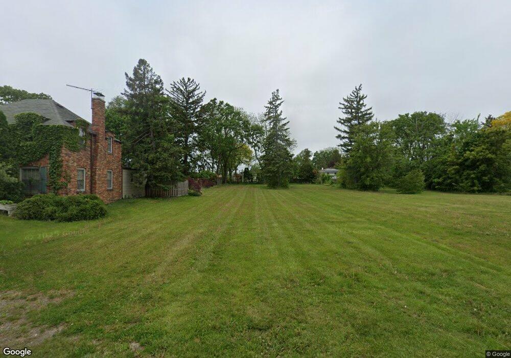
388 Hawthorne Ln Des Plaines, IL 60016
Estimated Value: $390,000
4
Beds
2
Baths
2,828
Sq Ft
$138/Sq Ft
Est. Value
About This Home
This home is located at 388 Hawthorne Ln, Des Plaines, IL 60016 and is currently priced at $390,000, approximately $137 per square foot. 388 Hawthorne Ln is a home located in Cook County with nearby schools including North Elementary School, Chippewa Middle School, and Maine West High School.
Ownership History
Date
Name
Owned For
Owner Type
Purchase Details
Closed on
Nov 18, 2019
Sold by
The City Of Des Plaines
Bought by
The City Of Des Plaines
Current Estimated Value
Purchase Details
Closed on
Oct 31, 2018
Sold by
The City Of Des Plaines
Bought by
City Of Des Plaines
Purchase Details
Closed on
Oct 9, 2017
Sold by
Hageman Robert V and Hageman Eileen M
Bought by
The City Of Des Plaines
Create a Home Valuation Report for This Property
The Home Valuation Report is an in-depth analysis detailing your home's value as well as a comparison with similar homes in the area
Home Values in the Area
Average Home Value in this Area
Purchase History
| Date | Buyer | Sale Price | Title Company |
|---|---|---|---|
| The City Of Des Plaines | -- | Attorney | |
| City Of Des Plaines | -- | Attorney | |
| The City Of Des Plaines | -- | Chicago Title Insurance |
Source: Public Records
Tax History Compared to Growth
Tax History
| Year | Tax Paid | Tax Assessment Tax Assessment Total Assessment is a certain percentage of the fair market value that is determined by local assessors to be the total taxable value of land and additions on the property. | Land | Improvement |
|---|---|---|---|---|
| 2024 | $11,181 | -- | -- | -- |
| 2023 | $11,181 | -- | -- | -- |
| 2022 | $11,181 | -- | -- | -- |
| 2021 | $11,181 | $0 | $0 | $0 |
| 2020 | $11,181 | $0 | $0 | $0 |
| 2019 | $0 | $0 | $0 | $0 |
| 2018 | $11,181 | $37,386 | $7,072 | $30,314 |
| 2017 | $9,992 | $37,386 | $7,072 | $30,314 |
| 2016 | $9,695 | $37,386 | $7,072 | $30,314 |
| 2015 | $7,735 | $28,208 | $6,150 | $22,058 |
| 2014 | $7,588 | $28,208 | $6,150 | $22,058 |
| 2013 | $7,381 | $28,208 | $6,150 | $22,058 |
Source: Public Records
Map
Nearby Homes
- 555 S River Rd Unit 301
- 1578 Woodland Ave Unit D
- 430 Oak St
- 1470 Jefferson St Unit 504
- 1470 Jefferson St Unit 405
- 394 Alles St Unit 3B
- 501 Alles St Unit 501A
- 1433 Willow Ave
- 1675 Mill St Unit 302
- 476 Alles St Unit 508
- 476 Alles St Unit 210
- 365 Graceland Ave Unit 205A
- 675 Pearson St Unit 710
- 650 S River Rd Unit 306
- 395 Graceland Ave Unit 207
- 550 Ida St Unit 2NW
- 711 S River Rd Unit 401
- 555 Graceland Ave Unit 206
- 1389 Perry St Unit 303
- 1363 Perry St Unit 1B
- 1738 Rand Rd
- 1770 Rand Rd
- 396 Hawthorne Ln
- 1710 Rand Rd
- 397 Hawthorne Ln
- 1745 Rand Rd Unit 2
- 1745 Rand Rd Unit 5
- 1745 Rand Rd Unit 4
- 1745 Rand Rd Unit 3
- 1745 Rand Rd Unit 6
- 1745 Rand Rd Unit 1
- 384 Hawthorne Ln
- 1717 Rand Rd
- 376 Hawthorne Ln
- 1776 Rand Rd
- 385 Hawthorne Ln
- 381 Elk Blvd
- 1794 Rand Rd
- 368 Hawthorne Ln
