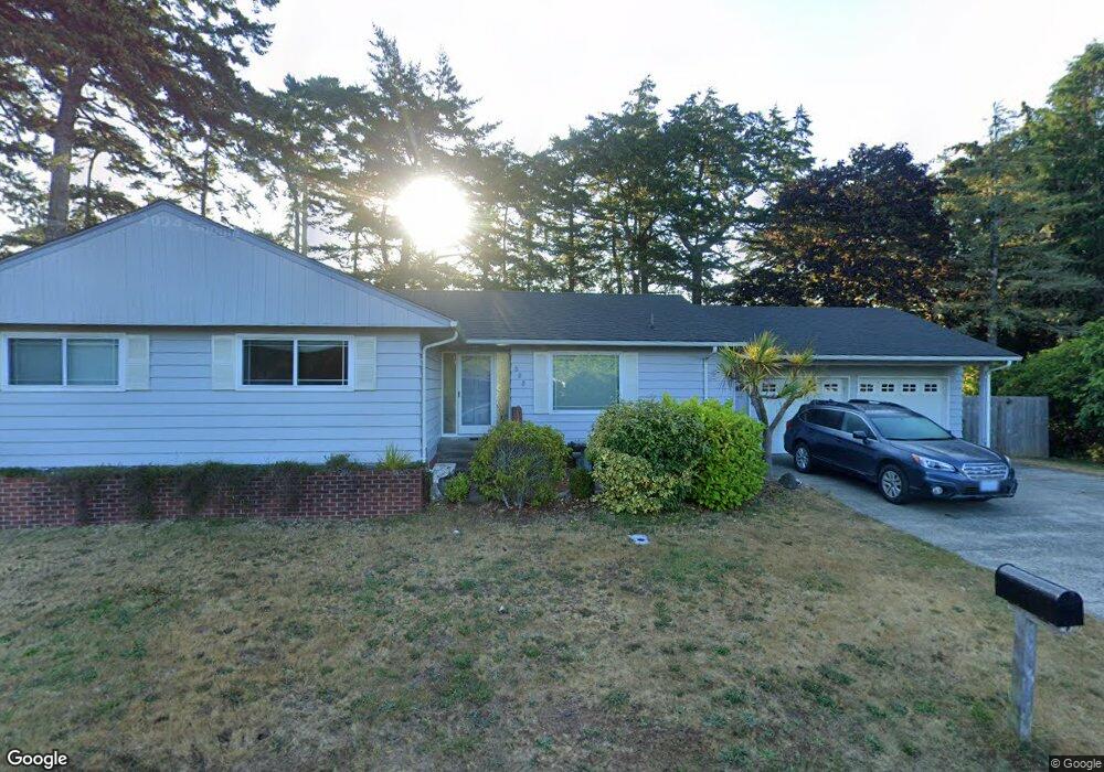
388 Hemlock St Florence, OR 97439
Estimated Value: $528,000 - $693,000
4
Beds
2
Baths
2,240
Sq Ft
$270/Sq Ft
Est. Value
About This Home
This home is located at 388 Hemlock St, Florence, OR 97439 and is currently estimated at $603,689, approximately $269 per square foot. 388 Hemlock St is a home located in Lane County with nearby schools including Siuslaw Elementary School, Siuslaw Middle School, and Siuslaw High School.
Ownership History
Date
Name
Owned For
Owner Type
Purchase Details
Closed on
Oct 28, 2020
Sold by
Gruber Rene and Gruber Torrie L
Bought by
Duman Terry W and Duman Mary J
Current Estimated Value
Purchase Details
Closed on
Dec 21, 1999
Sold by
Selden Charles P and Selden Loretta K
Bought by
Gruber Rene and Gruber Torrie L
Home Financials for this Owner
Home Financials are based on the most recent Mortgage that was taken out on this home.
Original Mortgage
$110,400
Interest Rate
7.69%
Create a Home Valuation Report for This Property
The Home Valuation Report is an in-depth analysis detailing your home's value as well as a comparison with similar homes in the area
Home Values in the Area
Average Home Value in this Area
Purchase History
| Date | Buyer | Sale Price | Title Company |
|---|---|---|---|
| Duman Terry W | $449,000 | Cascade Title Co | |
| Gruber Rene | $147,750 | Western Pioneer Title Co |
Source: Public Records
Mortgage History
| Date | Status | Borrower | Loan Amount |
|---|---|---|---|
| Previous Owner | Gruber Rene | $110,400 |
Source: Public Records
Tax History
| Year | Tax Paid | Tax Assessment Tax Assessment Total Assessment is a certain percentage of the fair market value that is determined by local assessors to be the total taxable value of land and additions on the property. | Land | Improvement |
|---|---|---|---|---|
| 2025 | $3,575 | $262,043 | -- | -- |
| 2024 | $3,472 | $254,411 | -- | -- |
| 2023 | $3,472 | $247,001 | $0 | $0 |
| 2022 | $3,239 | $239,807 | $0 | $0 |
| 2021 | $3,173 | $232,823 | $0 | $0 |
| 2020 | $3,089 | $226,042 | $0 | $0 |
| 2019 | $2,974 | $219,459 | $0 | $0 |
| 2018 | $2,980 | $206,861 | $0 | $0 |
| 2017 | $2,874 | $206,861 | $0 | $0 |
| 2016 | $2,792 | $200,836 | $0 | $0 |
| 2015 | $2,733 | $194,986 | $0 | $0 |
| 2014 | $2,704 | $189,307 | $0 | $0 |
Source: Public Records
Map
Nearby Homes
- 0 Hemlock St Unit TL 2200
- 0 Hemlock St Unit 24176357
- 0 Hemlock St Unit 23650308
- 777 Rhododendron Dr
- 1070 Bay St Unit 22
- 1040 Bay St Unit 14
- 1080 Bay St Unit 19
- 1695947 4th St
- 179 Laurel St Unit 9
- 1036 9th St
- 1335 7th St
- 1260 10th St Unit 5
- 1495 8th St
- 289 Harbor St
- 211 Harbor St Unit 22
- 1150 Hemlock St Unit C11
- 1150 Hemlock St Unit E17
- 1150 Hemlock St Unit D14
- 290 Harbor St
- 100 Rhododendron Dr
- 320 Hemlock St
- 412 Hemlock St
- 387 Hemlock St
- 347 Hemlock St
- 937 1st St
- 853 1st St
- 403 Hemlock St
- 0 Hemlock St Unit 1508 22427654
- 0 Hemlock St Unit 21439178
- 0 Hemlock St Unit 4601 20680381
- 0 Hemlock St Unit 9020370
- 0 Hemlock St Unit 9/10 13206797
- 0 Hemlock St Unit 4601 13283508
- 0 Hemlock St Unit 3000 14144328
- 0 Hemlock St Unit 15511673
- 0 Hemlock St Unit TL800 16027191
- 0 Hemlock St Unit 3000 16231734
- 0 Hemlock St Unit 17502728
- 0 Hemlock St Unit 4601 18467947
Your Personal Tour Guide
Ask me questions while you tour the home.