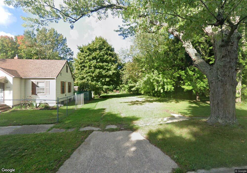
388 N Mccord St Benton Harbor, MI 49022
Estimated Value: $17,000 - $58,000
1
Bed
1
Bath
750
Sq Ft
$50/Sq Ft
Est. Value
About This Home
This home is located at 388 N Mccord St, Benton Harbor, MI 49022 and is currently estimated at $37,500, approximately $50 per square foot. 388 N Mccord St is a home located in Berrien County with nearby schools including Fair Plain Middle School, Benton Harbor High School, and Mildred C. Wells Preparatory Academy.
Ownership History
Date
Name
Owned For
Owner Type
Purchase Details
Closed on
Oct 30, 2017
Sold by
Berriel County Ttreasure
Bought by
Hicks Arister
Current Estimated Value
Purchase Details
Closed on
Sep 16, 2016
Sold by
Grant Dorrean
Bought by
Little Charles
Purchase Details
Closed on
Sep 22, 2014
Sold by
Berrien County Treasurer
Bought by
Grant Dreean
Purchase Details
Closed on
Apr 9, 2008
Sold by
Swanson James R
Bought by
Accord Property Solutions Llc
Purchase Details
Closed on
Dec 15, 2005
Sold by
Romain Rhea
Bought by
Citibank Na
Purchase Details
Closed on
Jan 26, 1998
Purchase Details
Closed on
Mar 18, 1981
Purchase Details
Closed on
Dec 14, 1977
Create a Home Valuation Report for This Property
The Home Valuation Report is an in-depth analysis detailing your home's value as well as a comparison with similar homes in the area
Home Values in the Area
Average Home Value in this Area
Purchase History
| Date | Buyer | Sale Price | Title Company |
|---|---|---|---|
| Hicks Arister | -- | None Available | |
| Little Charles | -- | None Available | |
| Grant Dreean | -- | None Available | |
| Accord Property Solutions Llc | -- | None Available | |
| Citibank Na | $70,896 | None Available | |
| -- | $100 | -- | |
| -- | $3,600 | -- | |
| -- | $3,600 | -- |
Source: Public Records
Tax History Compared to Growth
Tax History
| Year | Tax Paid | Tax Assessment Tax Assessment Total Assessment is a certain percentage of the fair market value that is determined by local assessors to be the total taxable value of land and additions on the property. | Land | Improvement |
|---|---|---|---|---|
| 2025 | $28 | $3,300 | $0 | $0 |
| 2024 | $27 | $2,800 | $0 | $0 |
| 2023 | $21 | $600 | $0 | $0 |
| 2022 | $24 | $400 | $0 | $0 |
| 2021 | $44 | $700 | $700 | $0 |
| 2020 | $44 | $700 | $0 | $0 |
| 2019 | $44 | $700 | $0 | $0 |
| 2018 | $178 | $2,900 | $0 | $0 |
| 2017 | $63 | $1,000 | $0 | $0 |
| 2016 | $262 | $1,000 | $0 | $0 |
| 2015 | $62 | $1,000 | $0 | $0 |
| 2014 | $36 | $1,200 | $0 | $0 |
Source: Public Records
Map
Nearby Homes
- 470 N Mccord St
- 530 Rembert Ct
- 6525 Territorial Rd
- 696 Highland Ave
- 238 Pine St
- 137 Cornelia St
- 710 Buss Ave
- 992 Highland Ave
- 1069 E Main St
- 234 Walnut St
- 363 Brunson Ave
- 1226 Chicago Ave
- 394 Linden St
- 309 High St
- 255 High St
- 419 Packard St
- 391 Pipestone St
- 378 Pipestone St
- 416 E Britain Ave
- 806 Pitkins Ave
- 392 N Mccord St
- 380 N Mccord St
- 760 Edgecumbe Ave
- 370 N Mccord St
- 366 N Mccord St
- 761 La Salle St
- 769 La Salle St
- 744 Madison Ave
- 385 John St
- 738 Madison Ave
- 381 John St
- 358 N Mccord St
- 369 John St
- 726 Madison Ave
- 779 La Salle St
- 782 Edgecumbe Ave
- 367 John St
- 350 N Mccord St
- 785 La Salle St
- 760 La Salle St