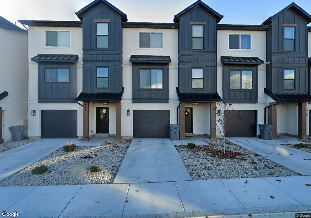
388 S 680 E Unit 154 American Fork, UT 84003
Estimated Value: $446,000 - $490,000
3
Beds
3
Baths
2,100
Sq Ft
$224/Sq Ft
Est. Value
About This Home
This home is located at 388 S 680 E Unit 154, American Fork, UT 84003 and is currently estimated at $470,718, approximately $224 per square foot. 388 S 680 E Unit 154 is a home located in Utah County with nearby schools including American Fork Junior High School, American Fork High School, and Athenian eAcademy.
Ownership History
Date
Name
Owned For
Owner Type
Purchase Details
Closed on
May 4, 2021
Sold by
Luminary Ck Llc
Bought by
Sherman Joshua K and Sherman Amber C
Current Estimated Value
Home Financials for this Owner
Home Financials are based on the most recent Mortgage that was taken out on this home.
Original Mortgage
$389,405
Outstanding Balance
$351,586
Interest Rate
3%
Mortgage Type
New Conventional
Estimated Equity
$119,132
Purchase Details
Closed on
Aug 31, 2020
Sold by
Pr Terracom Ck
Bought by
Luminary Ck Llc
Home Financials for this Owner
Home Financials are based on the most recent Mortgage that was taken out on this home.
Original Mortgage
$10,478,231
Interest Rate
2.9%
Mortgage Type
Future Advance Clause Open End Mortgage
Create a Home Valuation Report for This Property
The Home Valuation Report is an in-depth analysis detailing your home's value as well as a comparison with similar homes in the area
Home Values in the Area
Average Home Value in this Area
Purchase History
| Date | Buyer | Sale Price | Title Company |
|---|---|---|---|
| Sherman Joshua K | -- | 1St Liberty Title | |
| Luminary Ck Llc | -- | 1St Liberty Title | |
| Pr Terracom Ck | -- | 1St Liberty Title Llc |
Source: Public Records
Mortgage History
| Date | Status | Borrower | Loan Amount |
|---|---|---|---|
| Open | Sherman Joshua K | $389,405 | |
| Previous Owner | Luminary Ck Llc | $10,478,231 |
Source: Public Records
Tax History Compared to Growth
Tax History
| Year | Tax Paid | Tax Assessment Tax Assessment Total Assessment is a certain percentage of the fair market value that is determined by local assessors to be the total taxable value of land and additions on the property. | Land | Improvement |
|---|---|---|---|---|
| 2025 | $2,239 | $249,425 | $66,700 | $386,800 |
| 2024 | $2,239 | $248,765 | $0 | $0 |
| 2023 | $2,007 | $236,390 | $0 | $0 |
| 2022 | $1,989 | $231,275 | $0 | $0 |
| 2021 | $1,163 | $211,200 | $51,300 | $159,900 |
| 2020 | $929 | $90,000 | $90,000 | $0 |
| 2019 | $898 | $90,000 | $90,000 | $0 |
Source: Public Records
Map
Nearby Homes
- 638 E 360 S
- 642 E 340 S
- 614 E 340 S
- 723 E 380 S
- 732 E 480 S
- 407 S 740 St E
- 359 S 780 E
- 782 E 500 S
- 410 S 500 E
- 384 S 500 E
- 796 E 500 S
- 635 E Mayor Place Dr
- 477 S 850 E
- 599 S 500 St E
- 78 S 810 E
- 502 S 1040 E Unit 252
- 502 S 1040 E Unit 221
- 502 S 1040 E Unit 137
- 502 S 1040 E Unit 243
- 502 S 1040 E Unit 226
- 392 S 680 E Unit 155
- 392 S 680 E
- 386 S 680 E Unit 153
- 384 S 680 E
- 384 S 680 E Unit 152
- 394 S 680 E Unit 156
- 383 S 650 E
- 383 S 650 E Unit 162
- 377 S 650 E
- 371 S 650 E Unit 164
- 371 S 650 E
- 389 S 650 E Unit 161
- 396 S 680 E Unit 157
- 367 S 650 E
- 395 S 650 E
- 398 S 680 E Unit 158
- 399 S 650 E
- 681 E 380 S
- 387 S 680 E
- 355 S 650 E