Estimated Value: $495,000 - $543,862
4
Beds
3
Baths
2,392
Sq Ft
$221/Sq Ft
Est. Value
About This Home
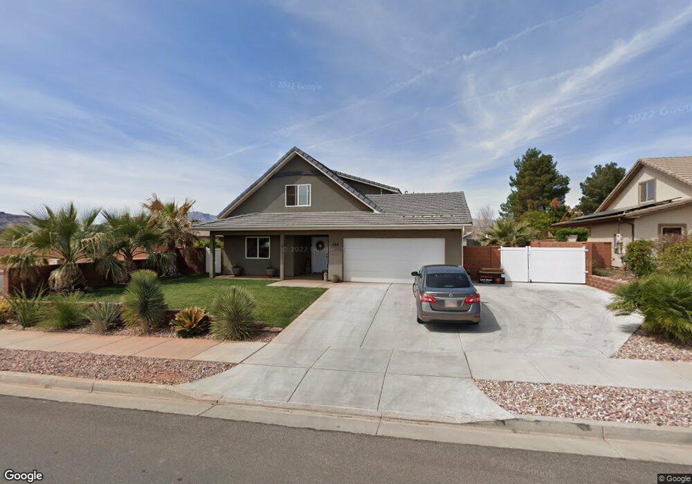
This home is located at 388 S Main St, Ivins, UT 84738 and is currently estimated at $529,716, approximately $221 per square foot. 388 S Main St is a home with nearby schools including Snow Canyon Middle School, Lava Ridge Intermediate School, and Snow Canyon High School.
Ownership History
Date
Name
Owned For
Owner Type
Purchase Details
Closed on
Apr 30, 2024
Sold by
Weight Brandon Tad
Bought by
Weight Brandon Tad
Current Estimated Value
Home Financials for this Owner
Home Financials are based on the most recent Mortgage that was taken out on this home.
Original Mortgage
$454,000
Outstanding Balance
$447,463
Interest Rate
6.74%
Mortgage Type
New Conventional
Estimated Equity
$82,253
Purchase Details
Closed on
Sep 13, 2018
Sold by
Gray Robert D and Gray Michele L
Bought by
Weight Brandon Tad
Home Financials for this Owner
Home Financials are based on the most recent Mortgage that was taken out on this home.
Original Mortgage
$325,004
Interest Rate
4.4%
Mortgage Type
FHA
Purchase Details
Closed on
May 10, 2013
Sold by
Color Country Community Housing Inc
Bought by
Gray Robert D and Gray Michele L
Home Financials for this Owner
Home Financials are based on the most recent Mortgage that was taken out on this home.
Original Mortgage
$193,000
Interest Rate
3.54%
Mortgage Type
USDA
Create a Home Valuation Report for This Property
The Home Valuation Report is an in-depth analysis detailing your home's value as well as a comparison with similar homes in the area
Home Values in the Area
Average Home Value in this Area
Purchase History
| Date | Buyer | Sale Price | Title Company |
|---|---|---|---|
| Weight Brandon Tad | -- | Inwest Title | |
| Weight Brandon Tad | -- | Rampart Title Ins Agency | |
| Gray Robert D | -- | First American Title Company |
Source: Public Records
Mortgage History
| Date | Status | Borrower | Loan Amount |
|---|---|---|---|
| Open | Weight Brandon Tad | $454,000 | |
| Previous Owner | Weight Brandon Tad | $325,004 | |
| Previous Owner | Gray Robert D | $193,000 |
Source: Public Records
Tax History Compared to Growth
Tax History
| Year | Tax Paid | Tax Assessment Tax Assessment Total Assessment is a certain percentage of the fair market value that is determined by local assessors to be the total taxable value of land and additions on the property. | Land | Improvement |
|---|---|---|---|---|
| 2025 | $2,114 | $279,235 | $67,925 | $211,310 |
| 2023 | $2,215 | $324,610 | $67,925 | $256,685 |
| 2022 | $2,365 | $326,315 | $67,925 | $258,390 |
| 2021 | $1,919 | $393,300 | $61,800 | $331,500 |
| 2020 | $1,773 | $343,800 | $61,800 | $282,000 |
| 2019 | $1,737 | $329,400 | $42,800 | $286,600 |
| 2018 | $1,337 | $130,460 | $0 | $0 |
| 2017 | $1,255 | $119,185 | $0 | $0 |
| 2016 | $1,274 | $111,760 | $0 | $0 |
| 2015 | $1,220 | $103,015 | $0 | $0 |
| 2014 | $477 | $40,500 | $0 | $0 |
Source: Public Records
Map
Nearby Homes
- 300 Main St
- 249 S 100 W
- 562 S Harmony Cir
- 29 W Serenity Cir
- 37 W Serenity Cir
- 492 S Memory Ln
- 234 United Way
- 253 United Way
- 257 S 230 W
- 274 United Way
- 515 S 250 E
- 713 S 230 W
- 712 S 230 W Unit 15
- 690 S 230 W Unit (lot 18)
- 635 S 230 W
- 686 S 230 W Unit (lot 19)
- Dearborn Plan at Vista Estates
- 673 S 230 W
- 693 S 230 W
- Daniel II Plan at Vista Estates