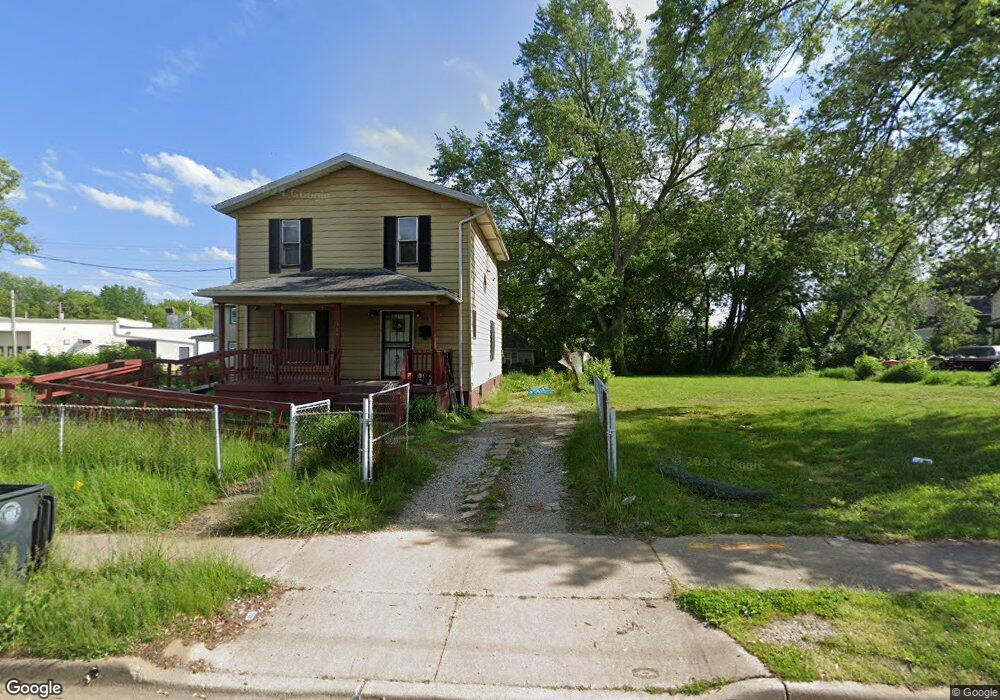
388 W Thornton St Akron, OH 44307
Sherbondy Hill NeighborhoodEstimated Value: $63,000 - $92,000
3
Beds
2
Baths
1,536
Sq Ft
$49/Sq Ft
Est. Value
About This Home
This home is located at 388 W Thornton St, Akron, OH 44307 and is currently estimated at $75,280, approximately $49 per square foot. 388 W Thornton St is a home located in Summit County with nearby schools including St. Bernard-St. Mary Elementary School.
Ownership History
Date
Name
Owned For
Owner Type
Purchase Details
Closed on
Nov 19, 2024
Sold by
Thomas Sterling L and Thomas Tammy
Bought by
Thomas Cameron T
Current Estimated Value
Purchase Details
Closed on
Jan 20, 2023
Sold by
Thomas Sterling L
Bought by
Thomas Sterling L
Purchase Details
Closed on
Nov 11, 2022
Sold by
Thomas Sterling L
Bought by
Thomas Sterling L
Create a Home Valuation Report for This Property
The Home Valuation Report is an in-depth analysis detailing your home's value as well as a comparison with similar homes in the area
Home Values in the Area
Average Home Value in this Area
Purchase History
| Date | Buyer | Sale Price | Title Company |
|---|---|---|---|
| Thomas Cameron T | -- | -- | |
| Thomas Cameron T | -- | -- | |
| Thomas Sterling L | -- | None Listed On Document | |
| Thomas Sterling L | -- | None Listed On Document |
Source: Public Records
Tax History Compared to Growth
Tax History
| Year | Tax Paid | Tax Assessment Tax Assessment Total Assessment is a certain percentage of the fair market value that is determined by local assessors to be the total taxable value of land and additions on the property. | Land | Improvement |
|---|---|---|---|---|
| 2025 | $965 | $13,665 | $4,155 | $9,510 |
| 2024 | $939 | $13,665 | $4,155 | $9,510 |
| 2023 | $965 | $13,665 | $4,155 | $9,510 |
| 2022 | $714 | $8,036 | $2,443 | $5,593 |
| 2021 | $177 | $8,036 | $2,443 | $5,593 |
| 2020 | $177 | $8,030 | $2,440 | $5,590 |
| 2019 | $177 | $6,810 | $3,370 | $3,440 |
| 2018 | $177 | $6,810 | $3,370 | $3,440 |
| 2017 | $122 | $6,810 | $3,370 | $3,440 |
| 2016 | $122 | $6,910 | $3,370 | $3,540 |
| 2015 | $122 | $6,910 | $3,370 | $3,540 |
| 2014 | $122 | $6,910 | $3,370 | $3,540 |
| 2013 | $122 | $7,500 | $3,370 | $4,130 |
Source: Public Records
Map
Nearby Homes
- 1063 Raymond St
- 949 Raymond St
- 364 Campbell St
- 834 Kenyon St
- 817 Raymond St
- 810 Amherst St
- 1001 Celina Ave
- 963 Penn Ave
- 849 Amherst St
- 151 Russell Ave
- 1132 Bristol Terrace
- 677 Vernon Odom Blvd
- 832 Yale St
- 721 Vernon Odom Blvd
- 829 Yale St
- 837 Yale St
- 849 Yale St
- 4 Manila Place
- 794 Ruth Ave
- 737 Vernon Odom Blvd
- 382 W Thornton St
- 1048 Nathan St Unit 1050
- 1054 Nathan St
- 398 W Thornton St
- 1060 Nathan St
- 1057 Raymond St
- 1053 Raymond St Unit 1055
- 1066 Nathan St
- 377 W Thornton St
- 405 W Thornton St
- 1068 Nathan St
- 878 W Bowery St
- 878 W Bowery St
- 1070 Nathan St
- 1058 Raymond St
- 1017 Nathan St
- 416 W Thornton St
- 1017 Raymond St
- 1014 Nathan St
- 1062 Raymond St