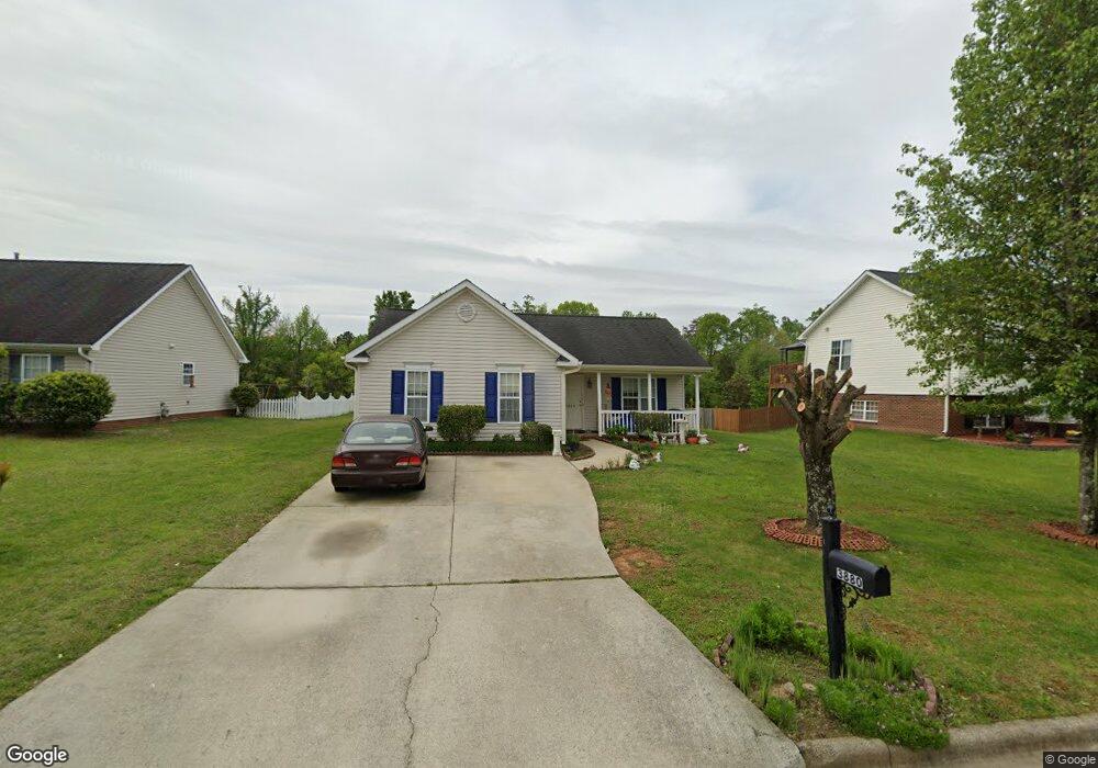
3880 Range Crest Ct High Point, NC 27265
Florence NeighborhoodEstimated Value: $249,212 - $282,000
3
Beds
2
Baths
1,134
Sq Ft
$230/Sq Ft
Est. Value
About This Home
This home is located at 3880 Range Crest Ct, High Point, NC 27265 and is currently estimated at $261,053, approximately $230 per square foot. 3880 Range Crest Ct is a home located in Guilford County with nearby schools including Montlieu Academy of Technology, Welborn Academy of Science & Technology, and T.W. Andrews High School.
Ownership History
Date
Name
Owned For
Owner Type
Purchase Details
Closed on
Nov 18, 2005
Sold by
Monsalve Camilo Andres and Ruiz Adriana
Bought by
Karaman Milos
Current Estimated Value
Home Financials for this Owner
Home Financials are based on the most recent Mortgage that was taken out on this home.
Original Mortgage
$114,109
Outstanding Balance
$62,522
Interest Rate
6.04%
Mortgage Type
FHA
Estimated Equity
$198,531
Purchase Details
Closed on
Jun 4, 2001
Sold by
Shugart Enterprises Llc
Bought by
Monsalve Camilo Andres and Ruiz Adriana
Home Financials for this Owner
Home Financials are based on the most recent Mortgage that was taken out on this home.
Original Mortgage
$99,517
Interest Rate
7.11%
Mortgage Type
FHA
Create a Home Valuation Report for This Property
The Home Valuation Report is an in-depth analysis detailing your home's value as well as a comparison with similar homes in the area
Home Values in the Area
Average Home Value in this Area
Purchase History
| Date | Buyer | Sale Price | Title Company |
|---|---|---|---|
| Karaman Milos | $116,000 | None Available | |
| Monsalve Camilo Andres | $100,500 | -- |
Source: Public Records
Mortgage History
| Date | Status | Borrower | Loan Amount |
|---|---|---|---|
| Open | Karaman Milos | $114,109 | |
| Previous Owner | Monsalve Camilo Andres | $99,517 |
Source: Public Records
Tax History
| Year | Tax Paid | Tax Assessment Tax Assessment Total Assessment is a certain percentage of the fair market value that is determined by local assessors to be the total taxable value of land and additions on the property. | Land | Improvement |
|---|---|---|---|---|
| 2025 | $2,092 | $151,800 | $44,000 | $107,800 |
| 2024 | $2,092 | $151,800 | $44,000 | $107,800 |
| 2023 | $2,092 | $151,800 | $44,000 | $107,800 |
| 2022 | $2,046 | $151,800 | $44,000 | $107,800 |
| 2021 | $1,543 | $112,000 | $30,000 | $82,000 |
| 2020 | $1,543 | $112,000 | $30,000 | $82,000 |
| 2019 | $1,543 | $112,000 | $0 | $0 |
| 2018 | $1,536 | $112,000 | $0 | $0 |
| 2017 | $1,536 | $112,000 | $0 | $0 |
| 2016 | $1,536 | $109,500 | $0 | $0 |
| 2015 | $1,544 | $109,500 | $0 | $0 |
| 2014 | $1,570 | $109,500 | $0 | $0 |
Source: Public Records
Map
Nearby Homes
- 3871 Eagleston Ct
- 3724 Spanish Peak Dr Unit 2B
- 3710 Spanish Peak Dr Unit 2D
- 3869 Hickswood Creek Dr
- 3920 Cloverwood Meadow Ln
- 2922 Hearthstone Point Dr
- 3973 Cobblestone Bend Dr
- 1650 Penny Rd
- 3518 Pebblestone Ln
- 3464 Basalt Ct
- 3815 Copperfield Ct
- 2116 Penny Rd
- 3859 Copperfield Ct
- 3776 Windstream Way
- 3128 Rock Pond Cir
- 3650 Sunset Hollow Dr
- 3741 Georgia Pond Ln
- 2855 Mossy Meadow Dr
- 3310 Cherrybrook Dr
- 1955 Eastchester Dr
- 3876 Range Crest Ct
- 3884 Range Crest Ct
- 3872 Range Crest Ct
- 3888 Range Crest Ct
- 3883 Range Crest Ct
- 3887 Range Crest Ct
- 3868 Range Crest Ct
- 3879 Range Crest Ct
- 3892 Range Crest Ct
- 3891 Range Crest Ct
- 3875 Range Crest Ct
- 3871 Range Crest Ct
- 3895 Range Crest Ct
- 3896 Range Crest Ct
- 3867 Range Crest Ct
- 3876 Eagleston Ct
- 3872 Eagleston Ct
- 3899 Range Crest Ct
- 3880 Eagleston Ct
- 3864 Range Crest Ct
Your Personal Tour Guide
Ask me questions while you tour the home.