Estimated Value: $94,000 - $155,448
Studio
--
Bath
2,380
Sq Ft
$51/Sq Ft
Est. Value
About This Home
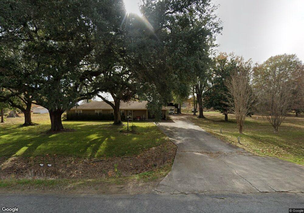
This home is located at 3882 Highway 134, Epps, LA 71237 and is currently estimated at $122,362, approximately $51 per square foot. 3882 Highway 134 is a home with nearby schools including Oak Grove Elementary School and Oak Grove High School.
Create a Home Valuation Report for This Property
The Home Valuation Report is an in-depth analysis detailing your home's value as well as a comparison with similar homes in the area
Tax History
| Year | Tax Paid | Tax Assessment Tax Assessment Total Assessment is a certain percentage of the fair market value that is determined by local assessors to be the total taxable value of land and additions on the property. | Land | Improvement |
|---|---|---|---|---|
| 2025 | $669 | $8,600 | $400 | $8,200 |
| 2024 | $709 | $8,600 | $400 | $8,200 |
| 2023 | $663 | $8,100 | $400 | $7,700 |
| 2022 | $663 | $8,100 | $400 | $7,700 |
| 2021 | $663 | $8,100 | $400 | $7,700 |
| 2020 | $591 | $8,100 | $400 | $7,700 |
| 2019 | $644 | $7,800 | $400 | $7,400 |
| 2018 | $626 | $7,800 | $400 | $7,400 |
| 2017 | $603 | $7,800 | $400 | $7,400 |
| 2016 | $603 | $7,800 | $400 | $7,400 |
| 2015 | $54 | $7,400 | $400 | $7,000 |
| 2014 | $516 | $7,400 | $400 | $7,000 |
| 2010 | $511 | $7,500 | $500 | $7,000 |
Source: Public Records
Map
Nearby Homes
- 194 Jones St
- 993 Louisiana 17
- 0 Louisiana 134
- 4332 Highway 134
- 377 Mcpherson Rd Unit 14.40+-acs/Tracts 1/
- 377 Mcpherson Rd Unit 113.60+-acs/Tracts 2
- 252 Mcpherson Rd
- 735 Hurt Rd
- 00 Hurt Rd
- 0 Mitchner Rd Unit 3+-acres
- 0 Mitchner Rd Unit 44+-acres 214841
- 0000 Mitchner Rd
- Lot 7 Cypress Cove Dr
- 5 Sheppard Rd
- 00 Mitchner Rd
- 0 Wade Rd
- 118 Choctaw Trail
- 0 Dearman Rd Unit Hwy 855
- LOT 4 Apache Trail
- 114 Apache Trail
- 126 Magnolia St
- 113 Magnolia St
- 129 Honeysuckle Ln
- 125 Magnolia St
- 291 Self Rd
- 123 Bogzack St
- 3844 Highway 134
- 133 Magnolia St
- 131 Bogzack St
- 137 Bogzack St
- 138 Bogzack St
- 145 Magnolia St
- 3828 Highway 134
- 138 Bogzack St
- 161 Bogzack St
- 3945 Highway 134
- 3956 Highway 134
- 136 Magnolia St
- 162 Bogzack St
- 119 Cawthon St
Your Personal Tour Guide
Ask me questions while you tour the home.