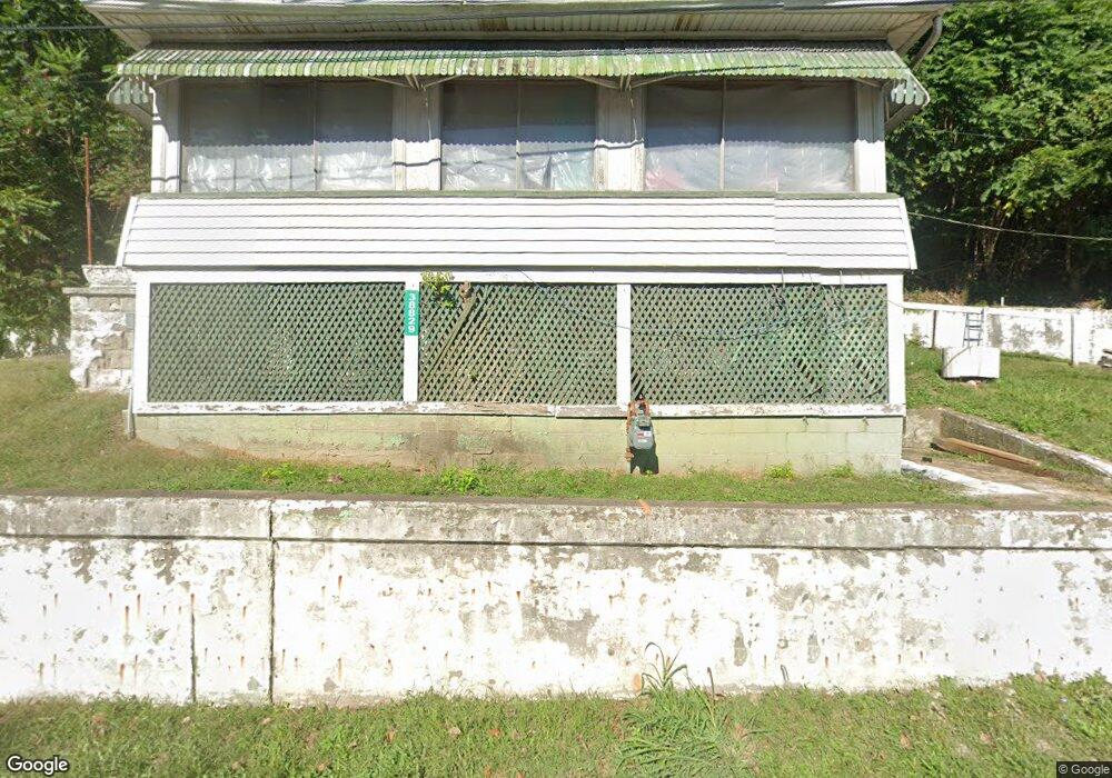
38829 State Route 7 Sardis, OH 43946
Estimated Value: $77,165 - $144,000
Studio
1
Bath
676
Sq Ft
$162/Sq Ft
Est. Value
About This Home
This home is located at 38829 State Route 7, Sardis, OH 43946 and is currently estimated at $109,291, approximately $161 per square foot. 38829 State Route 7 is a home located in Monroe County with nearby schools including River High School.
Ownership History
Date
Name
Owned For
Owner Type
Purchase Details
Closed on
Mar 10, 2021
Sold by
Wood Paul James Patrick Ellen and Llenwood Kilisha
Bought by
Yost Dominic
Current Estimated Value
Purchase Details
Closed on
Feb 4, 2020
Sold by
Yost Dominic
Bought by
Yost Kilisha
Purchase Details
Closed on
Dec 27, 2016
Sold by
Pierleoni Cindy K and Hoepfinger Sheila
Bought by
Yost Dominic
Purchase Details
Closed on
Jun 28, 2001
Bought by
Scott Juliana L. & Bethany S. Et.Al (L/E
Create a Home Valuation Report for This Property
The Home Valuation Report is an in-depth analysis detailing your home's value as well as a comparison with similar homes in the area
Purchase History
| Date | Buyer | Sale Price | Title Company |
|---|---|---|---|
| Yost Dominic | -- | None Available | |
| Yost Kilisha | -- | None Available | |
| Yost Dominic | $10,000 | None Available | |
| Scott Juliana L. & Bethany S. Et.Al (L/E | -- | -- |
Source: Public Records
Tax History
| Year | Tax Paid | Tax Assessment Tax Assessment Total Assessment is a certain percentage of the fair market value that is determined by local assessors to be the total taxable value of land and additions on the property. | Land | Improvement |
|---|---|---|---|---|
| 2025 | $552 | $19,500 | $1,190 | $18,310 |
| 2024 | $423 | $14,880 | $910 | $13,970 |
| 2023 | $423 | $14,880 | $910 | $13,970 |
| 2022 | $423 | $14,880 | $910 | $13,970 |
| 2021 | $422 | $14,730 | $760 | $13,970 |
| 2020 | $422 | $14,730 | $760 | $13,970 |
| 2019 | $422 | $14,730 | $760 | $13,970 |
| 2018 | $282 | $13,930 | $630 | $13,300 |
| 2017 | $151 | $13,930 | $630 | $13,300 |
| 2016 | $153 | $13,930 | $630 | $13,300 |
| 2015 | $89 | $11,610 | $500 | $11,110 |
| 2014 | $89 | $11,610 | $500 | $11,110 |
| 2013 | $84 | $11,250 | $490 | $10,760 |
Source: Public Records
Map
Nearby Homes
- 38811 State Route 7
- 38801 State Route 7
- 38777 State Route 7
- 38881 State Route 7
- 38786 State Route 7
- 38764 State Route 7
- 38764 State Route 7
- 38763 State Route 7
- 38744 State Route 7
- 38739 State Route 7
- 38721 State Route 7
- 52758 Fry Hill Rd
- 52750 Fry Hill Rd
- 38730 State Route 7
- 52716 Fry Hill Rd
- 38707 State Route 7
- 52712 Fry Hill Rd
- 38679 State Route 7
- 52708 Fry Hill Rd
- 38668 State Route 7
Your Personal Tour Guide
Ask me questions while you tour the home.