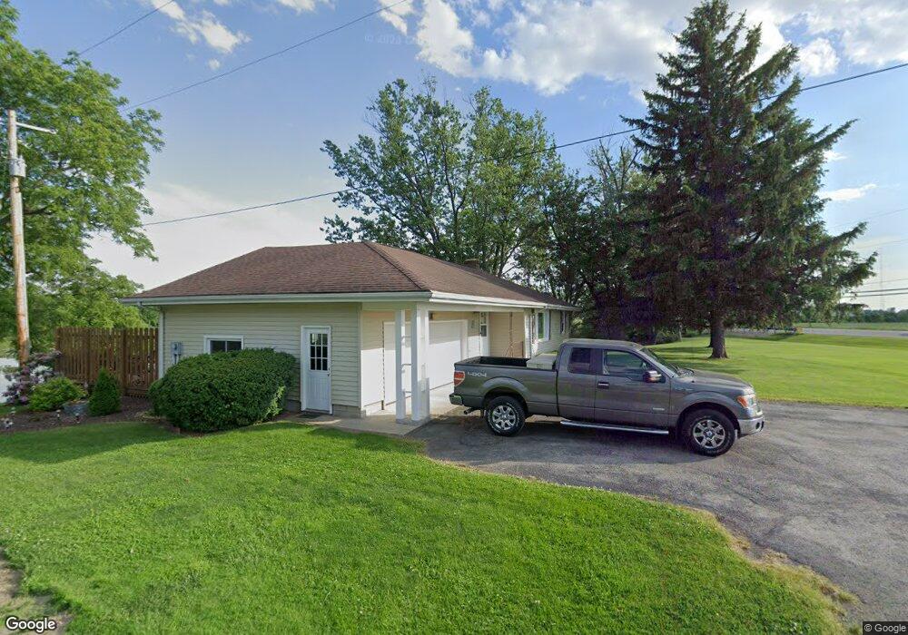
3883 N State Route 53 Fremont, OH 43420
Estimated Value: $169,000 - $219,612
3
Beds
2
Baths
1,450
Sq Ft
$133/Sq Ft
Est. Value
About This Home
This home is located at 3883 N State Route 53, Fremont, OH 43420 and is currently estimated at $193,153, approximately $133 per square foot. 3883 N State Route 53 is a home located in Sandusky County with nearby schools including Fremont Ross High School, St. Ann Catholic School, and Bishop Hoffman Catholic School - This is St Joe's School now.
Ownership History
Date
Name
Owned For
Owner Type
Purchase Details
Closed on
Jul 1, 1992
Sold by
Mulligan Kevin S
Bought by
Mulligan Kevin S
Current Estimated Value
Purchase Details
Closed on
Mar 1, 1992
Sold by
Mulligan Kevin S
Bought by
Mulligan Kevin S
Purchase Details
Closed on
Apr 1, 1989
Bought by
Mulligan Kevin S
Create a Home Valuation Report for This Property
The Home Valuation Report is an in-depth analysis detailing your home's value as well as a comparison with similar homes in the area
Home Values in the Area
Average Home Value in this Area
Purchase History
| Date | Buyer | Sale Price | Title Company |
|---|---|---|---|
| Mulligan Kevin S | $75,000 | -- | |
| Mulligan Kevin S | -- | -- | |
| Mulligan Kevin S | -- | -- |
Source: Public Records
Tax History Compared to Growth
Tax History
| Year | Tax Paid | Tax Assessment Tax Assessment Total Assessment is a certain percentage of the fair market value that is determined by local assessors to be the total taxable value of land and additions on the property. | Land | Improvement |
|---|---|---|---|---|
| 2024 | $2,003 | $52,220 | $8,610 | $43,610 |
| 2023 | $2,003 | $47,500 | $7,840 | $39,660 |
| 2022 | $1,929 | $47,500 | $7,840 | $39,660 |
| 2021 | $1,989 | $47,500 | $7,840 | $39,660 |
| 2020 | $1,817 | $42,700 | $7,840 | $34,860 |
| 2019 | $1,758 | $42,700 | $7,840 | $34,860 |
| 2018 | $1,697 | $42,700 | $7,840 | $34,860 |
| 2017 | $1,634 | $39,520 | $7,840 | $31,680 |
| 2016 | $1,436 | $39,520 | $7,840 | $31,680 |
| 2015 | $1,412 | $39,520 | $7,840 | $31,680 |
| 2014 | $1,456 | $38,720 | $7,740 | $30,980 |
| 2013 | $1,424 | $38,720 | $7,740 | $30,980 |
Source: Public Records
Map
Nearby Homes
- 3285 County Road 170
- 1301 Ohio 523 Unit 55
- 1301 Ohio 523 Unit 39
- 1301 Ohio 523 Unit 15
- 2939 County Road 206
- 0 County Road 210
- 0 Sean Dr
- Outlot A Sean Dr
- 2219 Oak Harbor Rd
- 2087 County Road 216
- 1730 Port Clinton Rd Unit 41
- 1730 Port Clinton Rd
- 1730 Port Clinton Rd Unit 33
- 711 Bloom Rd
- 2100 Ohio 53
- 1441 White Ave
- 1227 White Ave
- 900 Spring St
- 1720 North St
- 1707 North St
- 3901 N State Route 53
- 3909 N State Route 53
- 3913 N State Route 53
- 3921 N State Route 53
- 3939 N State Route 53
- 3949 N St Rt 53
- 3949 N S R 53
- 2551 County Road 174
- 3949 N State Route 53
- 815 Sunny Acres Dr
- 821 Sunny Acres Dr
- 3983 County Road 103
- 3805 N State Route 53
- 791 Sunny Acres Dr
- 3975 N Sr 53
- 3795 N State Route 53
- 2565 County Road 174
- 787 Sunny Acres Dr
- 3975 N State Route 53
- 828 Sunny Acres Dr