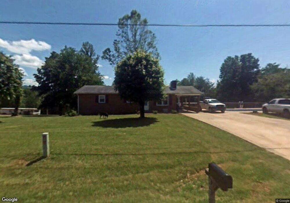
3885 Bennett Rd Morganton, NC 28655
Estimated Value: $238,000 - $258,637
3
Beds
2
Baths
1,688
Sq Ft
$147/Sq Ft
Est. Value
About This Home
This home is located at 3885 Bennett Rd, Morganton, NC 28655 and is currently estimated at $248,159, approximately $147 per square foot. 3885 Bennett Rd is a home located in Burke County with nearby schools including W.A. Young Elementary School, Table Rock Middle School, and Freedom High School.
Ownership History
Date
Name
Owned For
Owner Type
Purchase Details
Closed on
Jul 29, 2005
Sold by
Milligan Jackson Piercy and Milligan Lillie
Bought by
Michaels Gary and Michaels Melissa
Current Estimated Value
Home Financials for this Owner
Home Financials are based on the most recent Mortgage that was taken out on this home.
Original Mortgage
$101,000
Outstanding Balance
$51,652
Interest Rate
5.25%
Mortgage Type
Adjustable Rate Mortgage/ARM
Estimated Equity
$196,507
Create a Home Valuation Report for This Property
The Home Valuation Report is an in-depth analysis detailing your home's value as well as a comparison with similar homes in the area
Home Values in the Area
Average Home Value in this Area
Purchase History
| Date | Buyer | Sale Price | Title Company |
|---|---|---|---|
| Michaels Gary | $100,000 | None Available |
Source: Public Records
Mortgage History
| Date | Status | Borrower | Loan Amount |
|---|---|---|---|
| Open | Michaels Gary | $101,000 |
Source: Public Records
Tax History
| Year | Tax Paid | Tax Assessment Tax Assessment Total Assessment is a certain percentage of the fair market value that is determined by local assessors to be the total taxable value of land and additions on the property. | Land | Improvement |
|---|---|---|---|---|
| 2025 | $1,254 | $170,507 | $17,764 | $152,743 |
| 2024 | $1,135 | $153,442 | $17,764 | $135,678 |
| 2023 | $1,150 | $153,442 | $17,764 | $135,678 |
| 2022 | $1,093 | $121,136 | $11,764 | $109,372 |
| 2021 | $1,045 | $121,136 | $11,764 | $109,372 |
| 2020 | $1,041 | $121,136 | $11,764 | $109,372 |
| 2019 | $1,011 | $121,136 | $11,764 | $109,372 |
| 2018 | $860 | $101,645 | $11,764 | $89,881 |
| 2017 | $858 | $101,645 | $11,764 | $89,881 |
| 2016 | $812 | $98,275 | $11,764 | $86,511 |
| 2015 | $809 | $98,275 | $11,764 | $86,511 |
| 2014 | $807 | $98,275 | $11,764 | $86,511 |
| 2013 | $807 | $98,275 | $11,764 | $86,511 |
Source: Public Records
Map
Nearby Homes
- 4204 Bennett Rd Unit 4206
- Lot 1 & 2 Rainhill Church Rd
- 5341 Reese Store Ave
- 5251 Mount Olive Church Rd
- 3825 Wood Glen Dr Unit 5
- 4796 Nursery Rd
- 2130 South Dr Unit Lot 34
- 6091 Nowlings Chapel Rd
- 4617 Bristol Dr Unit 13
- 4555 Bristol Dr
- 0 Elk Ct Unit 26
- 0 Elk Ct Unit 27 CAR4005593
- 4498 Bristol Dr Unit 24
- 4482 Bristol Dr Unit 25
- 4542 Bristol Dr Unit 22
- 4629 Bristol Dr Unit 14
- 3712 Blankenship Dr
- 4254 Plantation Dr Unit 35
- 5983 Bollinger Loop
- 4269 Aaron Ct
- 3853 Ruby Epley Rd
- 3910 Bennett Rd
- 3956 Bennett Rd
- 3871 Bennett Rd
- 3829 Bennett Rd Unit 3835
- 3832 Bennett Rd
- 5084 Scott Rd
- 5090 Scott Rd
- 3935 Bennett Rd
- 5272 Scott Rd Unit 76
- 3798 Bennett Rd
- 5118 Scott Rd Unit 5126
- 5138 Scott Rd
- 3996 Bennett Rd
- 5094 Scott Rd
- 5267 Scott Rd
- 4024 Bennett Rd
- 5082 Scott Rd
- 5107 Scott Rd
- 5317 Scott Rd
Your Personal Tour Guide
Ask me questions while you tour the home.