Estimated Value: $729,000 - $1,068,000
4
Beds
4
Baths
4,357
Sq Ft
$210/Sq Ft
Est. Value
About This Home
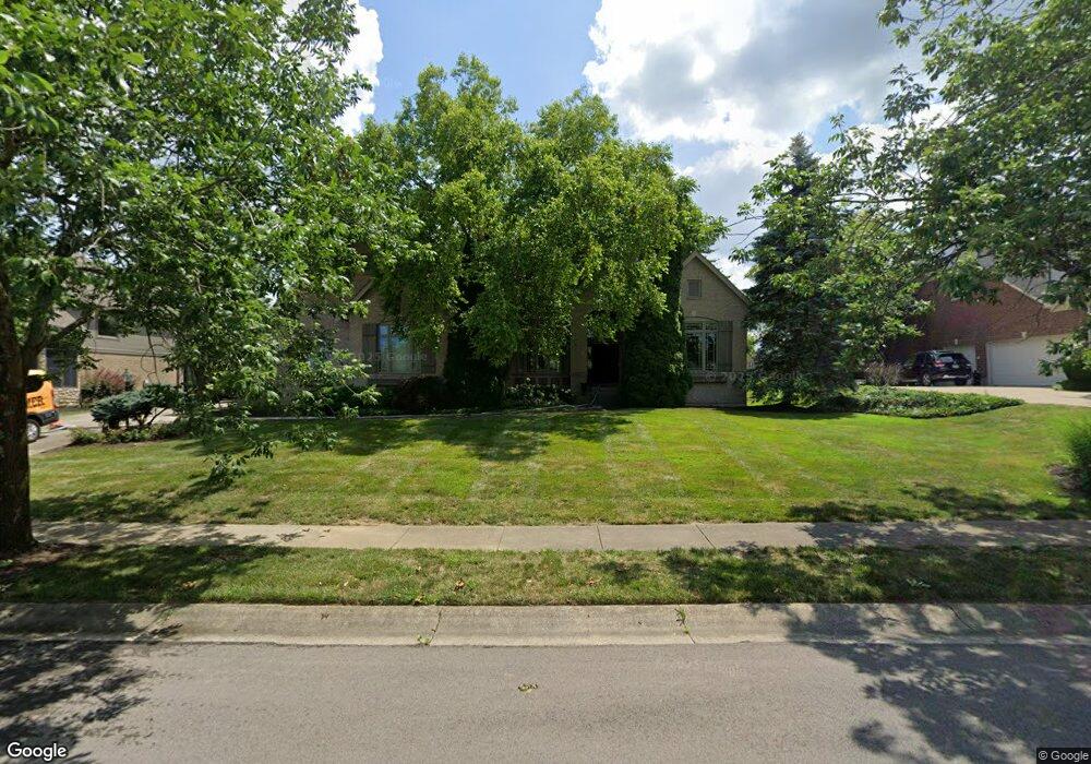
This home is located at 3887 Saint Andrews Ct, Mason, OH 45040 and is currently estimated at $916,706, approximately $210 per square foot. 3887 Saint Andrews Ct is a home located in Warren County with nearby schools including Mason Intermediate Elementary School, Mason Middle School, and William Mason High School.
Ownership History
Date
Name
Owned For
Owner Type
Purchase Details
Closed on
Sep 24, 2012
Sold by
Stevens James
Bought by
Stevens Michelle
Current Estimated Value
Purchase Details
Closed on
Jul 15, 2002
Sold by
Kristine Ford Trust
Bought by
Stevens James and Stevens Michelle
Purchase Details
Closed on
Nov 14, 2000
Sold by
Debrunier Bernard
Bought by
Evan H and Evan Kristine Ford
Purchase Details
Closed on
Jan 30, 1997
Sold by
Mason Joint Venture
Bought by
Conrad Shouvlin Inc
Home Financials for this Owner
Home Financials are based on the most recent Mortgage that was taken out on this home.
Original Mortgage
$456,000
Interest Rate
7.81%
Mortgage Type
New Conventional
Create a Home Valuation Report for This Property
The Home Valuation Report is an in-depth analysis detailing your home's value as well as a comparison with similar homes in the area
Home Values in the Area
Average Home Value in this Area
Purchase History
| Date | Buyer | Sale Price | Title Company |
|---|---|---|---|
| Stevens Michelle | -- | None Available | |
| Stevens James | $595,000 | -- | |
| Evan H | $528,000 | -- | |
| Conrad Shouvlin Inc | $85,000 | -- |
Source: Public Records
Mortgage History
| Date | Status | Borrower | Loan Amount |
|---|---|---|---|
| Previous Owner | Conrad Shouvlin Inc | $456,000 | |
| Closed | Stevens James | -- |
Source: Public Records
Tax History Compared to Growth
Tax History
| Year | Tax Paid | Tax Assessment Tax Assessment Total Assessment is a certain percentage of the fair market value that is determined by local assessors to be the total taxable value of land and additions on the property. | Land | Improvement |
|---|---|---|---|---|
| 2024 | $10,541 | $253,680 | $34,210 | $219,470 |
| 2023 | $10,140 | $206,248 | $32,725 | $173,523 |
| 2022 | $10,008 | $206,248 | $32,725 | $173,523 |
| 2021 | $9,478 | $206,248 | $32,725 | $173,523 |
| 2020 | $10,079 | $187,499 | $29,750 | $157,749 |
| 2019 | $9,289 | $187,499 | $29,750 | $157,749 |
| 2018 | $9,320 | $187,499 | $29,750 | $157,749 |
| 2017 | $9,100 | $170,891 | $27,696 | $143,196 |
| 2016 | $9,373 | $170,891 | $27,696 | $143,196 |
| 2015 | $4,696 | $170,891 | $27,696 | $143,196 |
| 2014 | $4,707 | $159,710 | $25,880 | $133,830 |
| 2013 | $9,434 | $183,570 | $29,750 | $153,820 |
Source: Public Records
Map
Nearby Homes
- 3900 St Andrews Ct
- 5799 Fairway Dr
- 711 Eagle View Ct
- 618 Bunker Ln
- 6309 Inverness Way
- 6415 Eagleview Dr
- 6572 Eagle View Dr
- 400 Walnut Ln
- 550 Maple Ln
- 4154 Fieldsedge Dr
- 6534 Turtle Point Place
- 4087 Fieldsedge Dr Unit 285E
- 6416 Inverness Way
- 4109 Old Manchester Ct
- 6486 Prestwick Ct
- 6394 Grand Cypress Way
- 236 Van Buren Dr
- 6521 Grand Cypress Way
- 6668 Pondfield Ln
- 421 Kings Mills Rd
- 3901 Saint Andrews Ct
- 3873 Saint Andrews Ct
- 3911 Saint Andrews Ct
- 3861 Saint Andrews Ct
- 3886 Saint Andrews Ct
- 3872 Saint Andrews Ct
- 3900 Saint Andrews Ct
- 3860 Saint Andrews Ct
- 3925 Saint Andrews Ct
- 3849 St Andrews Ct
- 3910 Saint Andrews Ct
- 3849 Saint Andrews Ct
- 3837 St Andrews Ct
- 3848 Saint Andrews Ct
- 3837 Saint Andrews Ct
- 3924 Saint Andrews Ct
- 3939 Saint Andrews Ct
- 6356 Tarton Fields Ln
- 6350 Tarton Fields Ln
- 6364 Tarton Fields Ln