
Landlord's Agent in 2025
Pape Ndao
RE/MAX
(203) 993-4239
74 Total Sales
Estimated Value: $529,000 - $575,000
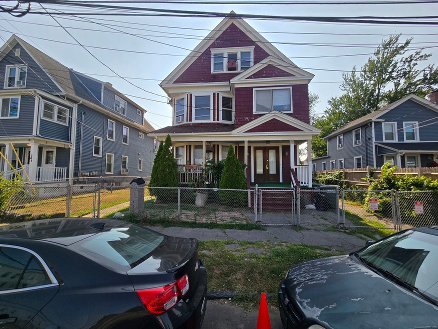
Available immediately for $1,350/month with a 2-month security deposit and first month's rent required at signing, this spacious 3rd-floor apartment offers incredible value. The unit features two dedicated bedrooms and a versatile **3rd bonus room**, perfect for a home office, den, or even an extra bedroom. You'll love the convenience of having your own **in-unit washer**, with space available for you to add your own dryer. Located in a convenient neighborhood, you'll be close to all amenities, and this great price makes it an opportunity you won't want to miss.
| Date | Buyer | Sale Price | Title Company |
|---|---|---|---|
| Moore Leyon | $18,000 | -- | |
| Moore Leyon | $18,000 | -- |
| Date | Status | Borrower | Loan Amount |
|---|---|---|---|
| Open | Moore Leyon | $80,000 | |
| Closed | Moore Leyon | $14,000 |
| Date | Event | Price | List to Sale | Price per Sq Ft |
|---|---|---|---|---|
| 08/31/2025 08/31/25 | Rented | $1,350 | 0.0% | -- |
| 08/28/2025 08/28/25 | Under Contract | -- | -- | -- |
| 08/16/2025 08/16/25 | For Rent | $1,350 | -- | -- |
| Year | Tax Paid | Tax Assessment Tax Assessment Total Assessment is a certain percentage of the fair market value that is determined by local assessors to be the total taxable value of land and additions on the property. | Land | Improvement |
|---|---|---|---|---|
| 2025 | $7,058 | $162,440 | $33,920 | $128,520 |
| 2024 | $7,058 | $162,440 | $33,920 | $128,520 |
| 2023 | $7,058 | $162,440 | $33,920 | $128,520 |
| 2022 | $7,058 | $162,440 | $33,920 | $128,520 |
| 2021 | $7,058 | $162,440 | $33,920 | $128,520 |
| 2020 | $6,798 | $125,910 | $18,970 | $106,940 |
| 2019 | $6,798 | $125,910 | $18,970 | $106,940 |
| 2018 | $6,846 | $125,910 | $18,970 | $106,940 |
| 2017 | $6,846 | $125,910 | $18,970 | $106,940 |
| 2016 | $6,846 | $125,910 | $18,970 | $106,940 |
| 2015 | $7,345 | $174,060 | $32,520 | $141,540 |
| 2014 | $7,345 | $174,060 | $32,520 | $141,540 |
Landlord's Agent in 2025
Pape Ndao
RE/MAX
(203) 993-4239
74 Total Sales
Source: SmartMLS
MLS Number: 24119707
APN: BRID-000633-000034
Disclaimer: Certain information contained herein is derived from information provided by parties other than Homes.com. All information provided is deemed reliable, but is not guaranteed to be accurate and should be independently verified.
![]() IDX information is provided exclusively for personal, non-commercial use, and may not be used for any purpose other than to identify prospective properties consumers may be interested in purchasing. Information is deemed reliable but not guaranteed.
IDX information is provided exclusively for personal, non-commercial use, and may not be used for any purpose other than to identify prospective properties consumers may be interested in purchasing. Information is deemed reliable but not guaranteed.