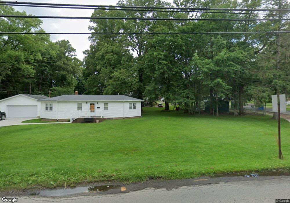
389 E Clinton St Doylestown, OH 44230
Estimated Value: $164,882 - $211,000
2
Beds
2
Baths
1,068
Sq Ft
$180/Sq Ft
Est. Value
About This Home
This home is located at 389 E Clinton St, Doylestown, OH 44230 and is currently estimated at $192,721, approximately $180 per square foot. 389 E Clinton St is a home located in Wayne County with nearby schools including Hazel Harvey Elementary School, Chippewa Intermediate School, and Chippewa Jr./Sr. High School.
Ownership History
Date
Name
Owned For
Owner Type
Purchase Details
Closed on
Nov 26, 1996
Sold by
Palitto Byron R
Bought by
Good Kenneth R and Good Judy A
Current Estimated Value
Home Financials for this Owner
Home Financials are based on the most recent Mortgage that was taken out on this home.
Original Mortgage
$40,000
Interest Rate
7.94%
Mortgage Type
New Conventional
Purchase Details
Closed on
Apr 28, 1992
Sold by
Williams Anthony N and Williams Debo
Bought by
Palitto Bryon R and Palitto Lisa J
Create a Home Valuation Report for This Property
The Home Valuation Report is an in-depth analysis detailing your home's value as well as a comparison with similar homes in the area
Home Values in the Area
Average Home Value in this Area
Purchase History
| Date | Buyer | Sale Price | Title Company |
|---|---|---|---|
| Good Kenneth R | $80,000 | -- | |
| Palitto Bryon R | $55,100 | -- |
Source: Public Records
Mortgage History
| Date | Status | Borrower | Loan Amount |
|---|---|---|---|
| Closed | Good Kenneth R | $40,000 |
Source: Public Records
Tax History
| Year | Tax Paid | Tax Assessment Tax Assessment Total Assessment is a certain percentage of the fair market value that is determined by local assessors to be the total taxable value of land and additions on the property. | Land | Improvement |
|---|---|---|---|---|
| 2024 | $1,034 | $38,350 | $9,280 | $29,070 |
| 2023 | $1,052 | $38,350 | $9,280 | $29,070 |
| 2022 | $852 | $29,970 | $7,250 | $22,720 |
| 2021 | $861 | $29,970 | $7,250 | $22,720 |
| 2020 | $865 | $29,970 | $7,250 | $22,720 |
| 2019 | $1,115 | $35,100 | $12,660 | $22,440 |
| 2018 | $1,125 | $35,100 | $12,660 | $22,440 |
| 2017 | $1,093 | $35,100 | $12,660 | $22,440 |
| 2016 | $1,075 | $33,750 | $12,170 | $21,580 |
| 2015 | $1,070 | $33,750 | $12,170 | $21,580 |
| 2014 | $948 | $33,750 | $12,170 | $21,580 |
| 2013 | $1,002 | $34,290 | $12,590 | $21,700 |
Source: Public Records
Map
Nearby Homes
- 288 E Clinton St
- 325 Catawba Path
- 46 Hidden Pond Dr
- 100 Merlot Ct
- 93 Cleveland Ave
- 0 S Portage St
- 680 Thorn Way
- 620 Thorn Way
- 580 Thorn Way
- 436 N Portage St
- TBD Coal Bank Rd
- VL 1067 Homan Dr
- 497 Gates St
- 15899 Mccallum Dr
- 0 Akron Rd Unit 5123781
- 233 Homan Dr
- V/L 1050 Melanie Ln
- 500 W Clinton St
- 14761 Calaboone Rd
- 15500 Freedom Dr
- 341 E Clinton St
- 0 E Clinton St
- 400 E Clinton St
- 36 Huffman Ave
- 52 Huffman Ave
- 380 E Clinton St
- 360 E Clinton St
- 435 E Clinton St
- 68 Huffman Ave
- 440 E Clinton St
- 333 E Clinton St
- 340 E Clinton St
- 21 Huffman Ave
- 324 E Clinton St
- 5 Byron Dr
- 456 E Clinton St
- 116 Huffman Ave
- 116 Huffman Ave
- 49 Huffman Ave
- 461 E Clinton St
Your Personal Tour Guide
Ask me questions while you tour the home.