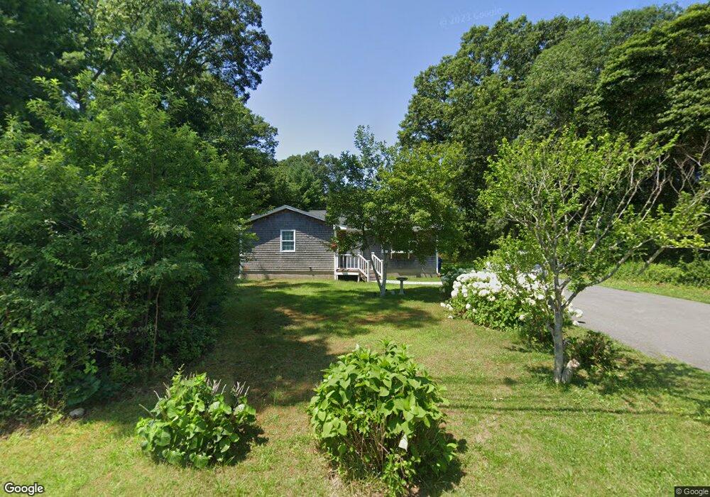
389 Fisher Rd Westport, MA 02790
Estimated Value: $432,000 - $525,000
3
Beds
1
Bath
1,051
Sq Ft
$452/Sq Ft
Est. Value
About This Home
This home is located at 389 Fisher Rd, Westport, MA 02790 and is currently estimated at $475,382, approximately $452 per square foot. 389 Fisher Rd is a home located in Bristol County with nearby schools including Alice A. Macomber Primary School, Westport Elementary School, and Westport Middle-High School.
Ownership History
Date
Name
Owned For
Owner Type
Purchase Details
Closed on
May 14, 2009
Sold by
Bernardo Nelson R and Bernardo Mary L
Bought by
Raposo Daniel F
Current Estimated Value
Home Financials for this Owner
Home Financials are based on the most recent Mortgage that was taken out on this home.
Original Mortgage
$168,000
Outstanding Balance
$105,229
Interest Rate
4.85%
Mortgage Type
Purchase Money Mortgage
Estimated Equity
$370,153
Purchase Details
Closed on
Mar 20, 2009
Sold by
Gmac Mortgage Llc
Bought by
Bernardo Nelson R and Bernardo Mary L
Home Financials for this Owner
Home Financials are based on the most recent Mortgage that was taken out on this home.
Original Mortgage
$168,000
Outstanding Balance
$105,229
Interest Rate
4.85%
Mortgage Type
Purchase Money Mortgage
Estimated Equity
$370,153
Purchase Details
Closed on
Jan 7, 2009
Sold by
Gauthier Mary L
Bought by
Gmac Mortgage Llc
Create a Home Valuation Report for This Property
The Home Valuation Report is an in-depth analysis detailing your home's value as well as a comparison with similar homes in the area
Home Values in the Area
Average Home Value in this Area
Purchase History
| Date | Buyer | Sale Price | Title Company |
|---|---|---|---|
| Raposo Daniel F | $210,000 | -- | |
| Bernardo Nelson R | $155,000 | -- | |
| Gmac Mortgage Llc | $234,000 | -- |
Source: Public Records
Mortgage History
| Date | Status | Borrower | Loan Amount |
|---|---|---|---|
| Open | Gmac Mortgage Llc | $168,000 |
Source: Public Records
Tax History Compared to Growth
Tax History
| Year | Tax Paid | Tax Assessment Tax Assessment Total Assessment is a certain percentage of the fair market value that is determined by local assessors to be the total taxable value of land and additions on the property. | Land | Improvement |
|---|---|---|---|---|
| 2025 | $2,622 | $352,000 | $194,800 | $157,200 |
| 2024 | $2,603 | $336,700 | $181,600 | $155,100 |
| 2023 | $2,493 | $305,500 | $166,200 | $139,300 |
| 2022 | $2,283 | $283,000 | $166,200 | $116,800 |
| 2021 | $6,432 | $264,800 | $152,400 | $112,400 |
| 2020 | $2,130 | $252,700 | $140,300 | $112,400 |
| 2019 | $5,796 | $250,700 | $140,300 | $110,400 |
| 2018 | $59 | $229,800 | $131,500 | $98,300 |
| 2017 | $5,067 | $224,000 | $127,800 | $96,200 |
| 2016 | $1,671 | $211,200 | $124,000 | $87,200 |
| 2015 | $1,608 | $202,800 | $126,500 | $76,300 |
Source: Public Records
Map
Nearby Homes
- 73 White Oak Run
- 47 Fallon Dr
- Lot 0 Marcotte
- 0 Hidden Glen Ln
- 118 Charlotte White Rd Extension
- 2 Slades Farm Ln
- 3 Roller Coaster Way Unit Lot 1
- 461 Reed Rd
- Lot 6 Rafael Rd
- 4 Main Rd
- 219 Chase Rd
- 320 Old Westport Rd
- 1150 Russells Mills Rd
- 29 Union Ave
- 312 Old Westport Rd
- 310 Old Westport Rd
- 332 Division Rd
- 96 Forge Rd
- 27 Dias Ave
- 32 Morton Ave
- 383 Fisher Rd
- 390 Fisher Rd
- 390 Fisher Rd Unit 1
- 377 Fisher Rd
- 404 Fisher Rd
- 8 Bluestone Ave
- Lot A Bluestone Ave
- 376 Fisher Rd
- 0 Bluestone Ave Unit 70628518
- 0 Bluestone Ave Unit 70474290
- 0 Bluestone Ave Unit 72529084
- 0 Bluestone Ave Unit 72448436
- 419 Fisher Rd
- 361 Fisher Rd
- 370 Fisher Rd
- 363 Fisher Rd
- 426 Fisher Rd
- 12 Stagecoach Rd
- 397 Fisher Rd
- 431 Fisher Rd