Estimated Value: $270,629 - $304,000
3
Beds
2
Baths
1,552
Sq Ft
$186/Sq Ft
Est. Value
About This Home
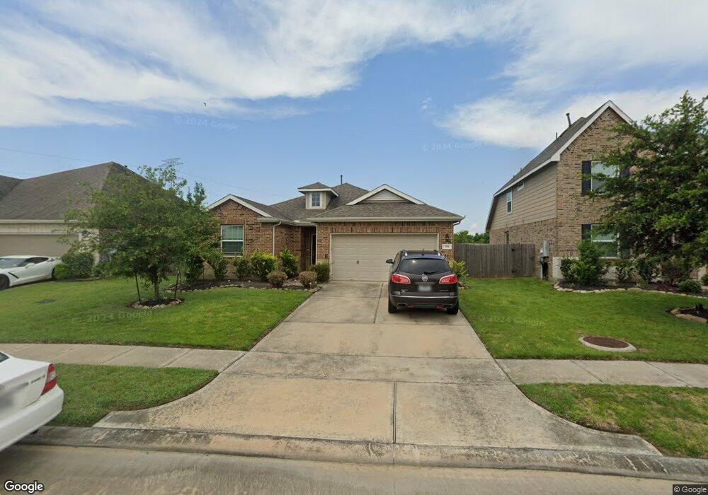
This home is located at 389 Lake Line Dr, Alvin, TX 77511 and is currently estimated at $288,407, approximately $185 per square foot. 389 Lake Line Dr is a home located in Brazoria County with nearby schools including Mark Twain Elementary School, G.W. Harby Junior High School, and Alvin High School.
Ownership History
Date
Name
Owned For
Owner Type
Purchase Details
Closed on
Jun 27, 2016
Sold by
K Hovnanian Of Houston Ii Llc
Bought by
Briggs Dqaryl
Current Estimated Value
Home Financials for this Owner
Home Financials are based on the most recent Mortgage that was taken out on this home.
Original Mortgage
$193,778
Outstanding Balance
$154,693
Interest Rate
3.58%
Mortgage Type
VA
Estimated Equity
$133,714
Purchase Details
Closed on
Feb 17, 2015
Sold by
Jnc Development Inc
Bought by
K Hovnanian Of Houston Iillc
Create a Home Valuation Report for This Property
The Home Valuation Report is an in-depth analysis detailing your home's value as well as a comparison with similar homes in the area
Home Values in the Area
Average Home Value in this Area
Purchase History
| Date | Buyer | Sale Price | Title Company |
|---|---|---|---|
| Briggs Dqaryl | -- | Alamo Title Co | |
| K Hovnanian Of Houston Iillc | -- | Alamo Title Company |
Source: Public Records
Mortgage History
| Date | Status | Borrower | Loan Amount |
|---|---|---|---|
| Open | Briggs Dqaryl | $193,778 |
Source: Public Records
Tax History Compared to Growth
Tax History
| Year | Tax Paid | Tax Assessment Tax Assessment Total Assessment is a certain percentage of the fair market value that is determined by local assessors to be the total taxable value of land and additions on the property. | Land | Improvement |
|---|---|---|---|---|
| 2025 | $5,637 | $254,300 | $62,270 | $192,030 |
| 2023 | $5,637 | $250,918 | $62,270 | $215,280 |
| 2022 | $7,831 | $228,107 | $36,110 | $194,940 |
| 2021 | $7,438 | $207,370 | $36,110 | $171,260 |
| 2020 | $7,272 | $200,520 | $36,110 | $164,410 |
| 2019 | $7,184 | $193,970 | $24,430 | $169,540 |
| 2018 | $6,553 | $176,670 | $24,430 | $152,240 |
| 2017 | $6,482 | $172,980 | $24,430 | $148,550 |
| 2016 | $915 | $24,430 | $24,430 | $0 |
| 2015 | -- | $24,430 | $24,430 | $0 |
Source: Public Records
Map
Nearby Homes
- 4738 Alluvial Cir
- 726 Rim Water Dr
- 4724 Alluvial Cir
- 4706 Alluvial Cir
- 349 Lake Line Dr
- 397 Kendall Crest Dr
- 418 Kendall Crest Dr
- 414 Kendall Crest Dr
- 404 Kendall Crest Dr
- 390 Kendall Crest Dr
- 431 Kendall Crest Dr
- 394 Kendall Crest Dr
- 396 Kendall Crest Dr
- 415 Kendall Crest Dr
- 406 Kendall Crest Dr
- 380 Kendall Crest Dr
- 424 Kendall Crest Dr
- 432 Kendall Crest Dr
- 340 Kendall Crest Dr
- 356 Selah Ct
- 391 Lake Line Dr
- 387 Lake Line Dr
- 393 Lake Line Dr
- 399 Lake Line Dr
- 385 Lake Line Dr
- 395 Lake Line Dr
- 388 Lake Line Dr
- 386 Lake Line Dr
- 390 Lake Line Dr
- 383 Lake Line Dr
- 397 Lake Line Dr
- 392 Lake Line Dr
- 380 Lake Line Dr
- 4701 Bella Ct
- 394 Lake Line Dr
- 381 Lake Line Dr
- 378 Lake Line Dr
- 4733 Alluvial Cir
- 4703 Bella Ct
- 401 Lake Line Dr