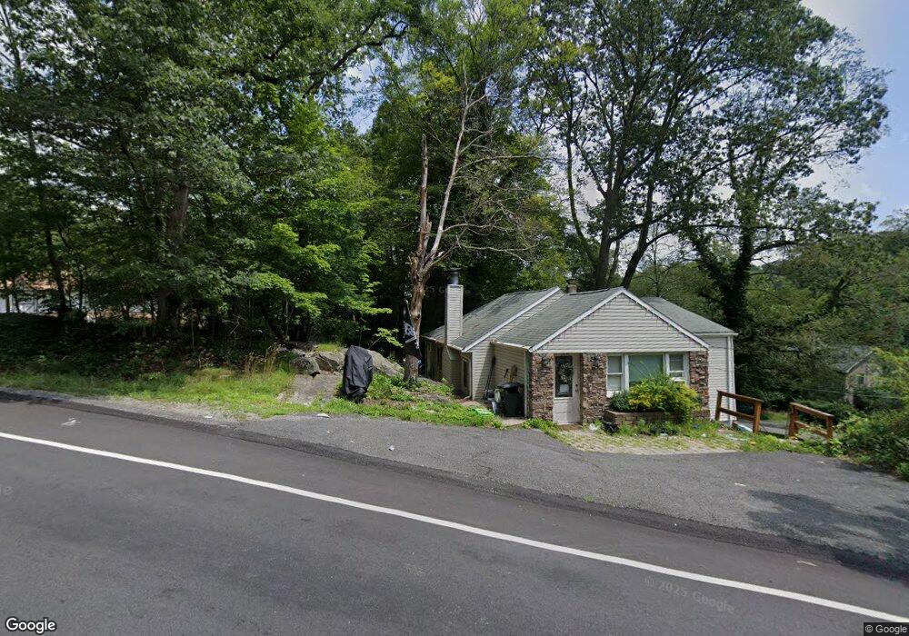
389 Maxim Dr Andover, NJ 07821
Estimated Value: $548,000 - $570,000
Studio
--
Bath
2,154
Sq Ft
$260/Sq Ft
Est. Value
About This Home
This home is located at 389 Maxim Dr, Andover, NJ 07821 and is currently estimated at $560,384, approximately $260 per square foot. 389 Maxim Dr is a home located in Sussex County with nearby schools including Hudson Maxim Elementary School, Durban Avenue Elementary School, and Tulsa Trail Elementary School.
Ownership History
Date
Name
Owned For
Owner Type
Purchase Details
Closed on
Oct 6, 2004
Sold by
Lessig Karla and Taylor Edward G
Bought by
Taylor Edward G
Current Estimated Value
Purchase Details
Closed on
Sep 13, 2004
Sold by
Lessig Karla
Bought by
Lessig Karla and Taylor Edward G
Purchase Details
Closed on
Sep 2, 1999
Sold by
Plinio John J and Taylor Edward G
Bought by
Lessig Karla
Create a Home Valuation Report for This Property
The Home Valuation Report is an in-depth analysis detailing your home's value as well as a comparison with similar homes in the area
Home Values in the Area
Average Home Value in this Area
Purchase History
| Date | Buyer | Sale Price | Title Company |
|---|---|---|---|
| Taylor Edward G | -- | Stewart Title Guaranty | |
| Lessig Karla | -- | Stewart Title Guaranty | |
| Lessig Karla | $62,900 | -- |
Source: Public Records
Tax History
| Year | Tax Paid | Tax Assessment Tax Assessment Total Assessment is a certain percentage of the fair market value that is determined by local assessors to be the total taxable value of land and additions on the property. | Land | Improvement |
|---|---|---|---|---|
| 2025 | $10,223 | $490,300 | $206,900 | $283,400 |
| 2024 | $11,106 | $490,300 | $206,900 | $283,400 |
Source: Public Records
Map
Nearby Homes
- 213 Squaw Trail
- 12 Hobart Trail
- 14 Marshall Trail
- 342 Dupont Ave
- 35 Mountain Trail
- 304 Squaw Trail
- 4 Bear Pond Trail
- 208 Maxim Dr
- 3 Bear Pond Trail
- 207 Dupont Ave
- 9 Temple Trail
- 8 Oneida Ave
- 207 Hudson Ave
- 34 Northwestern Trail
- 2 Oneida Ave
- 136 Dupont Ave
- 8 Lincoln Trail
- 656 Lakeside Ave
- 80 W River Styx Rd
- 6 Bucknell Trail
Your Personal Tour Guide
Ask me questions while you tour the home.