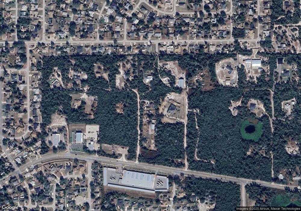
389 Polite Dr Deltona, FL 32725
Estimated Value: $472,000 - $553,000
4
Beds
3
Baths
2,840
Sq Ft
$178/Sq Ft
Est. Value
About This Home
This home is located at 389 Polite Dr, Deltona, FL 32725 and is currently estimated at $506,365, approximately $178 per square foot. 389 Polite Dr is a home located in Volusia County with nearby schools including Forest Lake Elementary School, Deltona Middle School, and University High School.
Ownership History
Date
Name
Owned For
Owner Type
Purchase Details
Closed on
Jul 19, 2013
Sold by
Senick William J and Senick Donna C
Bought by
Gandy Lonnie M and Gandy Jennifer R
Current Estimated Value
Home Financials for this Owner
Home Financials are based on the most recent Mortgage that was taken out on this home.
Original Mortgage
$163,920
Outstanding Balance
$119,395
Interest Rate
3.96%
Mortgage Type
New Conventional
Estimated Equity
$386,970
Purchase Details
Closed on
Feb 15, 1984
Bought by
Gandy Lonnie M and Gandy Jennifer R
Purchase Details
Closed on
Nov 15, 1983
Bought by
Gandy Lonnie M and Gandy Jennifer R
Purchase Details
Closed on
Nov 15, 1977
Bought by
Gandy Lonnie M and Gandy Jennifer R
Create a Home Valuation Report for This Property
The Home Valuation Report is an in-depth analysis detailing your home's value as well as a comparison with similar homes in the area
Home Values in the Area
Average Home Value in this Area
Purchase History
| Date | Buyer | Sale Price | Title Company |
|---|---|---|---|
| Gandy Lonnie M | $204,900 | Esquire Title Services Inc | |
| Gandy Lonnie M | $15,700 | -- | |
| Gandy Lonnie M | $100 | -- | |
| Gandy Lonnie M | $9,000 | -- |
Source: Public Records
Mortgage History
| Date | Status | Borrower | Loan Amount |
|---|---|---|---|
| Open | Gandy Lonnie M | $163,920 |
Source: Public Records
Tax History Compared to Growth
Tax History
| Year | Tax Paid | Tax Assessment Tax Assessment Total Assessment is a certain percentage of the fair market value that is determined by local assessors to be the total taxable value of land and additions on the property. | Land | Improvement |
|---|---|---|---|---|
| 2025 | $2,831 | $211,058 | -- | -- |
| 2024 | $2,831 | $205,110 | -- | -- |
| 2023 | $2,831 | $181,353 | $0 | $0 |
| 2022 | $2,769 | $176,071 | $0 | $0 |
| 2021 | $2,863 | $170,943 | $0 | $0 |
| 2020 | $2,819 | $168,583 | $0 | $0 |
| 2019 | $2,904 | $164,793 | $0 | $0 |
| 2018 | $2,893 | $161,720 | $0 | $0 |
| 2017 | $2,891 | $158,394 | $0 | $0 |
| 2016 | $2,760 | $155,136 | $0 | $0 |
| 2015 | $2,814 | $154,058 | $0 | $0 |
| 2014 | $2,785 | $152,835 | $0 | $0 |
Source: Public Records
Map
Nearby Homes
- 1302 Pine Song Dr
- 532 Blackstone Ave
- 1488 Anderson St
- 542 Blackstone Ave
- 1510 Doyle Rd
- 549 Mcneal Dr
- 1287 Voyager St
- 322 Champlain Dr
- 1281 Voyager St
- 1331 Wildberry Ln
- 555 Cavalier Ave
- 1197 Doyle Rd
- 184 Champlain Dr
- 1486 Randolph St
- 1101 Anderson St
- 558 Tyler Ave
- 1329 Herndon Ave
- 1321 Herndon Ave
- 1257 Herndon Ave
- 1116 Doyle Rd
- 1390 Doyle Rd
- 445 Polite Dr
- 400 Polite Dr
- 1350 Don Carlos Trail
- 495 Turf Ave
- 355 Polite Dr
- Doyle Rd
- 1297 Anderson St
- 1291 Anderson St
- 1301 Anderson St
- 1340 Don Carlos Trail
- 1285 Anderson St Unit 5
- 1307 Anderson St
- 1279 Anderson St
- 1311 Anderson St
- 1273 Anderson St
- 1319 Anderson St
- 1267 Anderson St
- 1355 Doyle Rd
- 1325 Anderson St
