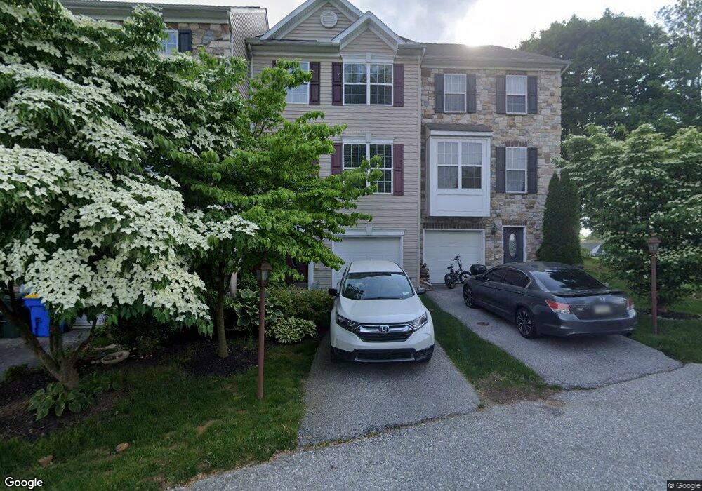
389 W Chestnut St Unit 2 Dallastown, PA 17313
Estimated Value: $200,000 - $221,000
3
Beds
2
Baths
1,640
Sq Ft
$128/Sq Ft
Est. Value
About This Home
This home is located at 389 W Chestnut St Unit 2, Dallastown, PA 17313 and is currently estimated at $210,710, approximately $128 per square foot. 389 W Chestnut St Unit 2 is a home located in York County with nearby schools including Dallastown Elementary School, Dallastown Area Middle School, and Dallastown Area High School.
Ownership History
Date
Name
Owned For
Owner Type
Purchase Details
Closed on
May 10, 2024
Sold by
Shaw Rhonda D and Canipe Carla E
Bought by
Einsig Timothy D and Einsig Lisa A
Current Estimated Value
Purchase Details
Closed on
May 31, 2018
Sold by
Wilson Alta R
Bought by
Shaw Rhonda D and Canipe Carla E
Purchase Details
Closed on
Oct 24, 2007
Sold by
Dallastown Acquisitions Lp
Bought by
Wilson Alta R
Create a Home Valuation Report for This Property
The Home Valuation Report is an in-depth analysis detailing your home's value as well as a comparison with similar homes in the area
Home Values in the Area
Average Home Value in this Area
Purchase History
| Date | Buyer | Sale Price | Title Company |
|---|---|---|---|
| Einsig Timothy D | $190,000 | None Listed On Document | |
| Shaw Rhonda D | -- | None Available | |
| Wilson Alta R | $197,140 | None Available |
Source: Public Records
Tax History Compared to Growth
Tax History
| Year | Tax Paid | Tax Assessment Tax Assessment Total Assessment is a certain percentage of the fair market value that is determined by local assessors to be the total taxable value of land and additions on the property. | Land | Improvement |
|---|---|---|---|---|
| 2025 | $3,491 | $101,695 | $0 | $101,695 |
| 2024 | $3,440 | $101,695 | $0 | $101,695 |
| 2023 | $3,440 | $101,695 | $0 | $101,695 |
| 2022 | $3,327 | $101,695 | $0 | $101,695 |
| 2021 | $3,170 | $101,695 | $0 | $101,695 |
| 2020 | $3,170 | $101,695 | $0 | $101,695 |
| 2019 | $3,160 | $101,695 | $0 | $101,695 |
| 2018 | $3,138 | $101,695 | $0 | $101,695 |
| 2017 | $3,013 | $101,695 | $0 | $101,695 |
| 2016 | $0 | $101,695 | $0 | $101,695 |
| 2015 | -- | $101,695 | $0 | $101,695 |
| 2014 | -- | $101,695 | $0 | $101,695 |
Source: Public Records
Map
Nearby Homes
- 732 Blossom Hill Ln
- 428 W Main St
- 355 W Main St
- 774 Blossom Hill Ln
- 0 S Franklin St
- 2981 Sunset Dr
- 106 Teila Dr
- 74 S Main St
- 136 Teila Dr
- 64 S Pleasant Ave
- 122 S Pleasant Ave
- 435 Frederick Dr
- 424 Dartha Dr
- 0 Gary Dr
- 2933 Exeter Dr S
- 125 Verna Dr
- 246 Hudson Blvd
- 56 E Frederick St
- 234 Hudson Blvd
- 680 Hampstead Ct
- 385 W Chestnut St Unit 3
- 393 W Chestnut St Unit 1
- 381 W Chestnut St Unit 4
- 377 W Chestnut St Unit 5
- 369 W Chestnut St Unit 6
- 270 N Cedar St
- 371 Clay Ave Unit 10
- 399 W Chestnut St
- 367 Clay Ave Unit 11
- 365 W Chestnut St Unit 7
- 361 W Chestnut St Unit 8
- 363 Clay Ave
- 357 W Chestnut St
- 357 W Chestnut St Unit 9
- 359 Clay Ave Unit 13
- 359 Clay Ave
- 355 Clay Ave Unit 14
- 264 N Cedar St
- 275 N Cedar St
- 0 Lot 12 Clay Ave Unit 20905801